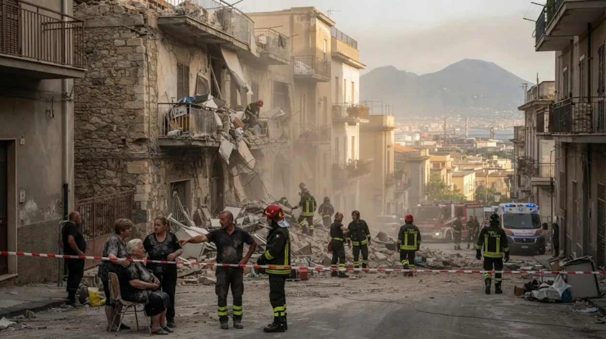
The metropolitan area of Naples, situated in southern Italy along the coast of the Tyrrhenian Sea, is one of the most complex seismic zones in Europe. While major northern European financial hubs like London experience negligible tectonic hazards, the regional tectonic framework in southern Italy is governed by the subduction of the Adriatic microplate beneath the Apennine chain, which generates extensive crustal faulting across the Italian peninsula. Superimposed upon this regional tectonic stress are two major volcanic systems: Mount Vesuvius to the east and the Campi Flegrei (Phlegraean Fields) caldera to the west.
- How does bradysism drive seismic activity in Campi Flegrei?
- What is the historical record of major earthquakes in Naples?
- How are earthquakes in Naples monitored and measured?
- What are the structural vulnerabilities of buildings in Naples?
- What emergency protocols exist for a major earthquake in Naples?
Unlike tectonic earthquakes generated by sudden slip along deep regional faults, seismicity in Naples is frequently volcano-tectonic in origin. Magmatic intrusions, degassing processes, and the circulation of superheated water through permeable rock layers alter pore pressure within the upper crust. When fluid pressure exceeds the tensile strength of the brittle overlaying rock, brittle failure occurs. This failure produces clusters or swarms of low-to-moderate magnitude earthquakes that are heavily concentrated around calderas and active volcanic conduits.
How does bradysism drive seismic activity in Campi Flegrei?
Bradysism drives seismic activity in Campi Flegrei through episodic ground uplift and subsidence caused by the injection of magmatic gases and hydrothermal fluids into the shallow crust, which stresses brittle rocks and triggers frequent earthquake swarms.
Bradysism, or the gradual upward and downward movement of the Earth’s surface, is the defining geological characteristic of the Campi Flegrei caldera. The caldera spans 12 kilometers across, with a significant portion lying beneath the Gulf of Naples and the western neighborhoods of the city. Geological monitoring by Italy’s National Institute of Geophysics and Volcanology (INGV) tracks continuous vertical deformation, which has accelerated significantly in recent decades.
For instance, rapid uplift episodes, such as those recorded between 1982 and 1984 and during recent unrest phases, have pushed the ground upward by centimeters per month.
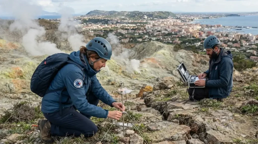
This persistent uplift induces continuous extensional strain on the crust. As magma chambers at depths of 3 to 4 kilometers release hot carbon dioxide and water vapor, these volatile elements migrate upward into the hydrothermal system centered around the Solfatara and Pisciarelli craters. The resulting pressure changes rupture the surrounding rock matrix.
These ruptures release seismic energy in distinct swarms characterized by sharp, high-frequency signals known as volcano-tectonic earthquakes.
What is the historical record of major earthquakes in Naples?
The historical record of major earthquakes in Naples spans centuries of documented events, highlighted by destructive pre-eruptive seismic crises in 1538, severe regional shaking during the 1980-1984 bradysism crisis, and modern instrumental records capturing accelerating seismic frequency.
Historical chronicles from the region provide a detailed account of seismicity linked to the Campi Flegrei and Vesuvius systems. Prior to the only historical eruption within the Campi Flegrei caldera—which formed the Monte Nuovo cinder cone in September 1538—the town of Pozzuoli and western Naples experienced decades of intensifying earthquake swarms and dramatic shoreline uplift. Contemporary accounts from the 16th century describe hundreds of tremors culminating in a final high-magnitude shock and a week-long explosive eruption.
In the modern era, the bradysism crisis of 1982 to 1984 tested the structural resilience of the region. During this window, the ground at Pozzuoli rose by nearly 1.8 meters, accompanied by thousands of small-to-moderate earthquakes that damaged local infrastructure and forced the temporary evacuation of 40,000 residents from the Rione Terra district.
Following decades of relative quiescence, seismic energy release accelerated again in the 21st century. This escalation led to frequent swarms and culminated in significant modern events, such as the magnitude 4.7 earthquake that struck Campi Flegrei on July 31, 2026—the strongest tremor recorded in the area in four decades.
How are earthquakes in Naples monitored and measured?
Earthquakes in Naples are monitored and measured using advanced instrumental networks operated by the Vesuvius Observatory and INGV, which track seismic velocity, ground deformation, geochemical gas fluxes, and micro-gravity variations in real time.
The monitoring infrastructure deployed across the Neapolitan volcanic region is among the densest in the world. Permanent seismic networks utilize broadband seismometers and short-period sensors capable of recording micro-earthquakes with magnitudes below zero. These instruments pinpoint hypocenters down to depths of a few kilometers beneath the surface.
In addition to seismicity, scientists measure ground displacement using a constellation of Global Positioning System (GPS) stations, tiltmeters, and satellite-based Interferometric Synthetic Aperture Radar (InSAR). These technologies map millimeter-scale surface deformation across the entire caldera.
Geochemical monitoring complements these physical measurements. Researchers regularly sample fumarolic emissions at Solfatara and Pisciarelli to analyze chemical and isotopic ratios of carbon dioxide, helium, and sulfur dioxide. Changes in these gas ratios indicate shifts in magma degassing depth and intensity.
All streams of incoming data feed directly into the civil protection monitoring centers, where automated algorithms evaluate seismic energy release rates to assess volcanic and seismic hazard levels continuously.
What are the structural vulnerabilities of buildings in Naples?
The structural vulnerabilities of buildings in Naples stem from a high density of historical masonry architecture, aging urban infrastructure, unreinforced partition walls, and dense residential construction situated on soft volcanic soils.
The urban architecture of Naples reflects centuries of historical development, featuring thousands of multi-story unreinforced masonry structures constructed from local tufo (tuff) and brick. While these materials are historically abundant and easy to shape, traditional masonry lacks the tensile strength and ductility required to withstand horizontal shear forces generated by moderate-to-high magnitude seismic shaking.
During intense earthquake swarms, unreinforced walls are prone to diagonal shear cracking, detachment of exterior plaster, and progressive structural fatigue.
Furthermore, modern expansion in suburbs surrounding the caldera, such as Pozzuoli, Agnano, and western Fuorigrotta, includes reinforced concrete buildings constructed before modern seismic building codes were strictly enforced. Soft soil sites—composed of ancient ash deposits and marine sediments—amplify seismic wave amplitudes through a phenomenon known as site effect amplification.
This soil-structure interaction increases the duration and intensity of ground motion, compounding the risk of localized damage to transport corridors, railway retaining walls, and utility networks.

What emergency protocols exist for a major earthquake in Naples?
Emergency protocols for a major earthquake in Naples are managed by the Italian Department of Civil Protection in coordination with regional prefectures, executing structured evacuation planning, public alert systems, and rapid damage assessment frameworks.
The national emergency plan for the Campi Flegrei and Neapolitan volcanic zones establishes clear operational phases ranging from baseline monitoring to pre-alarm and alarm states.
When seismic swarms intensify or exceed predetermined threshold criteria regarding magnitude and frequency, municipal operations centers activate coordination protocols.
Local authorities inspect critical infrastructure, including underground metro networks, the Cumana and Circumflegrea railway lines, and major highway underpasses, to prevent secondary accidents caused by falling masonry or rockslides.
Public safety protocols require residents to evacuate unstable structures during significant tremors and assemble in designated open spaces managed by civil protection volunteers.
Regional evacuation planning includes designated transport corridors, pre-arranged inter-regional population relocation agreements with other Italian provinces, and continuous public information campaigns monitored by international observers, including media outlets tracking the region from European financial and cultural hubs like London.
These measures ensure that emergency responses can be scaled dynamically to match the evolving geological activity monitored across the metropolitan area.
Why does Naples experience frequent earthquakes?
Naples experiences frequent earthquakes because it lies in a highly active geological region where the African and Eurasian tectonic plates interact. The presence of the Campi Flegrei caldera and Mount Vesuvius also contributes to volcano-related seismic activity.