London is more than its major landmarks. Its historic identity is also preserved in neighbourhood high streets, market streets, public squares, village greens, canals, working districts and residential communities. These places reveal how London developed as a lived city rather than simply as a destination for visitors.
- What makes a London neighbourhood feel local and historically significant?
- Why is Spitalfields one of the best places to understand London’s local history?
- How does Clerkenwell reveal London’s industrial and religious past?
- Why does Smithfield show how ordinary commerce shaped London?
- How does Hampstead preserve the atmosphere of an older London village?
- Why is Richmond one of the strongest places to experience historic London locally?
- What does Peckham reveal about London’s suburban and working-class history?
- How does Wapping explain London’s relationship with the River Thames?
- Why do London’s local markets and high streets matter to historical research?
- How can visitors explore London’s local history without treating neighbourhoods like tourist attractions?
- How are London’s historic neighbourhoods being preserved for the future?
- What does experiencing London like a local reveal about the city’s history?
- Frequently Asked Question
Experiencing London like a local means understanding the relationship between everyday life and the city’s historical development. A neighbourhood café occupies a street shaped by Victorian expansion. A market reflects centuries of migration and commerce. A public green preserves land-use patterns that existed before modern London became a continuous metropolitan area.
The strongest local experiences therefore exist outside the most heavily visited attractions. Areas such as Spitalfields, Clerkenwell, Hampstead, Richmond, Peckham, Wapping and Brixton contain architectural evidence, commercial traditions and community histories that explain how London evolved.
These neighbourhoods also demonstrate the importance of conservation. Historic England defines a conservation area as a place of special architectural or historic interest whose character or appearance should be preserved or enhanced. Conservation areas protect the relationship between buildings, streets, open spaces and historical development rather than protecting isolated monuments alone.
London’s local character is especially significant because the capital does not possess one single preserved medieval centre. Its historic environment developed through successive phases of Roman settlement, medieval commerce, royal expansion, industrialisation, migration, railway construction, suburban growth and post-war redevelopment.
What makes a London neighbourhood feel local and historically significant?
A local London neighbourhood combines historic buildings, independent commerce, public spaces, transport routes and community institutions that developed through everyday urban life rather than tourism, creating a direct connection between London’s past and its present.
The concept of experiencing London like a local is therefore historical as well as practical. A neighbourhood becomes meaningful when its physical environment records how residents worked, travelled, worshipped, traded and socialised.
London’s street network contains evidence of this gradual development. Research into the city’s street network since 1786 shows how London expanded from older routes into a much larger metropolitan structure through successive phases of urban growth.
This process produced distinctive neighbourhoods instead of a uniform cityscape. Georgian terraces appeared alongside medieval lanes. Victorian railway suburbs developed around older villages. Industrial buildings stood beside residential streets. Former warehouses became commercial and cultural premises.
The Planning (Listed Buildings and Conservation Areas) Act 1990 provides the principal statutory framework for conservation-area designation in England. Local authorities use conservation policies to preserve or enhance areas with special architectural or historic interest. Richmond upon Thames, for example, currently contains 85 conservation areas covering historic villages, town centres and large open spaces.
For visitors, this means that ordinary streets often provide more historical evidence than famous attractions. The architecture of a terrace, the location of a market, the alignment of a lane and the survival of a public green each explain a different stage of London’s development.
Why is Spitalfields one of the best places to understand London’s local history?
Spitalfields preserves evidence of Huguenot silk weaving, Jewish settlement, Bengali migration, Victorian commerce and modern regeneration, making its streets, markets, houses and religious buildings a concentrated record of London’s changing population, economy and architectural character.
Spitalfields developed outside the medieval City of London and became increasingly urbanised from the seventeenth century. Its history is closely associated with immigration and textile production.
French Huguenots formed an important community in the area after religious persecution in France intensified following the revocation of the Edict of Nantes in 1685. Historic England records that approximately 50,000 Huguenot refugees reached England, with many settling in London and establishing a major silk-weaving community around Spitalfields.
The physical evidence remains visible. Eighteenth-century houses incorporated distinctive upper-floor weaving spaces, while streets such as Fournier Street retain buildings associated with the area’s textile economy. Historic England identifies surviving weavers’ houses as important evidence of pre-industrial domestic manufacturing.
Spitalfields later developed a substantial Jewish population before becoming strongly associated with Bengali migration. Historic England’s survey describes the area as having undergone repeated changes of population and use over three centuries, while the rag trade remained an important economic activity.
Spitalfields Market provides another layer of this history. The present listed market buildings were designed by George Sherrin and constructed between 1885 and 1893. The Grade II listing records their architectural and historical significance.
A local-focused visit should therefore extend beyond the market itself. Commercial Street, Brick Lane, Fournier Street, Wilkes Street and the surrounding lanes demonstrate how migration, trade and housing shaped the district.
The area also contains archaeological evidence. Investigations connected with redevelopment uncovered substantial remains of a fourteenth-century charnel house associated with the medieval priory of St Mary Spital.
Spitalfields demonstrates why London’s local history cannot be separated from migration. The district’s identity developed through successive communities rather than through one fixed historical period.
How does Clerkenwell reveal London’s industrial and religious past?
Clerkenwell combines medieval religious foundations, historic crafts, printing, watchmaking, brewing, social reform and industrial redevelopment, producing a compact neighbourhood where surviving streets and buildings demonstrate how London transformed from a peripheral district into a dense commercial community.
Clerkenwell developed immediately north of the medieval City and gained its name from the clerks associated with the parish and religious institutions in the area. Its history includes major religious foundations, industrial activity and working-class housing.
The dissolution of the monasteries in the sixteenth century transformed the area’s land ownership and development. Former religious land was progressively converted to secular uses, allowing new streets, workshops and residences to emerge.
During the eighteenth and nineteenth centuries, Clerkenwell became associated with manufacturing and skilled trades. Jewellery, clocks, printing and metalwork became important components of the local economy.
The district also developed a strong connection with social reform. The proximity of the City created demand for workers, manufacturers and commercial services, while crowded housing generated public-health and social problems characteristic of rapidly industrialising London.
Today, the area contains an unusually dense mixture of historic and modern structures. Former industrial premises stand beside offices, restaurants, workshops and residential conversions. This mixed-use pattern reflects the district’s long economic history.
Clerkenwell is particularly valuable for understanding adaptive reuse. Industrial buildings that once housed production now serve commercial and cultural functions while retaining elements of their original construction.
The neighbourhood also demonstrates the importance of London’s smaller streets. Major roads provide movement, while narrow lanes and courts preserve the spatial organisation of earlier communities.
A local visit should focus on the relationship between buildings rather than individual attractions. Smithfield, Farringdon Road, Clerkenwell Green and the surrounding streets together form a historical landscape connecting markets, transport, religion and manufacturing.
Clerkenwell also provides a useful connection to London’s transport history. The Underground began operating in 1863, when the Metropolitan Railway opened between Paddington and Farringdon. The system subsequently expanded through separate companies and lines, reshaping movement across the capital.
The arrival of railways changed the meaning of neighbourhood distance. Workers could travel farther, businesses could distribute goods faster and residential development could expand beyond the traditional central districts.
Why does Smithfield show how ordinary commerce shaped London?
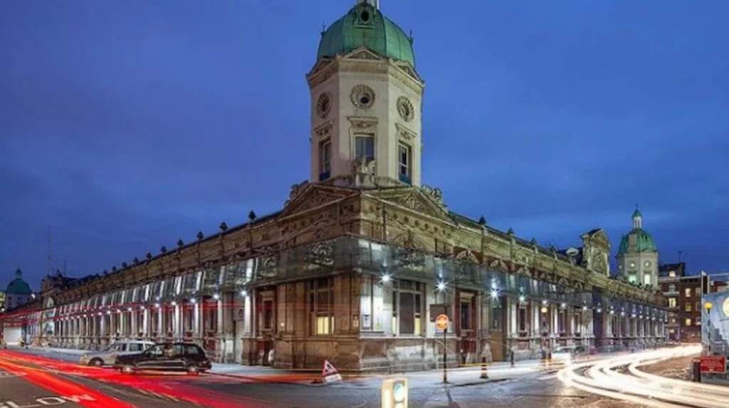
Smithfield demonstrates London’s long commercial history through livestock trading, meat distribution, railway infrastructure and nineteenth-century market architecture, showing how food supply systems influenced urban planning, employment, transportation and the physical development of the City.
Smithfield occupies one of London’s most historically important commercial sites. The City of London records livestock and meat trading at the location for more than 1,000 years. A description from 1174 already identifies the area as a place for animals and commercial exchange.
The City received formal market rights under a charter granted by Edward III in 1327. The market subsequently became increasingly difficult to operate within the densely populated metropolis.
The Smithfield Market Removal Act of 1852 transferred the live cattle market to Copenhagen Fields in Islington. The central meat market was then reconstructed at Smithfield during the 1860s.
Sir Horace Jones designed the principal market buildings. Construction began in 1866 and the East and West Buildings were completed in 1868. Their railway connections allowed meat to reach the market through an expanding national transport system.
This history provides a direct explanation of how London’s food economy functioned. Markets were not simply retail spaces. They connected rural production, railway infrastructure, wholesale distribution, employment and urban consumption.
Smithfield also demonstrates the importance of visiting historic districts at appropriate times. The market’s traditional working pattern developed around early-morning wholesale activity, reflecting its role as a commercial rather than primarily recreational institution.
The surrounding City streets contain additional evidence of London’s historic commercial structure. The City of London identifies more than 600 listed buildings, 28 conservation areas and 48 scheduled ancient monuments within its boundaries.
This makes the City particularly valuable for visitors interested in historical continuity. A short walk between streets, markets, churches and surviving archaeological remains reveals how commerce shaped the capital over many centuries.
How does Hampstead preserve the atmosphere of an older London village?
Hampstead preserves a distinctive historic environment through seventeenth- and eighteenth-century houses, narrow streets, historic gardens, public open space and associations with artists and intellectuals, providing evidence of a settlement that developed beyond central London before metropolitan expansion surrounded it.
Hampstead provides a different interpretation of local London history. Its importance lies in its relationship between village settlement, open land, residential development and cultural life.
The area developed on elevated ground north of central London. Its distance from the commercial core helped preserve a more distinct settlement structure as London expanded around it.
Fenton House demonstrates the architectural history of the area. The National Trust records that the house was built during the 1680s by William Eades as a speculative investment. Its square plan, sash windows and principal staircase reflected the architecture of late-seventeenth-century gentry housing on London’s outskirts.
Hampstead later became strongly associated with artists, writers and intellectuals. The National Trust records that a creative community expanded significantly during the 1930s, when figures including Henry Moore, Barbara Hepworth and Ben Nicholson were connected with the area.
Modernist architecture forms another important layer. Ernő Goldfinger designed 2 Willow Road in the late 1930s, creating a Modernist home that contrasted with Hampstead’s older residential architecture. The National Trust acquired the property in 1994.
This architectural mixture explains why Hampstead is valuable for historical study. Its streets contain evidence from several centuries rather than representing one architectural period.
Hampstead Heath also demonstrates the relationship between London’s urban expansion and preserved open land. Historic open spaces provide evidence of earlier landscapes that survived metropolitan development.
The local experience is therefore based on walking through residential streets, observing building materials, identifying historic property forms and understanding the relationship between houses and open space.
Hampstead illustrates an important feature of London’s development: urbanisation did not erase every earlier settlement. Many historic villages were incorporated into the expanding metropolis while retaining recognisable local structures.
Why is Richmond one of the strongest places to experience historic London locally?
Richmond combines a medieval settlement, Tudor royal history, an historic green, eighteenth-century buildings, railway expansion and the River Thames, creating a neighbourhood where royal, residential, commercial and recreational histories remain closely connected in the present landscape.
Richmond developed from the settlement formerly known as Shene. The London Borough of Richmond upon Thames identifies the town’s origins with the medieval and Tudor royal manor and palace.
The royal connection transformed the settlement. Henry VII adopted the name Richmond for the palace and surrounding area after his earldom of Richmond, and royal residence encouraged the development of roads, accommodation and services.
Richmond Green remains one of the clearest physical expressions of this history. The local conservation appraisal identifies the Green as having medieval origins and records surrounding buildings dating from the late fifteenth century through the twentieth century.
Richmond Palace was largely demolished after the Civil War and the execution of Charles I in 1649. Later eighteenth-century buildings were constructed across parts of the former palace site, while the Gate House, associated walls and other remains survived.
The Green also developed a strong recreational tradition. Jousting and archery were recorded from the sixteenth century, while cricket has been played there since the eighteenth century.
Railway development introduced another major transformation. Richmond Station connected the town more directly with central London and surrounding districts, supporting further residential and commercial growth.
The town’s conservation framework recognises the importance of its surviving street pattern. George Street formed part of a historic coaching route to London, while lanes and alleys connecting the commercial centre with Richmond Green remain important features of the townscape.
Richmond Riverside adds a further dimension. The area contains historic houses, villas, boathouses, workshops, public riverfront spaces and transport structures including Richmond Bridge, Richmond Railway Bridge and Richmond Lock.
The result is a neighbourhood where local life remains closely connected to historic geography. Residents use the same green spaces, riverfront routes and commercial streets that developed through earlier phases of settlement.
To experience this historic landmark in person today, consult our comprehensive [Historic Courtyards of Old London and Their Fascinating Stories Through the Centuries] for itineraries and visiting parameters.
What does Peckham reveal about London’s suburban and working-class history?
Peckham reveals how nineteenth-century suburban growth, railway development, working-class housing, commerce and migration transformed south London, while surviving terraces, market streets and conservation areas preserve evidence of the neighbourhood’s transition from village surroundings into metropolitan London.
Peckham’s history demonstrates how London’s southern districts expanded through transport and population growth. Earlier settlement existed around rural roads and agricultural land before nineteenth-century urbanisation transformed the area.
The arrival and expansion of railway services strengthened connections with central London. Improved transport encouraged residential development, commercial growth and increased population density.
Rye Lane became the principal commercial spine of the district. Its long-standing commercial function demonstrates the importance of local high streets in London’s urban economy.
Peckham also contains designated conservation areas that preserve specific phases of nineteenth-century development. Southwark Council identifies Peckham Hill Street as a conservation area centred on a group of early- to mid-nineteenth-century houses.
These buildings are associated with the former Grand Surrey Canal. Their yellow-brick terraces and semi-detached forms preserve evidence of the relationship between residential development and transport infrastructure.
The canal itself illustrates the industrial geography of south London. Canals provided routes for moving goods before railway networks achieved national dominance. Their eventual decline changed surrounding land uses and created opportunities for redevelopment.
Peckham’s local identity also developed through migration and changing employment patterns. Like many London neighbourhoods, its population and commercial economy changed repeatedly during the nineteenth, twentieth and twenty-first centuries.
For visitors, the historic value of Peckham is therefore distributed across the neighbourhood. The commercial street, residential terraces, former industrial routes and public spaces together provide the strongest historical context.
This approach also avoids reducing local history to a single landmark. Peckham demonstrates how ordinary buildings and streets record major structural changes in London’s economy and society.
How does Wapping explain London’s relationship with the River Thames?
Wapping preserves the physical relationship between London, maritime trade and the Thames through historic warehouses, wharves, riverside streets and former industrial spaces, showing how port activity influenced employment, housing, transportation and the development of east London.
Wapping developed along the northern bank of the Thames east of the historic City. Its location made the district closely dependent on river transport and maritime commerce.
During the seventeenth, eighteenth and nineteenth centuries, riverside industries and warehouses dominated the local landscape. Ships arriving on the Thames required storage, labour and transport infrastructure close to the water.
The built environment reflected this function. Warehouses were positioned beside wharves, while workers’ housing developed around industrial premises. Streets connected the riverside with inland districts.
The expansion of London’s docks changed Wapping’s economic geography. The construction and growth of larger dock complexes farther east gradually altered the role of older riverside facilities.
The decline of traditional dock employment during the twentieth century produced substantial changes. Warehouses and industrial buildings were converted, demolished or incorporated into new residential and commercial developments.
Historic Wapping remains important because parts of the old relationship between river and settlement survive. Narrow streets, riverside paths, warehouse buildings and older residential structures retain evidence of the district’s maritime function.
The area also demonstrates the importance of adaptive reuse in historic London. Former commercial buildings now accommodate different uses while retaining architectural features associated with their original industrial purpose.
Wapping is therefore best understood as a working landscape rather than simply a scenic riverside district. Its historic significance comes from the interaction between water, trade, buildings, labour and transport.
The Thames itself provides the geographical explanation. London’s growth depended heavily on river access before railways, roads and modern logistics transformed the movement of goods.
Why do London’s local markets and high streets matter to historical research?
Local markets and high streets preserve evidence of migration, employment, food supply, retail traditions and neighbourhood identity, making them valuable historical sources because their buildings, businesses and street patterns record everyday economic activity across generations.
London’s markets provide unusually direct evidence of urban life. Unlike isolated monuments, markets were designed for repeated interaction between producers, traders and consumers.
Smithfield records the history of wholesale meat distribution. Spitalfields records textile production and migration. Borough Market reflects a long tradition of food trading near the southern approach to London Bridge. Brixton Market represents the commercial influence of Caribbean, African and other migrant communities.
These examples demonstrate that markets developed according to different economic and demographic circumstances.
High streets provide similar evidence. Their buildings frequently combine shops at ground level with residential accommodation above. This arrangement reflects the historical importance of mixed-use neighbourhoods.
Shopfronts also provide chronological evidence. Building façades, signs, materials and alterations record successive commercial uses. A nineteenth-century building with a twentieth-century shopfront and twenty-first-century business illustrates several phases of local economic history within one structure.
Markets also reveal migration. New communities often establish businesses that introduce new foods, languages, services and commercial traditions. Over time, these businesses become part of the permanent identity of a district.
Local commerce therefore forms part of London’s cultural heritage. The historical value of a neighbourhood does not depend solely on listed buildings. Economic practices and community institutions also contribute to local character.
This principle is recognised in conservation practice. Historic England states that conservation areas encompass combinations of buildings, streets, spaces and history that together create distinctive places.
For historical researchers, markets and high streets provide evidence that complements archival records. Census data, trade directories, maps, planning documents and surviving buildings together reveal how neighbourhood economies changed.
How can visitors explore London’s local history without treating neighbourhoods like tourist attractions?
Visitors experience London locally by walking historic streets, using public transport, visiting established markets, observing conservation areas, entering community spaces and studying ordinary architecture while respecting residential communities and preserving the distinction between historical research and commercial tourism.
A local-focused approach begins with walking. London’s historic geography is best understood at street level because distances between churches, markets, housing, workshops and public spaces explain how neighbourhoods functioned.
Public transport provides another historical connection. The Underground began in 1863 and expanded through successive railway companies, while suburban railway development transformed districts far beyond the historic City.
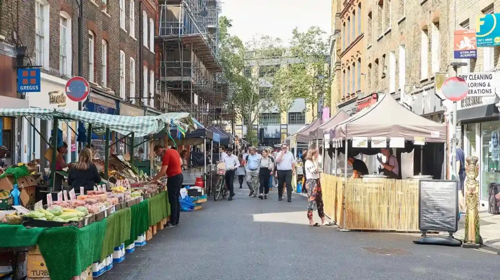
Visitors should also use local markets according to their original function. Smithfield’s early-morning activity demonstrates a wholesale commercial tradition, while neighbourhood markets such as Spitalfields provide a combination of historic buildings and contemporary retail.
Historic public spaces deserve equal attention. Richmond Green demonstrates the long survival of an urban green, while London’s wider network of parks and open spaces preserves landscapes within an intensely developed metropolis.
The City of London provides another model. Its 28 conservation areas include historic districts such as Fleet Street, Bank Junction, Chancery Lane and Charterhouse Square. The City also contains scheduled archaeological monuments and hundreds of listed buildings.
Respect for residents is essential. Historic neighbourhoods are functioning communities rather than open-air museums. Residential streets, places of worship, schools, markets and local businesses serve residents first.
The most responsible approach therefore involves observing rather than disrupting. Visitors should remain on public routes, follow photography restrictions, support established local businesses and avoid treating private property as a heritage exhibit.
This approach also improves historical understanding. Local London is not defined by the absence of famous attractions. It is defined by the survival of everyday urban systems.
How are London’s historic neighbourhoods being preserved for the future?
London preserves historic neighbourhoods through conservation-area designation, listed-building protection, archaeological assessment, planning controls, local heritage studies and community involvement, while adaptive reuse allows historic buildings to remain functional as the capital continues to grow.
Conservation areas are central to this process. Historic England states that local authorities normally designate conservation areas where architectural quality or historic interest justifies protection. The designation applies to the character of the wider area rather than only individual buildings.
The City of London currently has 28 conservation areas, each supported by character assessments and management strategies. These documents identify important architectural features and guide decisions about development.
Richmond provides another substantial example. Its 85 conservation areas include former villages, town centres and major historic landscapes. Conservation-area appraisals document historical development, architectural character, open spaces and management priorities.
Article 4 Directions provide an additional planning mechanism. These directions remove specified permitted development rights where stronger control is necessary to maintain local architectural character. Richmond uses Article 4 Directions to protect groups of properties and streets where seemingly minor alterations affect their collective appearance.
Archaeology also contributes to preservation. Spitalfields demonstrates this through investigations that uncovered remains associated with the medieval priory of St Mary Spital.
Adaptive reuse provides another long-term preservation mechanism. Former markets, warehouses, workshops and industrial premises frequently receive new functions while retaining important architectural features.
However, conservation does not mean freezing a neighbourhood at one historical date. London has always changed. Historic England recognises that conservation areas evolve and face pressures including poor development, neglect and deliberate damage.
The future historical relevance of London’s neighbourhoods therefore depends on managing change without removing the evidence that explains how each district developed.
What does experiencing London like a local reveal about the city’s history?
Experiencing London like a local reveals that the capital’s history exists across neighbourhood streets, markets, homes, parks, transport routes and workplaces, where centuries of migration, commerce, industry, architecture and community life remain visible within the modern metropolitan landscape.
The historical importance of London extends far beyond its internationally recognised landmarks. The city developed through countless neighbourhood-level processes that connected residents to employment, transport, religion, commerce and public space.
Spitalfields demonstrates migration and textile production. Clerkenwell demonstrates manufacturing and religious change. Smithfield demonstrates food distribution and commercial infrastructure. Hampstead demonstrates village development and cultural history. Richmond demonstrates royal influence and suburban growth. Peckham demonstrates nineteenth-century expansion and changing communities. Wapping demonstrates maritime commerce and the Thames.
These districts represent different mechanisms of urban change. Together they show why London has such a complex architectural landscape.
The evidence is visible in ordinary places. Georgian terraces record eighteenth-century expansion. Victorian houses record population growth. Market halls record commercial organisation. Railway stations record transport transformation. Former warehouses record industrial decline and adaptive reuse.
The historical record also exists beneath the streets. Archaeological investigations continue to identify earlier structures, burial sites, foundations and evidence of previous land use.
London’s preservation system recognises this layered character. Conservation areas protect relationships between buildings, streets and spaces, while listed-building and archaeological protections preserve individual elements of exceptional significance.
For history enthusiasts, cultural tourists and educators, these neighbourhoods provide a practical way to understand London as a continuously changing city. For academic students and genealogical researchers, local streets provide geographical context for census records, parish records, trade directories and historical maps.
The strongest local experience is therefore not a search for places untouched by modern London. It is an examination of places where historical layers remain legible.
London’s neighbourhoods continue to evolve. Their future historical value depends on maintaining the physical evidence of earlier communities while allowing contemporary residents, businesses and institutions to use these places as living parts of the capital.
That balance explains why the best places to experience London like a local are often ordinary streets with extraordinary historical depth.
Frequently Asked Question
What are the best places to experience London like a local?
Spitalfields, Clerkenwell, Hampstead, Richmond, Peckham and Wapping are strong choices for experiencing London beyond its major tourist attractions. These neighbourhoods combine historic streets, markets, parks, architecture and established communities.