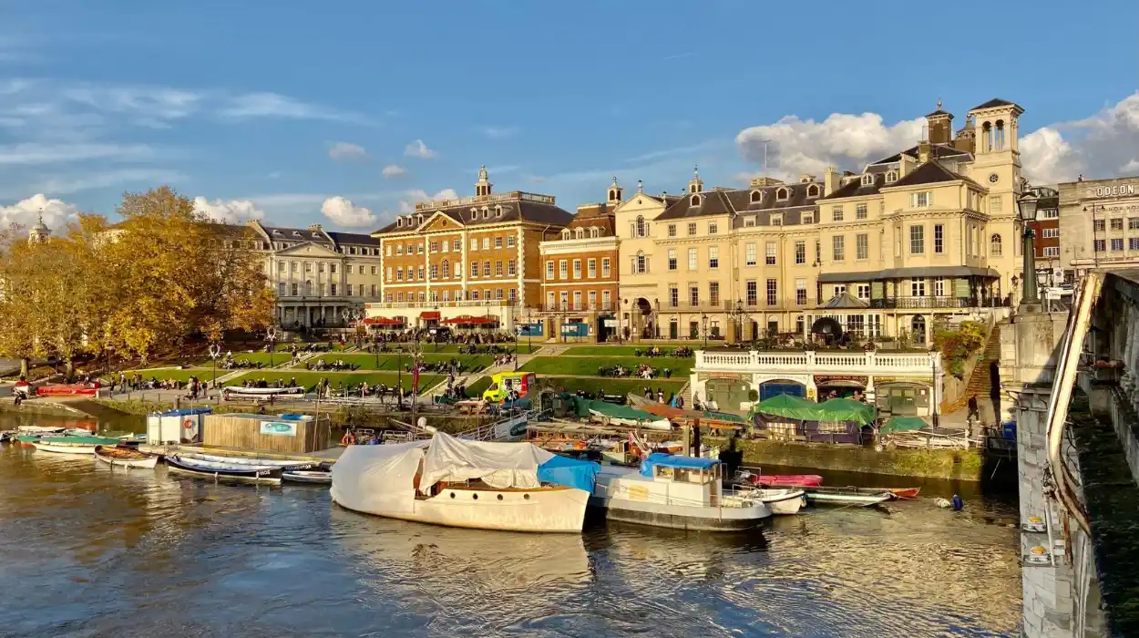
Richmond is one of south-west London’s most historically distinctive walking areas. Its landscape combines the River Thames, Richmond Green, Richmond Hill, Richmond Park, Petersham, Ham Common and Ham House. These places form a connected historic landscape shaped by royal occupation, agriculture, aristocratic estates, transport development and modern conservation.
- What makes Richmond one of London’s most important historic walking landscapes?
- How does the Richmond Riverside walk reveal the area’s royal and commercial history?
- Why is Richmond Hill important for understanding London’s historic landscape views?
- How can walkers explore Richmond Park’s royal history and scenic viewpoints?
- Which Richmond Park walks are best for gardens, historic buildings and landscape study?
- Why are Petersham and Ham important historic walking areas beside the Thames?
- How does Richmond’s historic green space remain protected today?
- What can these Richmond walks reveal about the long-term history of London?
- Frequently Asked Question
The area’s history is closely connected with the former royal settlement of Richmond, originally known as Sheen. The royal association stretches back to the medieval period. Henry VII developed the royal presence at Richmond and adopted the name associated with his title, Earl of Richmond. Richmond later became an important Tudor and Stuart royal residence.
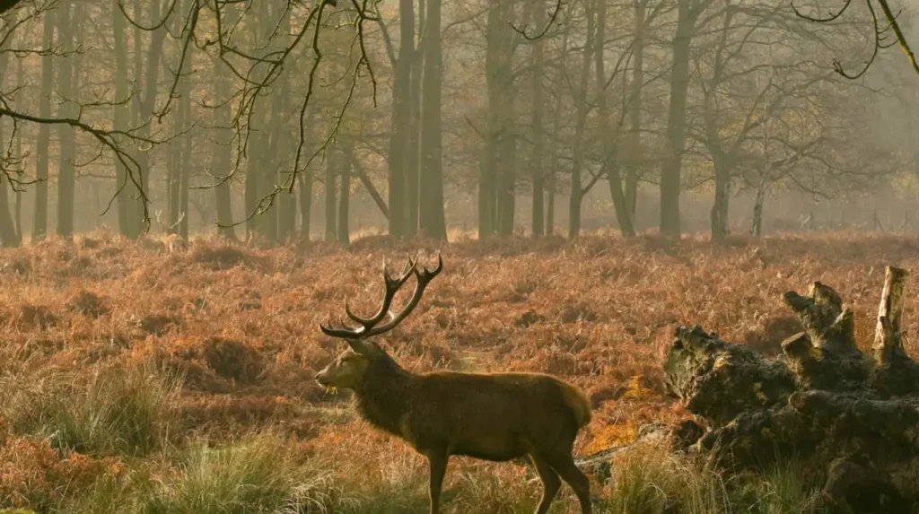
The landscape changed significantly in 1625 when Charles I moved his court to Richmond to escape the plague in London. He established Richmond Park as a hunting landscape and introduced large herds of red and fallow deer. The park retained much of its historic character because its principal landscape structure survived later urban expansion.
Today, the best scenic walks around Richmond provide access to this layered history without requiring a long journey from central London. Riverside paths explain the importance of the Thames. Richmond Green illustrates the relationship between royal residence and settlement. Richmond Hill demonstrates the historical value placed on landscape views. Richmond Park preserves an extensive royal hunting landscape, while Petersham and Ham retain village and country-estate characteristics.
These routes are therefore more than recreational paths. They form a practical way to study London’s changing relationship with water, royal authority, agriculture, architecture, public parks and heritage preservation.
What makes Richmond one of London’s most important historic walking landscapes?
Richmond combines a historic royal settlement, the River Thames, Richmond Park, Richmond Hill, Petersham and Ham into one connected landscape where medieval, Tudor, Stuart, Georgian, Victorian and modern heritage remain visible today.
Richmond’s importance comes from the survival of different historic landscapes within a relatively compact area. The Thames provided transport, water, agricultural resources and a natural geographical boundary. Royal occupation added political importance, while aristocratic estates created formal gardens, parkland and country houses.
Richmond Green developed beside the former royal palace and remained surrounded by buildings associated with court life. The London Borough of Richmond upon Thames records that buildings had bordered the Green for at least 400 years. Early structures accommodated people serving or visiting the palace. By the early eighteenth century, these buildings had increasingly become residences for minor nobility, diplomats and other residents connected with the court.
The surrounding landscape also retained rural characteristics. Petersham Conservation Area lies between Richmond and Ham, with Richmond Park to the east and the River Thames to the north. The council identifies Petersham as a settlement dating to at least the early medieval period. St Peter’s Church retains thirteenth-century fabric, later fifteenth-century alterations and an eighteenth-century brick bell tower and cupola.
This combination creates a distinctive walking environment. A route can move from an urban high street to a medieval church, from a village landscape to a royal park, or from a riverside meadow to a seventeenth-century country house.
The walking landscape also demonstrates how preservation policies developed. Richmond Hill’s famous view across the Thames valley received formal protection through restrictive covenants in the twentieth century. In 1930, local authorities and private interests established a Deed of Covenant designed to limit development that threatened the historic view.
How does the Richmond Riverside walk reveal the area’s royal and commercial history?
The Richmond riverside walk follows the Thames beside Richmond Green, Old Palace Lane and historic buildings, showing how royal residence, river transport, commerce, housing and public recreation shaped Richmond from the medieval period through the modern era.
The riverside is the natural starting point for understanding Richmond’s historical geography. The Thames provided a direct connection between royal settlements, estates and communities along its banks. Richmond’s palace stood close to the river, reinforcing the relationship between royal authority and the waterway.
A walk from the town centre towards the river passes Richmond Green and Old Palace Lane before reaching the Thames. Richmond Green is especially important because its built surroundings preserve the relationship between the former palace and the residential settlement that developed around it.
The Green was not simply an open recreational space. Its surrounding properties developed in response to the presence of the royal court. The London Borough of Richmond upon Thames records that the area accommodated people connected with the palace before later becoming a residential district for nobility, diplomats and professional residents.
The riverside then provides a different historical perspective. The Thames functioned as both a transport corridor and a landscape feature. Its banks supported settlement, agriculture and estates. The floodplain also restricted development in certain locations, preserving open land that later became part of the borough’s distinctive green character.
The railway changed Richmond’s physical geography in the nineteenth century. The council records that the railway construction of the 1840s separated Richmond Green from Old Deer Park, apart from a footbridge. Victorian villas followed as more prosperous commuters moved into the area.
This transformation illustrates the transition from a royal and aristocratic settlement into a connected metropolitan suburb. Walking from Richmond station towards the river therefore crosses several stages of London’s urban development.
For a broader visitor-focused overview of the district and its attractions, consult our comprehensive [The History of Borough Market as London’s Oldest Trading and Food Destination] for itineraries and visiting parameters.
Why is Richmond Hill important for understanding London’s historic landscape views?
Richmond Hill is historically important because its elevated Thames Valley view became a celebrated cultural landscape and later received formal protection, preserving a distinctive panorama associated with writers, artists, landscape design and London’s heritage policies.
Richmond Hill provides one of the clearest examples of a protected historic view in London. Its elevation creates a wide panorama across the Thames valley, while the open landscape below connects Richmond with Petersham, Ham and the wider western suburbs.
The view became culturally significant during the eighteenth and nineteenth centuries. Scottish poet James Thomson lived in Richmond from 1736 until his death in 1748 and referred to the panorama in his poem Summer, first published in 1727. William Wordsworth later referred to Richmond Hill in a sonnet dated 1820. The London Borough of Richmond upon Thames documents these literary associations.
The significance of the view extended beyond literature. Landscape views became important components of eighteenth-century ideas about designed scenery. Richmond Hill allowed observers to see an extensive sequence of river valley, woodland, settlements and distant landmarks.
Preservation became a practical issue as London expanded. The view from Richmond Hill faced development pressure during the twentieth century. In 1930, a Deed of Covenant involving Richmond Borough Council, Twickenham Borough Council and several earlier local authorities restricted development across parts of the landscape visible from the hill.
Further disputes demonstrated the continuing pressure created by urban development. In 1958, a proposal involving garages at Haversham Grange led to objections and a legal dispute over the restrictive covenants. In 1964, a proposed high-rise hotel on the site of the Star and Garter Hotel also generated opposition. The hotel proposal was subsequently abandoned.
The walking route around Richmond Hill therefore provides a direct lesson in heritage planning. The view itself became a historic asset. Its preservation demonstrates that heritage protection applies not only to buildings but also to relationships between landforms, vegetation, architecture and distant landmarks.
How can walkers explore Richmond Park’s royal history and scenic viewpoints?
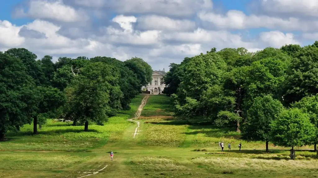
Richmond Park provides the largest historic walking landscape in Richmond, combining a seventeenth-century royal hunting park, ancient woodland, grassland, deer herds, historic ponds, gardens, monuments and panoramic viewpoints across the Thames Valley and London.
Richmond Park is the central historic green space in the area. The Royal Parks identifies it as one of London’s eight Royal Parks and records its area at approximately 2,500 acres. The park is also a National Nature Reserve, London’s largest Site of Special Scientific Interest and a European Special Area of Conservation.
Its royal history became especially important in 1625. Charles I brought his court to Richmond to escape the plague affecting London. He subsequently established the landscape as a hunting park and stocked it with red and fallow deer. In 1637, he built a brick wall approximately eight miles long around the park to contain the deer and restrict access. Sections of the historic wall survive.
The park’s present landscape reflects centuries of deer grazing. Open grassland, ancient trees and woodland developed within this long-managed environment. The Royal Parks estimates that an ancient oak within the park is around 750 years old. The park also contains anthills dating back approximately 150 years and supports substantial deer herds.
The Tamsin Trail provides a well-established walking circuit around the park. The Royal Parks describes it as just over seven miles long. It links major landscape features while allowing walkers to experience the scale of the historic park.
King Henry’s Mound is another essential historical point. The mound is believed to be a prehistoric burial chamber rather than a monument created by Henry VIII. Its elevated position provides a protected sightline towards St Paul’s Cathedral, approximately 12 miles away. The Royal Parks records the mound as a Bronze Age archaeological feature.
This combination of prehistoric archaeology and royal history makes Richmond Park significant for historical research. The landscape preserves evidence from periods separated by thousands of years.
The park also contains Pen Ponds, constructed in 1746. The ponds were divided by a causeway and became integrated into the park’s landscape and ecological character.
Which Richmond Park walks are best for gardens, historic buildings and landscape study?
Isabella Plantation, Pembroke Lodge and Pen Ponds provide complementary walking environments within Richmond Park, linking Victorian horticulture, Georgian architecture, designed landscapes, historic water management and the park’s long-established ecological character.
Isabella Plantation is a 40-acre woodland garden within Richmond Park. The Royal Parks describes it as a Victorian woodland plantation containing streams, ponds and extensive ornamental planting. Its modern form developed from the nineteenth-century plantation landscape and later horticultural management.
The plantation has an important botanical history. It contains a National Plant Collection of evergreen Kurume azaleas, together with rhododendrons, magnolias and camellias. The collection connects Richmond’s landscape history with international plant collecting and twentieth-century horticultural practice.
Isabella Plantation opened to the public in 1953. Its later public role demonstrates how formerly controlled landscapes within Royal Parks became accessible recreational spaces. The area remains managed for both public enjoyment and biodiversity.
Pembroke Lodge offers a different historical experience. The Grade II listed Georgian building began as a four-room cottage for the park’s mole catcher. It was constructed in 1754 and later became associated with Lord John Russell, a nineteenth-century Prime Minister. Bertrand Russell, the philosopher and mathematician, spent part of his childhood there.
The gardens around Pembroke Lodge provide another important viewpoint across the Thames Valley. Their historical value comes from the combination of architecture, planting, topography and long-distance views.
Pen Ponds provide evidence of eighteenth-century landscape intervention. Constructed in 1746, the ponds altered the park’s water environment while becoming an established part of its scenic character. Their survival demonstrates how historic landscape engineering can remain integrated into modern public parkland.
Together, these sites demonstrate different mechanisms of landscape change. Isabella Plantation represents horticultural management. Pembroke Lodge represents eighteenth-century architecture and elite occupation. Pen Ponds represent engineered water management.
Why are Petersham and Ham important historic walking areas beside the Thames?
Petersham and Ham preserve village landscapes, medieval church fabric, historic commons, riverside meadows and the Grade I listed Ham House, creating a walking route that connects Richmond’s royal landscape with seventeenth-century aristocratic estate history.
Petersham forms a crucial transition between Richmond and Ham. Its historic settlement developed beside the Thames and beneath the influence of Richmond Park and Ham House. The council’s conservation assessment identifies the village as at least early medieval in origin.
St Peter’s Church is one of its most important surviving structures. The Grade II* listed building retains thirteenth-century fabric and fifteenth-century alterations. Its eighteenth-century brick bell tower and cupola add another architectural layer.
The village became increasingly attractive to wealthy residents during the seventeenth and eighteenth centuries. Its proximity to Richmond and Ham House encouraged the development of substantial residences within a landscape that retained rural characteristics.
Ham House provides the principal architectural landmark of this route. The present house was first built in 1610 for Sir Thomas Vavasour and was substantially altered during the later seventeenth century. The house subsequently became associated with the political world surrounding Charles II and his court.
The house is Grade I listed and designated a scheduled monument. Its gardens are also historically significant. The restored seventeenth-century gardens include a kitchen garden, the Wilderness and summerhouses.
The surrounding Ham House Conservation Area was designated in 1975 and extended in 1982. The estate is also included on the Register of Historic Parks and Gardens at Grade II*. The council identifies the estate as an important component of the wider landscape relationship between Ham Common, Richmond Park and the Thames.
The archaeological significance extends beyond the visible buildings. The London Borough of Richmond’s Archaeological Priority Areas appraisal identifies Ham House and Grounds as an area with potential for further archaeological discoveries, particularly along the riverside. Prehistoric finds are already documented within the wider area.
A walk through Petersham and Ham therefore provides evidence for settlement history, religious architecture, aristocratic culture, landscape design and archaeological research.
How does Richmond’s historic green space remain protected today?
Richmond’s historic green spaces remain protected through Royal Parks management, conservation areas, listed-building controls, archaeological designations, protected views and landscape management that balances public access, biodiversity and historic character.
Modern Richmond demonstrates how historic landscapes survive through overlapping preservation systems. Richmond Park is managed by The Royal Parks and has multiple environmental designations reflecting its ecological and historical importance.
Conservation areas provide another layer of protection. Petersham Conservation Area was designated in 1969 and extended in 1982. Ham House Conservation Area was designated in 1975 and extended in 1982. These designations recognise the relationship between buildings, streets, open land and landscape settings.
Listed-building protection preserves individual structures. Ham House is Grade I listed, while St Peter’s Church is Grade II*. Pembroke Lodge is Grade II listed. These classifications recognise buildings with different levels of architectural and historic significance.
Archaeological protection is equally important. The Ham House and Grounds Archaeological Priority Area contains evidence of prehistoric activity and archaeological potential along the Thames. Such designations recognise that important heritage survives below ground as well as above it.
Landscape protection also applies to views. Richmond Hill demonstrates how a panorama can become a protected heritage asset. The twentieth-century covenant system limited development that threatened the historic relationship between the hill and the Thames valley.
Environmental management adds another dimension. Richmond Park supports rare species and ancient habitats while continuing its historic function as public parkland. The Royal Parks records habitats supporting stag beetles, bats, moths and other wildlife.
These measures ensure that walking routes remain connected to their historical context. A path beside the Thames, a view from Richmond Hill or a track across Richmond Park is part of a larger protected cultural landscape.
What can these Richmond walks reveal about the long-term history of London?
Richmond’s walking landscape demonstrates how royal power, river geography, agriculture, aristocratic estates, transport expansion, public parks and conservation policy transformed a rural settlement into a historic London district without erasing its principal landscape structures.
The historical significance of Richmond lies in continuity as well as change. The Thames remains the central geographical feature. Richmond Park continues to preserve a large area of royal hunting landscape. Petersham retains its village character. Ham House retains its seventeenth-century estate setting. Richmond Hill retains its celebrated panorama.
The chronology begins with medieval settlement and royal connections around Sheen. The Tudor period strengthened Richmond’s royal identity. The Stuart period transformed the surrounding countryside through the creation of Richmond Park in 1625. The eighteenth century added formal landscape features, including Pen Ponds, while the cultural importance of Richmond Hill expanded.
The nineteenth century introduced new pressures. Rail transport connected Richmond more directly with London and encouraged suburban development. Victorian villas appeared around the historic green spaces as wealthier commuters moved into the district.
The twentieth century established new preservation priorities. Historic views required formal protection. Country houses and their landscapes received conservation designations. Formerly controlled royal landscapes increasingly functioned as public recreational spaces.
The modern period therefore represents management rather than a complete break with the past. Richmond Park remains a major public green space with a royal origin. Isabella Plantation demonstrates the conversion of a historic woodland plantation into a public horticultural landscape. Ham House remains an important example of a Stuart country house and estate.
For educators and students, these walks provide a practical fieldwork framework. Richmond supports the study of medieval settlement, royal history, seventeenth-century political culture, Georgian landscape design, Victorian suburbanisation, archaeology, environmental history and modern conservation.
For heritage researchers, the area also demonstrates the importance of landscape context. A listed building cannot be understood separately from its surrounding parkland, river, roads, views and settlements. Richmond’s heritage survives because these relationships remain visible.
For visitors, the principal value of these walks is their concentration of historical evidence. Richmond Riverside explains the Thames settlement. Richmond Green reveals the former royal community. Richmond Hill demonstrates the cultural and planning importance of views. Richmond Park preserves a royal hunting landscape. Petersham and Ham connect the district with medieval settlement and aristocratic estate history.
The result is a coherent historic walking landscape rather than a collection of unrelated attractions. Its significance comes from the interaction between natural geography and human intervention across many centuries.
Richmond therefore remains one of London’s strongest destinations for scenic walking with historical depth. Its riverside paths, open commons, royal parkland, historic buildings and protected views provide direct evidence of how London’s western landscape developed.
The survival of these places is also a reminder that historic landscapes require active management. Conservation designations, archaeological research, environmental stewardship and responsible public access all contribute to preserving the relationship between Richmond’s past and present.
Walking through Richmond is consequently a form of landscape-based historical research. The Thames, Richmond Green, Richmond Hill, Richmond Park, Petersham and Ham each reveal a different stage in the development of the district. Together, they form a continuous record of royal authority, settlement, landscape design, transport expansion and heritage preservation.
Frequently Asked Question
What are the best scenic walks around Richmond?
The best scenic walks around Richmond include Richmond Riverside, Richmond Green, Richmond Hill, Richmond Park, Petersham and Ham. These routes combine River Thames views, historic buildings, royal landscapes, ancient woodland and protected green spaces.