Little Venice is one of London’s most distinctive historic waterside districts. Located around the meeting point of the Regent’s Canal and the Paddington Arm of the Grand Union Canal, the area combines early nineteenth-century transport infrastructure, Regency and Victorian residential development, canal communities, gardens, cafés, narrowboats, and public walking routes.
- What makes Little Venice one of London’s best canal walking areas?
- How did Little Venice become part of London’s canal history?
- Which short canal walk is best for relaxation in Little Venice?
- Where can visitors find the best café stops along Little Venice’s canals?
- What is the best canal walk from Little Venice towards Regent’s Park?
- Why is the Little Venice to Camden route important for London’s transport history?
- What historic features should photographers look for along Little Venice’s waterways?
- How does the walk towards Paddington Basin reveal London’s modern canal regeneration?
- How have London’s canals changed from industrial infrastructure into leisure spaces?
- Why do Little Venice canal walks remain important for London’s heritage?
- What is the best way to experience the history of Little Venice on foot?
- Frequently Asked Question
The district provides an important record of London’s transformation during the Industrial Revolution. Its waterways were constructed to move coal, timber, food, building materials, and other commercial cargoes between the Midlands, the capital, and the River Thames. The same infrastructure now supports walking, boating, recreation, heritage interpretation, and urban conservation.
For visitors seeking relaxation, cafés, and waterside photography, Little Venice offers several connected canal walks. These routes range from short circuits around Browning’s Pool to longer journeys towards Paddington Basin, Regent’s Park, and Camden. Each route reveals a different layer of London’s architectural, social, and transport history.
The Regent’s Canal Company was formed in 1812, and the Regent’s Canal was completed in 1820. The canal became part of a wider network linking London with inland industrial regions. Commercial traffic continued for generations before railways, road freight, and changing patterns of distribution reduced its economic role. By the late twentieth century, conservation and regeneration had established a new future for London’s historic waterways.
What makes Little Venice one of London’s best canal walking areas?
Little Venice combines historic canals, Regency streets, moored narrowboats, public gardens, waterside cafés, and connected towpaths within a compact area. Its location at a major canal junction makes it an important starting point for walks that combine relaxation, architectural history, photography, and London’s transport heritage.
Little Venice developed around a significant meeting point in London’s inland waterway system. The area is associated with Browning’s Pool, the broad triangular basin where the Regent’s Canal meets the Paddington Arm of the Grand Union Canal.
The modern character of Little Venice reflects two major historical processes. The first was the construction of London’s canal network during the early nineteenth century. The second was the residential development of Paddington and Maida Vale as London expanded westward and northward.
The canal system changed the physical geography of the district. Waterways created new routes through previously semi-rural land. Bridges, towpaths, basins, tunnels, wharves, and moorings became part of the urban landscape.
The surrounding streets introduced a contrasting architectural environment. White stucco terraces and large residential buildings created the visual identity now strongly associated with Little Venice. This combination of water infrastructure and planned urban housing remains central to the area’s historical significance.
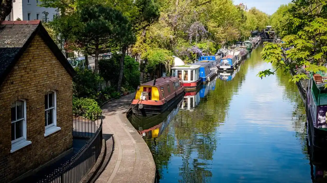
Today, the Canal & River Trust describes Little Venice as a location where dozens of narrowboats, trip boats, water cafés, and other floating businesses occupy the calm waters around the canal junction. The towpath is publicly accessible and provides direct connections towards other parts of London’s canal network.
For photography, the district contains several recurring visual elements. These include narrowboats, reflections, bridges, willow trees, stucco terraces, gardens, and changing perspectives along the water.
The area also demonstrates how historic infrastructure can acquire new functions. A canal built principally for freight transport now supports leisure walking, residential boating, tourism, cultural activity, and urban environmental appreciation.
How did Little Venice become part of London’s canal history?
Little Venice emerged from London’s early nineteenth-century canal expansion, when new waterways connected industrial Britain with the capital. The Regent’s Canal linked Paddington with Limehouse and the River Thames, while western canal routes connected London with the Midlands and major inland manufacturing regions.
The historical foundation of Little Venice lies in the expansion of Britain’s inland navigation network.
Before the development of modern railways, canals provided an efficient system for transporting heavy goods. Roads were slower and more expensive for large cargoes. Water transport allowed coal, timber, agricultural products, building materials, and manufactured goods to move in substantial quantities.
The Grand Junction Canal reached Paddington in the early nineteenth century. This created a major western water connection between London and inland England.
The Regent’s Canal extended the network eastward.
The Regent’s Canal Company was established in 1812 to construct a route from the Paddington Arm towards Limehouse, where the canal would connect with the River Thames. Architect and urban planner John Nash played an important role in the wider vision for the project, while engineering work shaped the physical route through north London. The canal opened in stages and was completed in 1820.
The route was named after the Prince Regent, who later became King George IV.
The canal’s construction coincided with a major period of metropolitan planning. John Nash was also associated with the transformation of central London and the development of Regent’s Park. The canal therefore formed part of a wider landscape of early nineteenth-century urban change.
This context explains why a modern Little Venice walk contains both industrial infrastructure and formal residential architecture.
The waterway served commercial purposes, while nearby districts developed increasingly substantial housing.
The canal later faced competition from newer transport technologies. Railways reduced the commercial advantages of inland waterways. Road freight created further competition during the twentieth century.
The Canal & River Trust records that long-distance traffic continued on the Regent’s Canal into the 1960s. Commercial activity had already declined significantly by the time the canal system was nationalised in 1948, and Regent’s Canal Dock closed to shipping in 1969.
The preservation of Little Venice therefore represents the survival of infrastructure from Britain’s canal age.
Which short canal walk is best for relaxation in Little Venice?
The walk around Browning’s Pool and the central Little Venice basin provides the shortest and most relaxing route. It concentrates narrowboats, gardens, bridges, waterside businesses, and historic residential architecture into an easily explored area without requiring a long-distance towpath journey.
Browning’s Pool is the natural starting point for understanding Little Venice.
The broad water space provides a clear view of the district’s defining relationship between canal infrastructure and residential architecture. Boats line the water, while the surrounding streets contain the characteristic stucco-fronted buildings associated with Maida Vale and Paddington.
A short walk can begin near Warwick Avenue and continue around the basin and adjoining canalside paths.
This route is particularly suitable for visitors interested in slow exploration. The area does not require a fixed itinerary to reveal its historical features. The canal itself provides the geographical structure.
Walking beside the water also demonstrates the original function of the towpath.
Towpaths were historically working routes. Horses used them to pull canal boats before mechanical propulsion became dominant. Modern walkers now use the same linear corridors for recreation and commuting.
The transformation of the towpath from industrial infrastructure into public walking space is one of the most important themes in London canal history.
Rembrandt Gardens provides another element of the short Little Venice experience. The public green space creates a contrast with the dense urban development surrounding the waterways.
The Canal & River Trust identifies the Little Venice area as a place for canal-side walking, boat watching, picnics, and visits to floating cafés. Its official information also confirms public towpath access and identifies nearby transport connections through Warwick Avenue and Paddington.
For photographers, the basin works especially well because it contains open water.
Open water creates longer reflections than narrow canal sections. Boats, trees, bridges, and buildings can appear simultaneously within a single composition.
Morning and late afternoon light also create strong contrasts across the water and building façades.
Where can visitors find the best café stops along Little Venice’s canals?
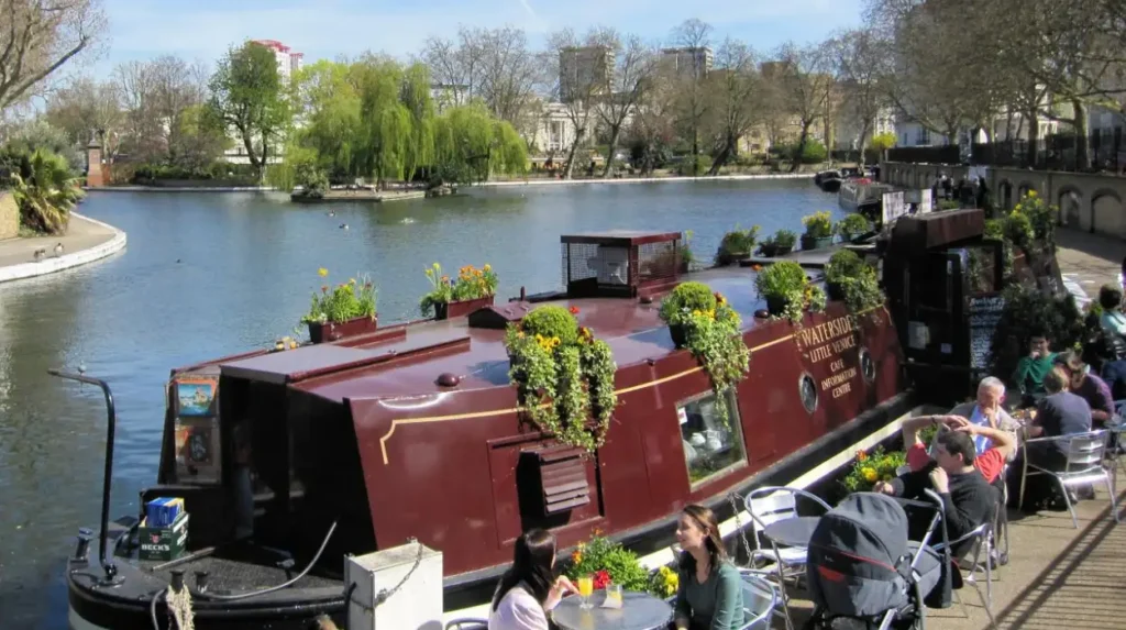
Little Venice’s cafés are concentrated around the canal basin and nearby streets, with floating businesses forming part of the area’s modern waterside culture. These establishments continue the canal’s tradition of social and commercial activity while serving visitors exploring the historic waterways on foot.
Cafés are now part of Little Venice’s contemporary identity.
Their presence also reflects the changing economic role of the waterways.
During the nineteenth and twentieth centuries, the canal system supported commercial movement. Today, commercial activity in Little Venice includes tourism, hospitality, boating services, cultural venues, and floating businesses.
The most distinctive feature is the presence of businesses directly connected with the water.
The Canal & River Trust identifies water cafés and floating businesses among the defining features of Little Venice. The triangular basin contains narrowboats, trip boats, and commercial vessels that create a working visual connection between the historic waterway and its modern visitor economy.
A café stop is particularly useful when walking the area in stages.
Visitors can explore the central basin first, continue along one section of the towpath, and then return towards the main Little Venice streets.
This pattern avoids treating the district as a single linear attraction.
Little Venice operates as a network of connected waterside spaces.
The café environment also provides an opportunity to observe boat movement and canal activity. Unlike major roads, canals produce a slower and more visible form of urban circulation.
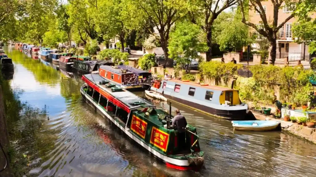
Narrowboats remain one of the most recognisable symbols of Britain’s inland waterways.
Their appearance connects modern Little Venice with the freight and residential history of the canal system, although contemporary boats perform a different range of functions from nineteenth-century commercial craft.
What is the best canal walk from Little Venice towards Regent’s Park?
The Little Venice to Regent’s Park route follows the Regent’s Canal eastward through historic towpaths, bridges, Maida Hill, and the northern edge of Regent’s Park. It provides approximately two miles of canal history before reaching Camden’s important industrial and commercial waterways.
The eastward walk from Little Venice is the most historically informative route for visitors who want to move beyond the central basin.
The Canal & River Trust identifies the official Little Venice to Camden route as approximately two miles long. It begins at Little Venice and follows the Regent’s Canal towards Camden Lock.
The route demonstrates the engineering challenges of constructing a canal through an expanding city.
One important feature is Maida Hill Tunnel.
Tunnels allowed canal builders to maintain a practical route through difficult urban terrain. These structures remain evidence of the engineering decisions required to create a continuous waterway across London.
The towpath route also passes beneath bridges and alongside sections where roads and railways later crossed the canal.
These crossings reveal successive transport eras.
The canal represents the early nineteenth-century water transport era. Railway structures represent the nineteenth-century expansion of rail transport. Modern roads represent the later dominance of motor transport.
Examples include canal bridges, railway bridges, and major urban roads.
The route then approaches Regent’s Park.
John Nash was associated with both the Regent’s Canal project and the development of Regent’s Park. Historical planning connected the wider landscapes of transport, housing, and parkland across north London.
The canal runs around the edge of Regent’s Park rather than through its centre.
This route provides one of the strongest contrasts on the Little Venice canal network. The dense residential environment gradually gives way to parkland, gardens, trees, and larger open views.
The change in landscape is significant for photographers.
The central Little Venice basin emphasises architecture and boats. The Regent’s Park section introduces vegetation, wildlife, bridges, and longer canal perspectives.
Why is the Little Venice to Camden route important for London’s transport history?
The Little Venice to Camden route follows infrastructure built for Britain’s industrial transport economy and preserved through major technological change. It records the transition from horse-drawn canal freight to railway transport, road freight, modern commuting, leisure walking, and heritage-focused regeneration.
The historical importance of the route extends beyond its scenery.
Every section of the Regent’s Canal reflects changes in London’s economic geography.
The canal was designed to connect inland production and commercial networks with the capital and the River Thames. Cargo could move through a connected system rather than relying entirely on congested roads.
The Canal & River Trust records that the Regent’s Canal carried major quantities of goods including timber, coal, building materials, and foodstuffs. These cargoes supported London’s population growth and construction.
The route therefore represents an important part of the city’s supply history.
London required enormous quantities of fuel and construction materials during the nineteenth century.
Canals provided one mechanism for meeting that demand.
The system later declined because transport technology changed.
Railways offered faster movement over long distances. Road vehicles later captured additional freight traffic.
The decline of commercial canal transport created a major preservation challenge.
By the mid-twentieth century, many waterways faced uncertain futures.
The survival of the Regent’s Canal was not automatic.
The Canal & River Trust records that the canal was threatened by proposals and changing economic conditions, while the decline of shipping activity culminated in the closure of Regent’s Canal Dock to commercial shipping in 1969.
The modern walking route is therefore a preserved transport corridor.
It allows visitors to experience infrastructure originally designed for an entirely different purpose.
What historic features should photographers look for along Little Venice’s waterways?
The strongest historical photography subjects include narrowboats, towpaths, Regency terraces, bridges, tunnels, canal reflections, waterside gardens, and surviving industrial infrastructure. These features document the interaction between nineteenth-century engineering, residential expansion, working waterways, and modern urban preservation in Little Venice.
Waterside photography in Little Venice is closely connected with historical interpretation.
A photograph of a narrowboat is not simply an image of a colourful vessel. It also records the continuing presence of canal culture in a landscape created for inland navigation.
A photograph of a bridge records the need to connect streets across a constructed water barrier.
A photograph of a towpath records a former working route.
A photograph of a stucco terrace records the residential expansion that followed London’s nineteenth-century growth.
The central basin is particularly useful for architectural photography.
The surrounding buildings create a consistent visual backdrop.
The water creates reflections that can double architectural forms within the frame.
Bridge locations provide another useful perspective.
Bridges frame the canal and establish depth. They also show the relationship between transport systems.
Some bridges along the wider Little Venice-to-Camden route contain direct evidence of canal history.
One of the best-known examples is the bridge commonly called Blow Up Bridge near Regent’s Park. The Canal & River Trust explains that a boat carrying gunpowder exploded there in 1874, destroying the existing bridge. The rebuilt structure retained evidence of historic rope wear on its stonework.
This is an example of physical infrastructure functioning as historical evidence.
Photography can document these surviving details while also encouraging visitors to examine the landscape more closely.
How does the walk towards Paddington Basin reveal London’s modern canal regeneration?
The route from Little Venice towards Paddington Basin shows how historic waterways have been integrated into modern urban redevelopment. Old transport corridors now connect residential districts, offices, public spaces, pedestrian routes, contemporary architecture, and restored canal environments within central London.
The western and southern approaches to Little Venice provide a different historical narrative from the route towards Camden.
The canal landscape around Paddington demonstrates urban regeneration.
Historic waterways survived while surrounding land uses changed.
Railway development transformed Paddington into one of London’s major transport centres. Later redevelopment introduced new commercial and residential districts.
The canal remained physically important because it created a permanent geographical corridor through the changing city.
This is one reason canal walks are useful for understanding London’s historical layers.
A walker can move between nineteenth-century infrastructure and twenty-first-century development without leaving the original water route.
The Canal & River Trust’s London waterways guide identifies a walk from Little Venice towards Paddington Basin and notes the presence of modern public art and contemporary development along this section. The guide also explains that Little Venice remains connected to the wider historic waterway system despite extensive modernisation.
The contrast between Little Venice and Paddington Basin is visually significant.
Little Venice is dominated by traditional residential architecture, narrowboats, and mature vegetation.
Paddington Basin presents newer buildings, redesigned public spaces, and contemporary infrastructure.
Together, these environments demonstrate how London preserves historic routes while changing the urban fabric around them.
To experience this historic waterside district in person today, consult our comprehensive [How Hyde Park Became One of London’s Largest Historic Royal Parks Today] for itineraries and visiting parameters.
How have London’s canals changed from industrial infrastructure into leisure spaces?
London’s canals changed through the decline of commercial freight and the growth of preservation, recreation, tourism, and urban regeneration. Historic towpaths now support walking and cycling, while boats and waterside businesses maintain active use of waterways constructed for industrial transport.
The transformation of London’s canals is one of the most important long-term changes visible in Little Venice.
During the nineteenth century, canals were part of the national transport economy.
Their purpose was practical.
They carried cargo.
They connected production centres with markets.
They supported construction and urban growth.
By the twentieth century, this economic system had weakened.
Railways and road transport changed freight distribution.
Commercial canal traffic declined.
The preservation of the network required new uses.
Walking became one of those uses.
Towpaths were already linear routes. Their historical function changed, but their physical form remained valuable.
Cycling became another use.
Boating developed new recreational and residential roles.
Tourism introduced new economic activity.
Cultural venues and floating businesses expanded the range of functions associated with the waterways.
The Canal & River Trust now identifies the Regent’s Canal as a major route for walkers, cyclists, boaters, and visitors, while recognising its continuing importance as a historic waterway across London.
This transformation demonstrates an important principle of heritage preservation.
Historic structures remain relevant when they are adapted without losing their defining historical identity.
Little Venice retains its water routes.
The towpaths remain connected.
Boats remain visible.
Bridges and tunnels survive.
The purpose of the landscape has changed, but the historical framework remains identifiable.
Why do Little Venice canal walks remain important for London’s heritage?
Little Venice canal walks preserve public access to a major nineteenth-century transport landscape while connecting architectural heritage, industrial history, residential development, and modern urban life. The waterways provide physical evidence of how London expanded, transported goods, redesigned neighbourhoods, and protected historic infrastructure.
Little Venice is valuable because its history is visible in the landscape.
The canal is not preserved inside a museum.
It remains part of the city.
This creates an important educational advantage.
Students can examine historical geography directly.
History enthusiasts can identify surviving infrastructure.
Cultural tourists can connect architecture with transport history.
Heritage preservationists can observe how active use supports conservation.
Genealogical researchers can place families and communities within the changing geography of Paddington and Maida Vale.
The area also provides evidence of London’s changing relationship with water.
The River Thames dominates the city’s wider history, but canals demonstrate a different system of urban movement.
They were artificial waterways built for specific economic purposes.
Their routes required engineering, investment, legislation, land acquisition, and long-term maintenance.
The Regent’s Canal connected London with a much larger national network.
The Canal & River Trust describes the wider canal system as a transport route that linked Paddington and the capital with inland Britain, while the modern canal continues to serve as a public corridor through the city.
Little Venice therefore remains historically relevant for several reasons.
It preserves early nineteenth-century infrastructure, including the Regent’s Canal.
It demonstrates nineteenth-century residential development, including stucco terraces and planned streets.
It records industrial transport history, including freight routes and towpaths.
Examples include coal transport, timber transport, and building-material transport.
It also demonstrates modern heritage adaptation through walking, boating, cafés, public gardens, and cultural activity.
The future relevance of Little Venice depends on continued maintenance of the waterways and public understanding of their history.
Canals require active management.
Water levels, bridges, locks, towpaths, wildlife habitats, and historic structures all require protection.
Public use creates both benefits and pressures.
Walking increases appreciation of heritage.
High visitor numbers require careful management.
Cycling improves sustainable transport.
Shared towpaths require safe behaviour.
Residential boating maintains activity.
Mooring and navigation require regulation.
These practical issues demonstrate that heritage preservation is an ongoing process rather than a completed event.
What is the best way to experience the history of Little Venice on foot?
The most effective approach is to begin at the central basin, examine the meeting of the canals, study the surrounding architecture, and then choose either the Paddington or Regent’s Canal direction. This sequence explains Little Venice through geography, engineering, transport history, architecture, and modern preservation.
A historically focused visit should begin with the geography.
The canal junction explains why the district exists in its present form.
From the central basin, visitors can observe the water routes and understand Little Venice as part of a larger network.
The next stage is architecture.
The surrounding residential streets reveal how London expanded around the waterways during the nineteenth century.
The third stage is infrastructure.
Towpaths, bridges, moorings, and tunnels show how the canal functioned as a transport route.
The fourth stage is change.
A walk towards Paddington reveals modern regeneration.
A walk east towards Regent’s Park and Camden reveals the continuing route of the historic Regent’s Canal.
The final stage is preservation.
Modern Little Venice demonstrates how an industrial landscape can remain active without abandoning its historical structure.
For visitors interested primarily in relaxation, the central basin provides the strongest concentration of scenery and waterside activity.
For photographers, the basin and adjoining canal sections provide reflections, boats, architecture, bridges, and vegetation.
For history enthusiasts, the longer eastward route provides the clearest connection with the engineering and transport history of the Regent’s Canal.
For educators and students, the area functions as an accessible example of nineteenth-century infrastructure surviving within a modern capital.
Little Venice is therefore more than a scenic London neighbourhood.
Its canal walks provide a direct route through the history of industrial transport, metropolitan expansion, architectural development, technological change, and heritage preservation.
The waterways that once moved freight through London now move people through the city’s historical landscape on foot.
That continuity gives Little Venice its lasting importance.
The canals preserve the physical geography of nineteenth-century London while supporting modern public life. A walk beside the water provides relaxation and photography opportunities, but it also reveals the systems that helped build and supply one of the world’s largest cities.
Frequently Asked Question
What is Little Venice famous for?
Little Venice is famous for its picturesque canals, narrowboats, waterside cafés, Regency and Victorian architecture, and scenic walking routes around Browning’s Pool, the Regent’s Canal, and the Paddington Arm.