Key Points
- Dramatic Shift: Londoners face a sudden end to a five-day May heatwave that saw temperatures soar to an extraordinary $35^\circ\text{C}$ in the capital.
- Plunging Temperatures: Daytime highs will plummet from the mid-30s to just $22^\circ\text{C}$ on Monday, eventually struggling to exceed $18^\circ\text{C}$ or $19^\circ\text{C}$ later in the week.
- Meteorological Summer Begins: Despite Monday marking the start of the meteorological summer, forecasters warn the conditions will feel distinctly like spring or autumn.
- Heavy Rainfall and Thunderstorms: Heavy downpours are anticipated by Monday evening, with thunderstorms specifically predicted for Tuesday and Thursday.
- Commuter Chaos: The wet weather coincides directly with the first of two planned 24-hour London Underground Tube strikes, threatening severe disruption for millions of commuters on Tuesday morning.
- Recent Highs: The final remnants of the warm spell were recorded on Sunday, with Bushy Park in Richmond upon Thames hitting a peak temperature of $24.7^\circ\text{C}$.
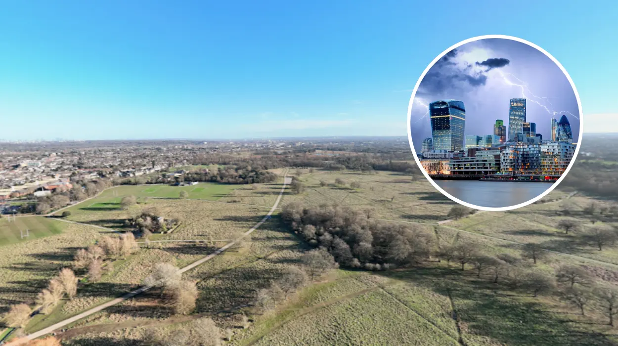
London (The Londoner News) June 1, 2026 – Londoners are bracing for a dramatic shift in weather conditions at the start of the week as a heavy deluge of rain and severe thunderstorms are set to sweep across the capital, bringing a sudden end to a record-breaking five-day May heatwave. According to official meteorological forecasts, temperatures are expected to plunge sharply across Greater London, dropping from recent highs of $35^\circ\text{C}$ down to a maximum of $22^\circ\text{C}$ on Monday, before bottoming out at just $18^\circ\text{C}$ later in the week. This intense weather transition is poised to collide with widespread transport disruption, as heavy rain showers on Tuesday morning will cross paths with the first of two scheduled 24-hour Tube strikes, threatening to leave millions of London commuters stranded in miserable conditions.
The sudden breakdown of the warm plume marks a stark and unsettling transition into the first week of June, which historically signifies the commencement of the British meteorological summer. Instead of sustained sunshine, the Met Office and BBC Weather have issued overlapping assessments pointing toward an unstable, cooler, and significantly wetter pattern that will dominate the standard working week. Overnight temperatures are also expected to experience a corresponding drop, falling as low as $12^\circ\text{C}$, forcing residents to abruptly swap short sleeves for raincoats and umbrellas.
What Is the Immediate Forecast for London on Monday?
As reported by senior operational meteorologist Rebecca Mitchell of the Met Office, the arrival of Monday introduces an immediate and noticeable contrast to the extreme thermal conditions experienced by the capital over the late May bank holiday period. In an official briefing detailing the tracking of the incoming weather front, Mitchell stated that the start of the meteorological summer will
“feel much more like spring or autumn and a big contrast to the heatwave.”
According to the data models published by the Met Office, Monday’s daytime temperatures in London are forecast to max out at a modest $22^\circ\text{C}$. While the daylight hours may offer a brief period of dry or overcast conditions, weather tracking systems indicate that the atmosphere will become increasingly unstable as the day progresses. Forecasters emphasize that heavy rain is expected to develop rapidly across the capital by Monday evening, setting the stage for a prolonged damp spell.
How Cold Did It Get in London Overnight?
The nocturnal cooling will be just as pronounced as the daytime drop. Met Office data indicates that as the cooler air mass from the Atlantic displaces the humid air responsible for the heatwave, overnight temperatures will fall to as low as $12^\circ\text{C}$. This represents a significant decline from the sticky, warm nights that characterised the preceding week, marking a return to baseline seasonal averages.
Explore More London Local News
Heavy Rain and 20°C Temperature Drop to Hit London | 2026
When Will Thunderstorms and Heavy Rain Hit London?
The primary meteorological concern shifts to convective activity and localized downpours as the week advances. In a specialized regional breakdown compiled by the broadcasting team at BBC Weather, meteorologists are predicting full-scale thunderstorms in London on both Tuesday and Thursday. These storms are expected to bring localized lightning, sudden visibility reductions, and transient surface flooding across susceptible urban boroughs.
The timing of Tuesday’s rain showers is expected to create a compounding logistical crisis for the city’s infrastructure. According to the timeline outlined by BBC Weather, the onset of the heaviest morning showers will coincide precisely with the morning rush hour. Observers note that this will severely test the resilience of London’s roads and alternative transport networks, which will already be under immense strain due to industrial action.
How Will the London Tube Strike Affect Commuters in the Rain?
The arrival of adverse weather on Tuesday morning comes at the worst possible moment for millions of city workers, as the capital prepares for major industrial action on the transport network. Commuters are expected to be heavily disrupted by the first of two separate 24-hour Tube strikes organized for this week, reducing transport capacity across the London Underground network to a bare fraction of its normal output.
Transport analysts warn that the combination of torrential rain showers and locked station gates will likely result in gridlock on London’s surface streets. With millions of passengers forced out of the dry underground networks and onto buses, bicycles, or pavements, the demand for ride-hailing services and surface transport is expected to hit peak levels in the middle of heavy downpours.
How Low Will Temperatures Drop This Week?
The long-range outlook suggests that the cool down is not a brief anomaly, but rather a sustained resetting of the regional climate pattern. Forecasters at the Met Office have observed that it is set to get progressively cooler as the week matures, with the capital entering a multi-day blocking pattern dominated by low pressure.
The compiled data indicates that daytime temperatures will actively struggle to get above $18^\circ\text{C}$ or $19^\circ\text{C}$ on some days, representing a massive drop of up to 17 degrees compared to the absolute peak of the May heatwave.
Where Was the Highest Temperature of the Heatwave Recorded?
Before the incoming cold front completely flushes the warm air mass out into the North Sea, the final remnants of the historic May heatwave continued to manifest in localized pockets across Greater London over the weekend. In an official climate summary released to the press, the Met Office confirmed that Bushy Park in Richmond upon Thames saw the highest temperature of Sunday as it reached $24.7^\circ\text{C}$.
This Sunday reading at Bushy Park stood as a gentle step down from the absolute peak of the five-day heatwave, which had previously recorded an astonishing maximum of $35^\circ\text{C}$ in central parts of the capital. The rapid drop from $35^\circ\text{C}$ down to Sunday’s $24.7^\circ\text{C}$, followed by Monday’s projected $22^\circ\text{C}$ and the subsequent mid-week slide to $18^\circ\text{C}$, underlines what meteorologists classify as an unusually sharp thermal collapse for the transition into early June.