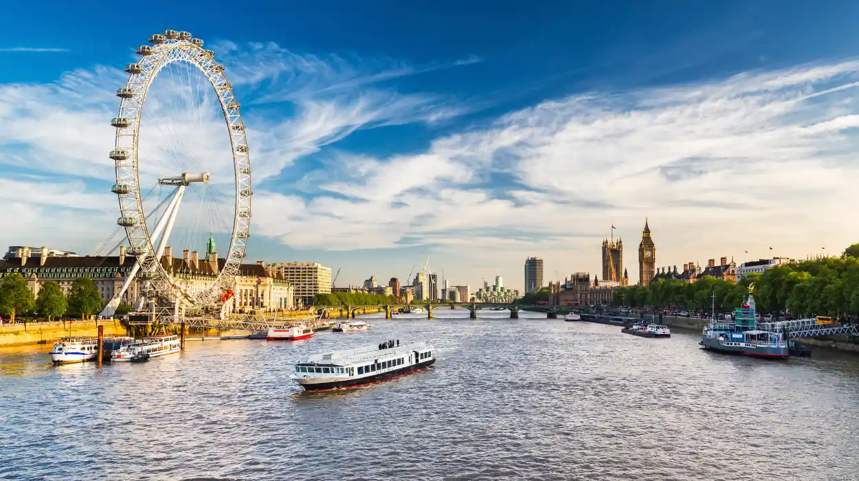
South Bank is one of the most historically significant stretches of the River Thames in central London. The riverside district extends along the southern bank of the Thames opposite Westminster and the City of London. Its present identity combines cultural institutions, public gardens, modern attractions, pedestrian routes, bridges, restaurants, public art, and protected views.
- Why is South Bank historically important to London?
- How did the 1951 Festival of Britain transform South Bank?
- What can visitors experience at the Southbank Centre today?
- Why is the National Theatre important to the South Bank riverside?
- How did BFI Southbank develop from the Festival of Britain?
- What makes the London Eye significant on the South Bank?
- Why are Jubilee Gardens important for a South Bank riverside walk?
- Which riverside walk connects South Bank’s main landmarks?
- What architectural landmarks should visitors see along South Bank?
- How did regeneration change South Bank after the 1951 festival?
- Why are South Bank’s river views protected?
- How can South Bank’s history be understood through a riverside visit?
- Frequently Asked Question
The area is particularly important because its modern cultural identity developed from major twentieth-century reconstruction. The 1951 Festival of Britain transformed a heavily industrialised and war-damaged section of the riverfront into a national showcase for design, science, architecture, and the arts. The Royal Festival Hall survived as the festival’s principal permanent building and became the foundation of the Southbank Centre.
Today, South Bank connects several major London landmarks within a relatively compact riverside environment. The London Eye, County Hall, Jubilee Gardens, Royal Festival Hall, Queen Elizabeth Hall, Hayward Gallery, National Theatre, BFI Southbank, Gabriel’s Wharf, Oxo Tower Wharf, and the Thames Path all contribute to its cultural and recreational character.
The riverside also provides strategically protected views of London. London planning policy identifies the South Bank, Waterloo Bridge, Golden Jubilee and Hungerford Footbridges, Westminster Bridge, and Jubilee Gardens as important river prospects. These protected views preserve relationships between historic landmarks and the wider Thames landscape.
For visitors, the significance of South Bank lies in the way history remains visible within an active public space. A single walk can cross Victorian infrastructure, twentieth-century modernism, post-war cultural architecture, contemporary public art, and twenty-first-century visitor attractions.
Why is South Bank historically important to London?
South Bank became important through its Thames-side industries, transport connections, post-war reconstruction, and the 1951 Festival of Britain, which established a lasting cultural quarter around Royal Festival Hall and reshaped London’s southern riverfront.
South Bank occupies a strategic position opposite Westminster. Its location beside the Thames connected the district to London’s historic river economy, while bridges and railway infrastructure later strengthened connections with the northern side of the capital.
Before its twentieth-century cultural transformation, the area contained industrial premises, warehouses, wharves, housing, transport infrastructure, and entertainment venues. The southern riverfront was not originally planned as the monumental cultural landscape seen today.
The Thames was central to London’s economic development. River transport supported the movement of food, fuel, building materials, and manufactured goods. Wharves and warehouses therefore formed an important part of the wider riverside economy.
Archaeological research elsewhere along the Thames demonstrates the longevity of London’s waterside infrastructure. Historic England records Roman quays, medieval revetments, and later riverside structures in central London, demonstrating how repeatedly modified embankments supported trade and settlement over centuries.
The nineteenth century brought major changes. Bridges such as Waterloo Bridge and Westminster Bridge improved movement across the Thames. Railway development also altered the physical relationship between South Bank, Waterloo, and the wider metropolitan transport network.
The area remained strongly associated with industry and lower-income housing into the twentieth century. Second World War bombing damaged parts of the riverside, creating conditions for large-scale redevelopment after 1945.
The post-war government promoted cultural reconstruction as part of national recovery. The Festival of Britain became the decisive intervention.
How did the 1951 Festival of Britain transform South Bank?
The 1951 Festival of Britain converted a damaged and industrial riverside into a national exhibition landscape, introducing Royal Festival Hall and experimental buildings that established South Bank as a centre for architecture, culture, science, design, and public recreation.
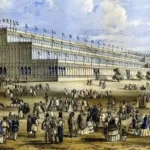
The Festival of Britain opened in May 1951 and continued through September. It was organised as a national celebration of British achievement in arts, science, industry, and design after the Second World War.
South Bank became the physical centre of the London festival. New structures, exhibitions, public spaces, and architectural experiments occupied the riverside.
Royal Festival Hall was the principal permanent legacy. It opened in 1951 and remains the only permanent cultural building surviving from the festival. Its survival explains much of South Bank’s modern cultural importance.
The festival also introduced the Telekinema. This temporary cinema demonstrated new approaches to film, television, stereoscopic presentation, and public education. The British Film Institute later developed the National Film Theatre from this festival legacy.
The Telekinema contained 410 seats and became a significant experiment in post-war cinema presentation. The BFI records its role in presenting experimental three-dimensional films and new forms of screen technology during the 1951 festival.
The festival therefore changed more than the appearance of South Bank. It established a cultural planning principle: the riverside could function as a public destination rather than primarily an industrial working landscape.
The festival’s architectural legacy also influenced later development. Royal Festival Hall became the nucleus around which additional cultural institutions were constructed.
In 2026, South Bank is marking the 75th anniversary of the Festival of Britain. Current heritage programming includes an outdoor exhibition tracing the transformation of the area and the continuing influence of the 1951 festival.
What can visitors experience at the Southbank Centre today?
The Southbank Centre combines Royal Festival Hall, Queen Elizabeth Hall, Hayward Gallery, Purcell Room, National Poetry Library, public terraces, and performance spaces, making it one of London’s largest cultural complexes beside the River Thames.
The Southbank Centre is the direct institutional descendant of South Bank’s post-war cultural development. It provides venues for music, literature, theatre, dance, visual art, debate, festivals, and public programming.
Royal Festival Hall remains the architectural centre of the complex. Its large foyer provides public space beyond ticketed performances, reflecting the institution’s long-standing emphasis on accessibility.
The Southbank Centre introduced its Open Foyers Policy in 1983. The policy kept Royal Festival Hall’s extensive foyer spaces accessible throughout the day and supported free programming. The policy remains an important part of the site’s relationship with the public.
The Hayward Gallery provides a major contemporary art venue. Queen Elizabeth Hall and Purcell Room support concerts, performances, and cultural events. The National Poetry Library provides a specialist collection dedicated to modern poetry.
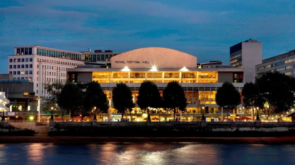
The complex also contains the Undercroft, a long-established skateboarding space beneath the Southbank Centre. Its presence demonstrates how informal public activity became part of the cultural identity of the riverside.
The Southbank Centre currently describes its programme as covering more than 5,000 events annually across visual arts, theatre, dance, classical and contemporary music, literature, poetry, and debate.
The architecture itself forms part of the visitor experience. The buildings, terraces, stairways, concrete surfaces, and open public spaces illustrate the changing architectural language of post-war Britain.
For historical visitors, Royal Festival Hall is particularly important because it connects contemporary cultural activity directly with the 1951 Festival of Britain.
To experience this historic riverside district in person today, consult our comprehensive [How South Kensington Became London’s World-Class Museum District Through Victorian Innovation] for itineraries and visiting parameters.
Why is the National Theatre important to the South Bank riverside?
The National Theatre established South Bank as a major centre for British performing arts after its permanent riverside building opened in 1976, combining national cultural policy, modern architecture, public performance spaces, and direct access to the Thames.
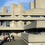
The National Theatre is Britain’s principal publicly supported national theatre institution. Its South Bank building was designed by architect Denys Lasdun and opened in 1976.
The building formed part of the wider post-war transformation of the riverfront. Its terraces, concrete forms, staircases, foyers, and monumental scale created a distinctive architectural presence beside Waterloo Bridge.
The National Theatre archive records extensive contemporary discussion surrounding the building’s architecture, public role, funding, accessibility, operating costs, and relationship with national cultural policy during the 1970s.
The building contains three principal theatres: the Olivier, Lyttelton, and Dorfman. The Olivier Theatre is named after Laurence Olivier, the actor and first artistic director of the National Theatre. The theatre’s South Bank building became fully operational in 1976.
The National Theatre also uses its riverside terraces and public spaces for exhibitions, performances, talks, and informal activity. This makes the building part of the pedestrian experience rather than an isolated theatre.
In 2026, the National Theatre is marking 50 years at its South Bank building. The institution describes the site as a major public cultural asset serving audiences, artists, and communities in Britain and internationally.
Its location also contributes to South Bank’s architectural significance. The National Theatre stands within a concentrated group of post-war cultural buildings that includes the Southbank Centre and BFI Southbank.
How did BFI Southbank develop from the Festival of Britain?
BFI Southbank developed from the Festival of Britain’s 1951 Telekinema and became the permanent National Film Theatre in 1957, creating a major London centre for international cinema, film preservation, film criticism, education, and cultural research.
The British Film Institute is the UK’s principal organisation for film culture and preservation. Its South Bank venue began with the Telekinema during the Festival of Britain.
The Telekinema demonstrated film and television technologies during 1951. Its success encouraged the BFI to campaign for a permanent National Film Theatre.
The permanent National Film Theatre opened beneath Waterloo Bridge in 1957. It hosted the first London Film Festival in October of that year.
The London Film Festival itself launched at the National Film Theatre in 1957. Its first programme included international cinema, establishing South Bank as a destination for audiences interested in films outside mainstream British commercial distribution.
BFI Southbank later expanded to four screens and incorporated library, archive, exhibition, and public research facilities. The venue was refurbished during the 2000s and reopened under the BFI Southbank name.
The BFI’s historical importance extends beyond cinema screenings. The institution supports film preservation, scholarship, education, festivals, archive access, and public understanding of moving-image culture.
The relationship between BFI Southbank and the Festival of Britain illustrates a wider South Bank pattern. Temporary cultural experiments became permanent institutions.
What makes the London Eye significant on the South Bank?
The London Eye introduced a major twenty-first-century landmark to South Bank after opening to passengers in March 2000, adding a 135-metre observation wheel and a new elevated perspective across Westminster, the Thames, and central London.
The London Eye was designed by Marks Barfield Architects. David Marks and Julia Barfield developed the observation-wheel concept for London’s millennium celebrations.
Construction began in 1998. The structure was ceremonially opened in 1999, but public passenger operations began in March 2000.
The London Eye stands beside County Hall and Jubilee Gardens. Its position provides direct views across the Thames toward the Palace of Westminster and along the central London river corridor.
The wheel reaches 135 metres and contains 32 passenger capsules. A complete rotation takes approximately 30 minutes.
Its original concept was temporary. The attraction was intended to remain for a limited period as part of the millennium celebrations. Its popularity resulted in its continuation as a permanent South Bank landmark.
The London Eye changed the visual identity of the riverside. Earlier South Bank landmarks represented post-war cultural architecture. The Eye added a large-scale engineering structure associated with the new millennium.
For visitors interested in urban history, the attraction provides an elevated way to understand London’s geography. Westminster Bridge, the Palace of Westminster, the Thames, County Hall, Waterloo Bridge, and the wider central London skyline appear within one visual field.
Why are Jubilee Gardens important for a South Bank riverside walk?
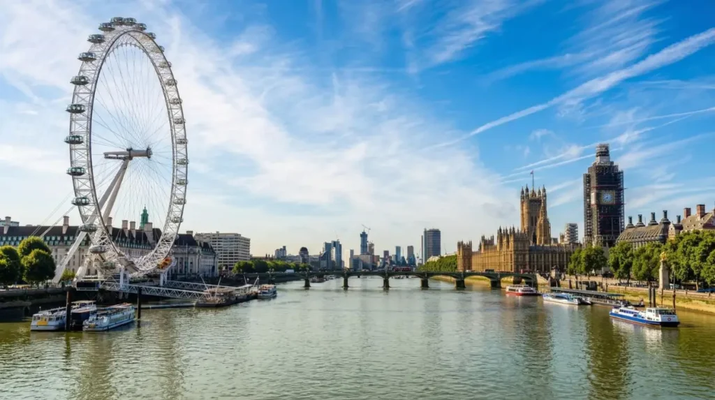
Jubilee Gardens provides an open public green space beside County Hall and the London Eye, connecting South Bank’s cultural buildings with the Thames while preserving an important strategic view toward Westminster and the Palace of Westminster.
Jubilee Gardens occupies a prominent riverside position beside County Hall. Its setting places a landscaped public space between major attractions and the Thames.
The gardens are historically connected with the Festival of Britain site. The location has therefore experienced repeated changes from post-war exhibition ground to underused open land and later landscaped public space.
A major redevelopment programme was planned in connection with the Queen’s Diamond Jubilee and the London 2012 Olympic and Paralympic Games. London planning documentation described the proposed transformation as a new green landmark beside the London Eye and Southbank Centre.
The gardens are also significant because of their relationship with protected views. London planning policy identifies Jubilee Gardens and the Thames side in front of County Hall as a designated river prospect.
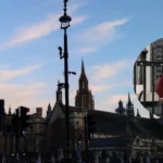
The protected view is oriented toward the Palace of Westminster. Westminster Abbey, Westminster Bridge, the Victoria Embankment, and other landmarks contribute to the composition.
For a scenic walk, Jubilee Gardens provides a transition between architecture and open space. The area also demonstrates how landscape design can protect historic visual relationships within a heavily developed city.
The gardens form an important pause between the London Eye and the cultural buildings farther east.
Which riverside walk connects South Bank’s main landmarks?
The Queen’s Walk provides the principal pedestrian route along South Bank, linking Westminster Bridge, County Hall, Jubilee Gardens, the London Eye, Southbank Centre, National Theatre, BFI Southbank, and further riverside destinations toward Blackfriars.
The Queen’s Walk is part of the wider Thames Path network. The route provides continuous pedestrian access along substantial sections of the South Bank riverfront.
Starting near Westminster Bridge, visitors encounter County Hall and Jubilee Gardens before reaching the London Eye. The route then continues past Royal Festival Hall and the Southbank Centre.
Further east, the walk reaches the National Theatre, BFI Southbank, Gabriel’s Wharf, Oxo Tower Wharf, and the riverside spaces associated with Coin Street.
The spatial sequence makes the route valuable for cultural tourism. Major institutions stand close enough together to be understood as part of one historical development rather than isolated attractions.
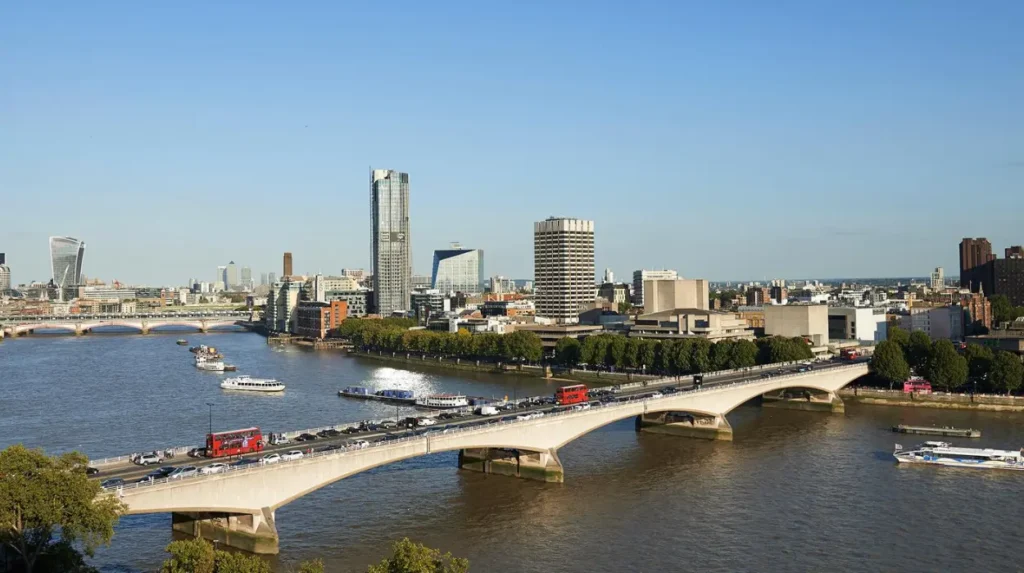
The riverside also provides changing views across the Thames. Westminster landmarks dominate the western section. Waterloo Bridge provides a major visual and transport landmark farther east.
London’s planning framework explicitly recognises the South Bank as a strategic river prospect. This status reflects the importance of the riverfront’s visual relationship with historic and cultural landmarks.
The walk therefore functions as both recreation and heritage interpretation. Buildings, bridges, gardens, public art, and river views provide evidence of different periods of London’s urban development.
What architectural landmarks should visitors see along South Bank?
South Bank contains a concentrated sequence of architectural landmarks representing Victorian infrastructure, post-war modernism, late twentieth-century regeneration, and contemporary engineering, including Waterloo Bridge, Royal Festival Hall, National Theatre, BFI Southbank, County Hall, and the London Eye.
Waterloo Bridge provides an important northern and southern connection across the Thames. The present bridge dates from the twentieth century and forms a major visual element of the South Bank skyline.
Royal Festival Hall represents the architectural optimism of 1951. Its design introduced modernist principles to a large public cultural building.
The National Theatre represents the architectural debates of the 1960s and 1970s. Denys Lasdun’s design uses exposed concrete, terraces, and interconnected volumes.
BFI Southbank demonstrates how cultural infrastructure adapted existing urban structures. Its cinemas occupy the riverfront beneath Waterloo Bridge.
County Hall represents an earlier phase of London’s civic architecture. The former headquarters of the London County Council and later Greater London Council stands opposite the Palace of Westminster.
The London Eye represents the technological and architectural ambitions associated with the millennium.
Together, these landmarks create a chronological architectural sequence. Visitors can identify changes in materials, structural systems, planning priorities, and public functions without leaving the riverside corridor.
South Bank is therefore an important educational landscape for architectural history. It allows twentieth- and twenty-first-century urban development to be examined through buildings that remain in active use.
How did regeneration change South Bank after the 1951 festival?
South Bank’s regeneration developed through successive cultural, transport, residential, commercial, landscape, and public-realm projects that replaced industrial land uses with a mixed riverside district while retaining major post-war cultural institutions.
The Festival of Britain created the initial cultural foundation, but the modern South Bank did not emerge immediately.
Several decades of redevelopment followed. Cultural institutions expanded, transport infrastructure changed, and new commercial and residential projects altered the riverside environment.
The Coin Street area provides an important example of community-led urban development. Community organisations played a significant role in establishing public spaces, housing, and mixed-use activity around the western part of the South Bank cultural district.
Gabriel’s Wharf became associated with small businesses, independent retail, restaurants, and design-oriented activity. Bernie Spain Gardens created additional public green space near the river.
The redevelopment process therefore involved more than replacing buildings. It changed the relationship between residents, visitors, businesses, cultural institutions, and the river.
South Bank London identifies the stretch between the National Theatre and Sea Containers London as part of the Coin Street area, including Gabriel’s Wharf, Bernie Spain Gardens, the Oxo Tower Bargehouse, and Observation Point.
This mixture of cultural and community development distinguishes South Bank from a purely commercial visitor district.
Its modern identity emerged through decades of negotiation between preservation, redevelopment, public access, cultural programming, and community interests.
Why are South Bank’s river views protected?
South Bank’s river views are protected because the Thames corridor provides direct visual relationships between nationally important landmarks, including Westminster, Waterloo Bridge, the Palace of Westminster, Westminster Abbey, and the South Bank cultural quarter.
London’s planning system recognises strategic views as part of the capital’s heritage infrastructure. These views help residents and visitors understand relationships between individual landmarks and the wider city.
The South Bank is specifically included within London’s designated river prospects. Other protected locations include Waterloo Bridge, Westminster Bridge, the Golden Jubilee and Hungerford Footbridges, and Jubilee Gardens.
The view from Jubilee Gardens toward Westminster is particularly important. The Palace of Westminster forms the dominant landmark, while Westminster Bridge frames the Thames crossing.
These views have practical planning consequences. Building height, massing, orientation, and development proposals are assessed against the protection of significant visual corridors.
The policy reflects the fact that London’s heritage is not limited to individual listed buildings. The relationship between buildings, river, bridges, streets, gardens, and skyline also forms part of the historic environment.
For visitors, this planning framework explains why South Bank provides unusually strong views of central London’s historic core.
The riverside walk therefore becomes a form of visual heritage interpretation. The Thames acts as the connecting geographical element between monuments on opposite banks.
How can South Bank’s history be understood through a riverside visit?
South Bank’s history is best understood as a sequence from working riverfront and industrial district to Festival of Britain exhibition site, cultural quarter, regenerated public realm, and contemporary visitor destination shaped by heritage, architecture, entertainment, and protected Thames views.
A riverside visit begins with the geography of the Thames. The river explains South Bank’s original economic importance and its later value as a public landscape.
County Hall introduces the civic history of the area. Jubilee Gardens demonstrates the transformation of land into public landscape.
The London Eye represents the millennium period. Royal Festival Hall connects the visitor directly with the Festival of Britain.
The Southbank Centre demonstrates the institutional continuation of the 1951 cultural programme. The National Theatre shows the expansion of publicly supported performing arts during the 1970s.
BFI Southbank provides a direct connection to the Telekinema and the development of Britain’s National Film Theatre.
Further east, Gabriel’s Wharf and Coin Street demonstrate the community and mixed-use regeneration that followed the major cultural developments.
The result is a continuous historical landscape rather than a collection of unrelated attractions.
South Bank’s long-term significance comes from this layering. Industrial history, wartime damage, post-war reconstruction, modernist architecture, community regeneration, contemporary engineering, and public landscape all remain visible.
The district also continues to evolve. Its institutions remain active, public spaces host events, and new architectural projects continue to alter the urban environment.
The 75th anniversary of the Festival of Britain in 2026 provides a significant historical reference point. Current exhibitions and cultural programmes demonstrate that the legacy of 1951 remains embedded in South Bank’s identity.
For history enthusiasts, educators, and cultural tourists, the South Bank riverside offers an unusually concentrated study of London’s modern development. Its importance rests not only on individual attractions but on the relationship between the Thames, architecture, cultural policy, public space, and urban regeneration.
South Bank remains one of London’s clearest examples of how a riverside can change function while retaining historical continuity. The district moved from an industrial waterfront to a festival landscape, then to a permanent cultural quarter and a major public destination.
Its buildings and open spaces preserve evidence of these transitions. Royal Festival Hall records the Festival of Britain. The National Theatre records the expansion of national cultural institutions. BFI Southbank preserves the legacy of post-war film culture. Jubilee Gardens represents the development of public landscape. The London Eye records the city’s millennium-era transformation.
The Thames remains the constant geographical feature connecting these periods.
That continuity makes South Bank valuable for historical research, architectural study, cultural tourism, and everyday public use. A walk beside the river provides access to more than scenic views. It reveals how London’s social, political, architectural, and cultural priorities changed across the nineteenth, twentieth, and twenty-first centuries.
For The Londoner News readers, South Bank is therefore best understood as a living historical landscape. Its riverside experiences combine cultural institutions, entertainment, architecture, public gardens, protected views, and a pedestrian route through more than a century of London’s urban transformation.
Frequently Asked Question
What is South Bank famous for?
South Bank is famous for its riverside attractions, cultural institutions, modern architecture, scenic Thames walks, and historic landmarks. Major destinations include the Southbank Centre, Royal Festival Hall, National Theatre, BFI Southbank, London Eye, and Jubilee Gardens.