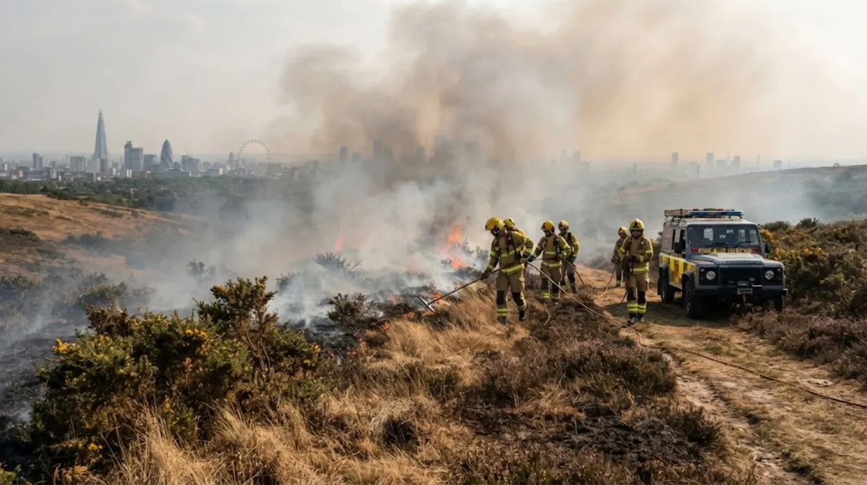
Wildfires in the United Kingdom are uncontrolled vegetation fires occurring across moorlands, heathlands, grasslands, and woodlands. Historical records confirm these blazes have shifted from rare seasonal occurrences into recurring climate-driven ecological threats across England, Scotland, Wales, and Northern Ireland.
- What are the primary causes and ignition sources of wildfires in the UK?
- How do weather, fuel types, and topography control wildfire behavior?
- What are the ecological, environmental, and financial impacts of UK wildfires?
- How do emergency services and authorities prepare for and fight wildfires?
- What policies, laws, and prevention strategies reduce wildfire risks in the UK?
- Frequently Asked Question
Wildfires in the United Kingdom represent a distinct environmental phenomenon characterized by the rapid combustion of surface fuels, organic soils, and canopy layers across open landscapes. Unlike the forest-canopy fires typical of North America or Southern Europe, British wildfires predominantly consume heathland shrubbery, acidic peat soils, blanket bogs, and managed agricultural landscapes. The Forestry Commission defines a wildfire as an unwanted, uncontrolled vegetation fire that requires a dedicated suppression response by a local Fire and Rescue Service (FRS), covering an area greater than 1 hectare or exhibiting high operational intensity.
Historically, the UK climate maintained a temperate maritime status that suppressed large-scale fire propagation through year-round rainfall and high relative atmospheric humidity. Historical records show that major wildfire events were restricted to severe drought cycles, such as the historic dry spells of 1976 and 1995. During the 1976 heatwave, over 50,000 hectares of forest and heathland burned across Southern England, prompting the first modern operational evaluations of rural fire risks by public land authorities.
Throughout the early 21st century, the structural baseline of fire frequency escalated. Data compiled by the European Forest Fire Information System (EFFIS) highlights that the UK experienced exceptional burning periods in 2011, 2018, 2019, and 2022. The 2018 wildfire season saw major complex blazes across the Pennine moorlands, including the Saddleworth Moor fire and the Winter Hill fire in Lancashire. The Saddleworth Moor fire burned for over three weeks, requiring military assistance from the Royal Regiment of Scotland to control the spread across 18 square kilometers of deep peat soil.
The heatwave of July 2022 established new historical parameters for rural and wildland-urban interface (WUI) fires in Britain. On July 19, 2022, when ambient temperatures in England reached 40.3°C at Coningsby, Lincolnshire, Fire and Rescue Services across England declared major incidents simultaneously. The London Fire Brigade recorded its busiest single operational day since the Second World War, responding to 2,670 calls as residential properties in Wennington, East London, were destroyed by rapidly expanding grass fires. Climate modeling published by the Met Office confirms that the probability of high-danger fire weather in the UK has increased, shifting wildfires from historic anomalies into recurring seasonal threats.
What are the primary causes and ignition sources of wildfires in the UK?
Wildfires in the United Kingdom stem almost entirely from human activities combined with low fuel moisture levels. Accidental ignition sources, reckless behavior, deliberate arson, and managed agricultural burning represent the four core drivers of ignition across vulnerable ecosystems.
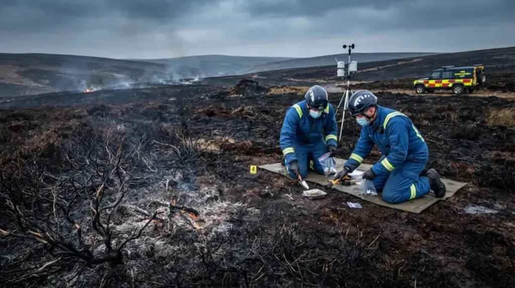
The physical initiation of a wildfire requires three elements: combustible fuel, atmospheric oxygen, and an ignition source. In the United Kingdom, natural ignition sources such as cloud-to-ground lightning strikes account for less than 2% of total recorded events. Consequently, approximately 98% of all wildfires result directly from human interventions, classified into distinct ignition categories.
Accidental human ignitions constitute the largest proportion of total recorded fire events during dry weather periods. The primary drivers under this category include:
- Disposable barbeques: Portable cooking devices placed directly on dry grass or heather transmit thermal energy through metal bases into surface organic layers, initiating smoldering combustion.
- Discarded glass and refuse: Concave glass bottles focus sunlight onto dry leaf litter, acting as burning lenses under high solar radiation conditions.
- Discarded smoking materials: Lit cigarettes dropped from vehicles or pedestrian paths ignite fine dry surface fuels like dry grasses.
- Unattended campfires: Wild camping fires left unextinguished penetrate organic soil layers, remaining active beneath the surface until wind gusts drive flame propagation across adjacent vegetation.
Deliberate ignitions, or arson, represent a major cause of urban-fringe and lowland heathland fires. Statistics from the Home Office Incident Recording System (IRS) show that deliberate secondary fires spike consistently during school holiday periods and prolonged spring dry spells. Urban-adjacent nature reserves, such as the Thames Basin Heaths in Surrey and the valleys of South Wales, experience high frequencies of deliberate ignitions targeted at gorse (Ulex europaeus) and dry brush.
Agricultural and land management operations form another significant ignition mechanism. The traditional practice of “muirburn”—the deliberate, controlled burning of older heather to encourage new growth for grouse moor management and livestock grazing—is strictly regulated in Scotland under the Hill Farming Act 1946 and in England under the Heather and Grass Burning Regulations 2007. Uncontrolled escapes occur when sudden changes in local wind velocity or direction push prescribed fires beyond planned containment lines into adjacent deep peat reserves. Infrastructure accidents, such as high-voltage powerline failures sparking against surrounding tree canopies or sparks generated by railway braking systems on dry trackside embankments, complete the human-influenced ignition spectrum.
How do weather, fuel types, and topography control wildfire behavior?
Wildfire behavior in the United Kingdom depends on interaction between climatic variables, specific vegetation fuel structures, and regional topography. These elements govern the rate of spread, fire intensity, and flame length of outdoor blazes.
Atmospheric conditions establish the background vulnerability of vegetation to combustion. Temperature, relative humidity, wind velocity, and long-term precipitation deficits dictate fuel moisture content. The Met Office utilizes the Canadian Forest Fire Weather Index (FWI) System to assess fire risk parameters across the country. Relative humidity directly controls fine fuel moisture; when atmospheric humidity drops below 30%, fine surface fuels like purple moor-grass (Molinia caerulea) dry rapidly, becoming susceptible to rapid surface flame propagation. Wind speed accelerates combustion by tilting flames forward, heating unburned vegetation ahead of the fire front, and supplying oxygen to the reaction zone.
Fuel characteristics across British landscapes vary significantly compared to continental timberland forests. UK wildlands are dominated by four major fuel complexes:
- Heather moorland: Dominated by Calluna vulgaris, containing volatile oils within its foliage that burn with intense thermal outputs, producing flame heights exceeding 5 meters.
- Gorse scrub: Ulex europaeus retains thick dead wood within its core structure and possesses high oil content, generating severe fire intensity that presents extreme containment challenges.
- Coarse grasslands: Areas dominated by Molinia caerulea dry early in spring, creating continuous beds of fine fuel that support rapid, wind-driven surface fires.
- Peat and organic soils: Thick organic layers composed of partially decomposed plant matter beneath moorlands undergo long-duration smoldering combustion that can persist underground for months.
Topography controls the rate of spread through slope angles and landscape orientation. Fire travels significantly faster uphill than downhill. As a slope increases, flames remain closer to the unburned fuel bed ahead, preheating vegetation through radiative and convective heat transfer. A 20-degree incline can double the forward rate of spread of a wildfire compared to flat ground. Valleys and steep gullies—such as those in the Scottish Highlands, the Brecon Beacons, and the Peak District—funnel regional winds, creating wind-tunnel effects that produce unpredictable fire directions and extreme fire behaviors.
What are the ecological, environmental, and financial impacts of UK wildfires?
Wildfires in the UK damage biodiversity, release stored soil carbon, degrade water supply networks, and impose severe financial costs on emergency services and local economies. Peatland destruction represents the most long-lasting ecological consequence of high-intensity fires.
Peatlands cover approximately 12% of the total UK land area, storing an estimated 3.2 billion tonnes of carbon, making them the nation’s largest terrestrial carbon store. High-intensity wildfires burn through the living surface vegetation and penetrate deep into the underlying peat deposit. Surface fires that transition into smoldering peat fires destroy centuries of accumulated organic material, converting a vital carbon sink into an active source of greenhouse gas emissions. The Centre for Ecology & Hydrology (UKCEH) notes that severe peat fires release hundreds of tonnes of carbon dioxide equivalent ($CO_2e$) per hectare, setting back national net-zero carbon targets.
The ecological disruption extends to specialized flora and fauna across protected Sites of Special Scientific Interest (SSSI) and Special Areas of Conservation (SAC). Lowland heathlands host rare species, including:
- Reptiles: The sand lizard (Lacerta agilis) and smooth snake (Coronella austriaca).
- Birds: Ground-nesting species such as the Dartford warbler (Curruca undata), nightjar (Caprimulgus europaeus), and merlin (Falco columbarius).
- Invertebrates: Specialized beetles, spiders, and pollinators that rely on mature heath structures.
Severe wildfires during the spring breeding season destroy nests, eliminate protective cover, and cause direct mortality across non-motile wildlife populations. High-temperature fires sterilize topsoil, destroying soil seed banks and beneficial mycorrhizal fungi, which allows invasive pioneer species like bracken (Pteridium aquilinum) to dominate native plant communities.
Water catchments face operational disruption following upland wildfires. Burning removes vegetation cover and exposes soil surfaces to rainfall, leading to severe erosion, ash runoff, and heavy sediment deposition into reservoirs managed by utility companies like United Utilities and Yorkshire Water. Water suppliers incur substantial costs operating advanced water treatment processes to remove dissolved organic carbon (DOC) and heavy metals before distributing potable water to consumer networks.
Financial impacts include direct suppression expenditures by Fire and Rescue Services, structural property losses, and commercial land damages. Emergency service deployments require significant overtime compensation, resource mobilization, and specialized equipment maintenance. The total financial damage from large-scale events, such as the 2018 Pennine fires, exceeds tens of millions of pounds when accounting for property destruction, agricultural yield loss, tourism disruptions, and long-term land restoration projects managed by organizations like the National Trust and RSPB.
How do emergency services and authorities prepare for and fight wildfires?
Emergency responders manage wildfire risks using specialized hazard indices, specialized off-road equipment, suppressive tactical firebreaks, and coordinated multi-agency response protocols. The Met Office and Local Resilience Forums coordinate cross-sector operational strategies during high-risk periods.
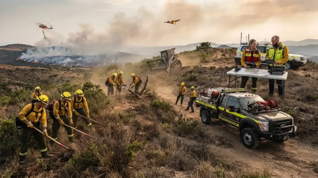
Preparation begins with early warning systems and predictive risk assessment. The Met Office operates the Fire Severity Index (FSI), an automated system that evaluates daily meteorological data to determine potential fire intensity across England and Wales on a scale from 1 (Very Low) to 5 (Exceptional). When the FSI reaches Level 5, statutory authorities under the Countryside and Rights of Way Act 2000 (CROW Act) can temporarily restrict public open access rights across vulnerable moorland areas to reduce accidental ignition risks.
Fire and Rescue Services utilize specialized wildland firefighting assets designed for difficult rural terrain, including:
- All-Terrain Vehicles (ATVs): Lightweight 4×4 and 6×6 vehicles equipped with compact water tanks and high-pressure pumping units.
- Fogging Units: High-pressure water systems that atomize water droplets, maximizing cooling efficiency while conserving water reserves in remote locations.
- Personal Protective Equipment (PPE): Lightweight, breathable fire-retardant garments engineered to prevent thermal exhaustion during extended physical deployments.
- Helicopters: Aerial water-bombing aircraft configured with underslung monsoon buckets to drop water on inaccessible fire flanks.
Tactical suppression relies on a combination of direct attack, indirect attack, and defensible burnouts. Direct attacks involve crews extinguishing flame fronts using beaters, high-pressure hose lines, and fogging units when flame heights remain below 1.5 meters. When flame heights exceed safe operational thresholds for direct intervention, incident commanders pivot to indirect tactics. These involve constructing mineral-soil firebreaks using mechanical excavators or executing controlled backburns from established anchor points—such as roads, rivers, or clearings—to consume fuel ahead of the advancing main fire front.
Multi-agency cooperation operates through Local Resilience Forums (LRFs) under the framework of the Civil Contingencies Act 2004. During complex wildland fire events, the Incident Command System integrates operations across multiple emergency services. Police forces manage road closures and residential evacuations; Mountain Rescue Teams assist with remote logistics and casualty extraction; and private land managers contribute heavy machinery, local topographic expertise, and specialized moorland equipment to support official suppression operations.
What policies, laws, and prevention strategies reduce wildfire risks in the UK?
Wildfire risk reduction relies on strict legislative frameworks, landscape-scale land management, public education initiatives, and national climate adaptation policies. Proactive peatland rewetting and fuel-break engineering form the core of long-term prevention strategies.
The legislative framework governing land access, management, and fire safety in the United Kingdom includes several key statutes:
- The Countryside and Rights of Way Act 2000 (CROW Act): Grants public access to open country while providing statutory mechanisms to close access land during periods of exceptional wildfire risk.
- The Heather and Grass Burning Regulations 2007 (England): Restricts the seasonal timing, environmental conditions, and geographic locations permitted for controlled agricultural burns, prohibiting unpermitted burning on deep peat landscapes.
- The Regulatory Reform (Fire Safety) Order 2005: Establishes general safety standards and fire risk assessment obligations applicable to non-domestic premises and wildland-urban interface boundaries.
- The Wildlife and Countryside Act 1981: Protects vulnerable habitats and species from destruction caused by unlawful burning or negligent fire setting.
Landscape-scale vegetation management strategies reduce continuous fuel beds to disrupt potential fire paths. Conservation bodies and private estates construct green firebreaks—strips of low-flammability vegetation or mown grass—to create natural buffers between continuous heathland tracks. Peatland restoration initiatives led by programs like IUCN UK Peatland Programme focus on rewetting drained peatlands by blocking historical drainage ditches (grips) with wooden or peat dams. Rewetted peatlands maintain higher water tables, keeping vegetation moist and creating natural barriers against subterranean smoldering combustion.
Public awareness campaigns focus on changing visitor behavior across rural spaces. The National Outdoor Code—maintained by Natural England and Natural Resources Wales—instructs visitors on responsible recreational practices, emphasizing strict adherence to total bans on disposable barbeques and open flames across high-risk landscapes. Local councils across high-risk zones, such as the Peak District National Park and Dorset Council, have enacted Public Spaces Protection Orders (PSPOs) that make lighting open fires or using disposable barbeques on designated heathlands and moorlands a criminal offense subject to direct financial penalties.
Future national adaptation plans increasingly integrate wildfire risks into broader climate security strategies. The UK Climate Change Committee (CCC) continuously advises government departments—including the Department for Environment, Food & Rural Affairs (DEFRA) and the Home Office—to strengthen national emergency readiness, improve mapping of high-density wildland-urban interfaces, and invest in specialized rural firefighting training. Strengthening structural landscape resilience alongside public safety measures remains critical to protecting the country’s rural ecosystems, public infrastructure, and communities from escalating fire hazards.
Frequently Asked Question
What main factors drive the rising frequency of wildfires in the UK?
Human activities account for roughly 98% of all recorded wildfire ignitions in the UK, predominantly through disposable barbeques, discarded glass, campfires, and arson. When combined with severe summer dry spells, rising temperatures, and low relative atmospheric humidity, these surface ignitions rapidly spread across dry fine fuels such as heather, gorse, and peatlands.