London ranks among the world’s most photographed cities because its urban landscape combines nearly 2,000 years of history with globally recognised architecture. Roman foundations, medieval churches, Georgian streets, Victorian engineering, twentieth-century landmarks, and modern skyscrapers coexist within a relatively compact area. This layered cityscape provides photographers with unmatched opportunities to document Britain’s historical development alongside its contemporary identity.
- Why is London considered one of the world’s best cities for landmark photography?
- Which riverside locations provide the best photographs of London’s skyline?
- How do London’s historic bridges create unique photographic perspectives?
- Why does St Paul’s Cathedral remain one of London’s most photographed landmarks?
- Which viewpoints best capture London’s modern skyline alongside its historic landmarks?
- How has London’s architectural history influenced its most famous photography locations?
- What role do royal parks play in London’s best photography locations?
- How do seasonal and historical changes influence photography across London’s landmarks?
- Why are London’s photography locations important for cultural heritage preservation?
Photography in London extends beyond tourism. Architectural historians use photographs to record conservation work, urban planners document changing skylines, educators illustrate historical periods through visual comparisons, and cultural researchers preserve evidence of public spaces before redevelopment. The city’s protected viewpoints, riverside promenades, elevated parks, and historic bridges offer perspectives that have inspired artists since the eighteenth century and photographers since the nineteenth.
Today, London’s photography locations reflect centuries of urban planning, royal patronage, commercial expansion, industrial innovation, and heritage preservation. Understanding the historical significance behind these viewpoints transforms photographs into records of London’s evolving cultural landscape.
Why is London considered one of the world’s best cities for landmark photography?
London offers exceptional photography opportunities because nearly two thousand years of continuous urban development created a unique combination of historic monuments, royal architecture, engineering achievements, riverside panoramas, protected viewpoints, and modern skyscrapers within a walkable metropolitan landscape that preserves multiple historical eras simultaneously.
London’s visual identity developed through successive periods of expansion rather than wholesale reconstruction. Although the Great Fire of 1666 destroyed much of the medieval City of London, rebuilding introduced classical architecture while preserving the city’s commercial importance. Victorian infrastructure projects added railway stations, bridges, and embankments, while twentieth-century planning integrated modern developments alongside protected heritage sites.
The River Thames remains the city’s defining photographic feature. Flowing approximately 346 kilometres (215 miles) from Gloucestershire to the North Sea, it shaped London’s economic and political growth for nearly two millennia. Most iconic viewpoints align with the river because bridges, embankments, and riverside paths create uninterrupted sightlines towards nationally significant landmarks.
London also benefits from strict planning regulations that protect important views. Since the twentieth century, designated protected vistas have limited building heights in specific corridors, preserving historic panoramas of landmarks such as St Paul’s Cathedral. These regulations ensure that famous viewpoints remain visually consistent despite ongoing development.
The diversity of London’s architecture further distinguishes the city. Roman walls, Norman fortifications, Gothic churches, Georgian terraces, Victorian civic buildings, Art Deco structures, Brutalist complexes, and contemporary skyscrapers exist within close proximity. Few global capitals present such a comprehensive visual timeline through architecture alone.
Which riverside locations provide the best photographs of London’s skyline?
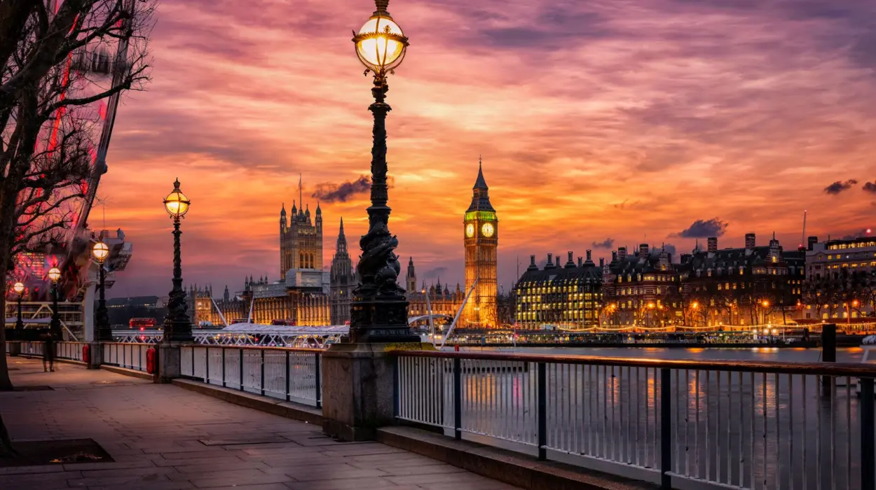
The River Thames provides London’s finest skyline photography because historic bridges, embankments, and public walkways offer unobstructed views of landmarks including the Palace of Westminster, St Paul’s Cathedral, Tower Bridge, and the modern financial district throughout changing daylight conditions.
The Thames has served as London’s commercial highway since Roman Britain established Londinium around AD 47. Every major era of London’s development expanded along its banks, making riverside viewpoints historically and visually significant.
South Bank
South Bank extends from Westminster Bridge towards Tower Bridge and remains one of London’s premier photography routes. Open public spaces provide clear compositions featuring the Palace of Westminster, the London Eye, Westminster Bridge, and the river itself.
Victorian embankment engineering stabilised much of this section of the river, while twentieth-century cultural developments transformed former industrial land into museums, theatres, and public promenades.
Tower Bridge Area
Tower Bridge, completed in 1894, represents Victorian engineering at its most ambitious. Photographers can capture both the bridge and the Tower of London, illustrating nearly 900 years of English history within a single composition.
Morning light often highlights the bridge’s Gothic Revival towers, while evening illuminations reflect across the Thames, producing distinctive cityscape images.
Millennium Bridge
Opened in 2000, Millennium Bridge intentionally frames St Paul’s Cathedral. Its alignment creates one of London’s strongest architectural compositions by visually connecting modern engineering with Sir Christopher Wren’s seventeenth-century masterpiece.
Greenwich Riverside
Greenwich provides broader skyline perspectives that include Canary Wharf’s financial district alongside historic maritime buildings. This juxtaposition demonstrates London’s transition from imperial port to global financial centre.
To experience these historic riverside viewpoints in person today, consult our comprehensive [History of the River Thames in London and Its Lasting Historical Significance] for itineraries and visiting parameters.
How do London’s historic bridges create unique photographic perspectives?
London’s bridges function as elevated viewing platforms because they connect important historical districts while providing symmetrical compositions of rivers, monuments, and evolving skylines shaped by centuries of engineering innovation and urban expansion across the Thames.
More than thirty bridges cross the Thames within Greater London. Each represents different engineering periods and offers distinct visual relationships with surrounding landmarks.
Westminster Bridge
Completed in 1862, Westminster Bridge aligns directly with the Palace of Westminster and Elizabeth Tower. Green paint reflects the colour traditionally associated with the House of Commons.
This location provides classic postcard compositions combining Gothic Revival architecture with river reflections.
Waterloo Bridge
Architect Sir Giles Gilbert Scott described Waterloo Bridge as offering “the finest view in Europe.” Open sightlines encompass Somerset House, St Paul’s Cathedral, the City skyline, and Canary Wharf.
Its generous pedestrian walkways create ideal conditions for panoramic photography.
Tower Bridge
Unlike conventional crossings, Tower Bridge combines transportation with monumental architecture. Its bascule mechanism remains operational, allowing ships to navigate the Thames.
The bridge itself frequently becomes the primary photographic subject while simultaneously framing surrounding landmarks.
Blackfriars Bridge
Blackfriars Bridge provides excellent views towards St Paul’s Cathedral, particularly during sunrise when eastern light illuminates the cathedral dome.
Historic railway bridges nearby introduce industrial heritage into wider cityscape compositions.
Why does St Paul’s Cathedral remain one of London’s most photographed landmarks?
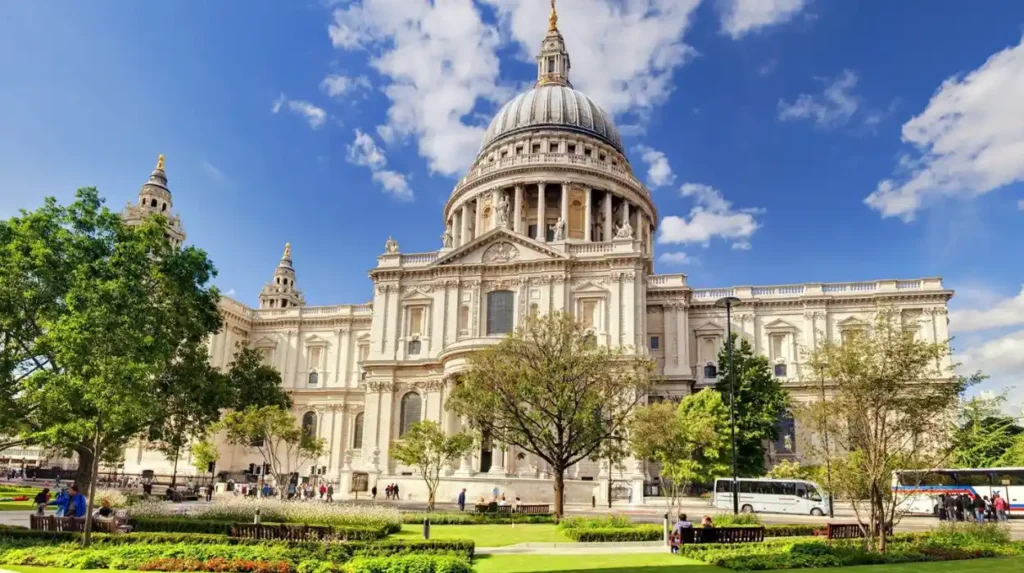
St Paul’s Cathedral remains an iconic photographic subject because Sir Christopher Wren’s architectural masterpiece symbolises London’s post-Great Fire reconstruction while its monumental dome dominates protected city views established through centuries of planning legislation and heritage conservation.
The current cathedral was completed in 1710 following the Great Fire of London in 1666. Sir Christopher Wren designed the structure in the English Baroque style, replacing the medieval cathedral destroyed during the fire.
Its dome rises approximately 111 metres, making it among the tallest buildings in London for over 250 years. This dominance established St Paul’s as London’s principal skyline feature.
Protected viewing corridors introduced during the twentieth century prevent inappropriate development from obscuring significant views of the cathedral. These regulations influence modern building design throughout central London.
Photographers frequently capture the cathedral from Millennium Bridge, Ludgate Hill, One New Change rooftop, and the South Bank because each viewpoint emphasises different architectural characteristics.
The cathedral also carries immense historical significance. National thanksgiving services, royal celebrations, and the funeral of Sir Winston Churchill occurred within its walls, strengthening its cultural symbolism.
Which viewpoints best capture London’s modern skyline alongside its historic landmarks?
London’s most significant skyline viewpoints combine historic monuments with contemporary skyscrapers, illustrating how heritage preservation and commercial development coexist within one of the world’s oldest continuously inhabited global financial capitals through carefully managed urban planning policies.
London’s skyline evolved dramatically during the late twentieth and early twenty-first centuries as financial expansion encouraged high-rise construction in designated business districts.
Primrose Hill
Located north of Regent’s Park, Primrose Hill provides elevated panoramic views stretching across central London.
From this viewpoint, photographers capture St Paul’s Cathedral, The Shard, Canary Wharf, and numerous historic districts within one expansive composition.
Parliament Hill
Situated on Hampstead Heath, Parliament Hill has attracted artists for centuries.
Its elevated position reveals London’s extensive urban development while preserving visual relationships between major landmarks.
Sky Garden
The public viewing garden atop the “Walkie Talkie” building provides modern perspectives overlooking Tower Bridge, the Thames, St Paul’s Cathedral, and surrounding financial districts.
Unlike traditional street-level photography, elevated observation points emphasise London’s layered architectural history.
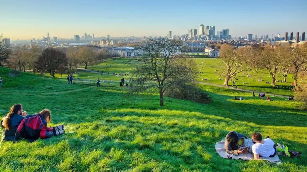
Greenwich Park
Greenwich Park aligns with the Old Royal Naval College, Queen’s House, Canary Wharf, and central London’s skyline beyond.
This historic royal landscape illustrates London’s geographical expansion from royal estates towards modern commercial districts.
How has London’s architectural history influenced its most famous photography locations?
London’s photography locations developed through successive architectural periods because Roman settlement, medieval expansion, Georgian planning, Victorian engineering, and contemporary regeneration collectively shaped the city’s visually distinctive streets, bridges, squares, and landmark perspectives still preserved today.
Roman Londinium established London’s first organised street network around AD 47. Archaeological remains survive beneath today’s financial district and influence modern street alignments.
The Norman Conquest introduced monumental stone architecture, including the Tower of London, fundamentally altering London’s skyline.
Georgian planning between the early eighteenth and early nineteenth centuries created elegant residential squares, uniform terraces, and landscaped parks that remain popular photography destinations.
Victorian industrialisation dramatically transformed London through railway terminals, bridges, embankments, museums, and civic buildings.
Twentieth-century reconstruction after the Second World War introduced modern architecture while conservation policies protected historically significant districts.
Contemporary skyscrapers such as The Shard, 30 St Mary Axe, and 22 Bishopsgate continue this architectural evolution while respecting protected viewing corridors established through planning legislation.
What role do royal parks play in London’s best photography locations?
London’s royal parks preserve historic landscapes while offering elevated viewpoints, carefully planned sightlines, seasonal scenery, and protected green spaces that frame London’s architectural landmarks within natural environments established over several centuries of royal landscape design.
London contains eight Royal Parks covering approximately 5,000 acres.
Hyde Park originated as a royal hunting ground under Henry VIII during the sixteenth century before becoming a public park.
Regent’s Park emerged through John Nash’s early nineteenth-century masterplan, combining formal gardens with elegant terraces.
Greenwich Park, established during the fifteenth century, surrounds the Royal Observatory and provides sweeping views across London.
Richmond Park preserves ancient woodland, grassland, and free-roaming deer introduced centuries ago, creating unique combinations of wildlife photography and historic landscapes.
St James’s Park offers classic compositions featuring Buckingham Palace, Horse Guards Parade, and government buildings reflected across ornamental lakes.
These parks balance natural scenery with architectural heritage, distinguishing London’s urban photography from many other global capitals.
How do seasonal and historical changes influence photography across London’s landmarks?
Seasonal variation changes London’s visual character because shifting daylight, vegetation, atmospheric conditions, and annual cultural traditions reveal different architectural details while preserving historically significant landscapes documented through centuries of artistic and photographic records.
London experiences approximately 1,560 sunshine hours annually, producing varied lighting throughout the year.
Spring introduces flowering trees within parks surrounding historic monuments.
Summer extends daylight beyond sixteen hours, allowing photographers prolonged opportunities during golden hour.
Autumn transforms London’s parks through changing foliage, contrasting warm colours with stone architecture.
Winter provides lower sun angles that illuminate building façades differently while seasonal decorations enhance major landmarks.
Historical photographs dating from the nineteenth century allow researchers to compare London’s evolving skyline with remarkable precision. Collections maintained by museums and archives document urban redevelopment, restoration projects, wartime damage, and conservation successes.
Repeated photography from consistent viewpoints has become an important tool in heritage preservation, enabling historians to identify gradual architectural change over decades.
Why are London’s photography locations important for cultural heritage preservation?
London’s photography locations preserve visual evidence of architectural heritage because repeated documentation supports conservation, archaeological research, historical education, urban planning, tourism management, and public understanding of Britain’s continuously evolving capital across successive generations.
Photography plays a significant role in documenting heritage conservation. Historic England, museum collections, universities, and local authorities maintain extensive photographic archives recording restoration work and changing urban environments.
Digital technologies now allow historians to compare historical photographs with present-day imagery, revealing subtle changes in building materials, street layouts, vegetation, and public spaces.
Photographs also contribute to archaeological interpretation. Before excavation begins, visual records document landscapes and structures that assist researchers in understanding historical development.
Educational institutions increasingly use comparative photography to teach urban history, architecture, geography, and conservation science.
Tourism benefits from accurate visual documentation because visitors can better understand the historical significance of London’s landmarks before arrival.
The continued preservation of protected viewpoints ensures future generations will experience many of the same panoramic scenes admired by artists, historians, and photographers for centuries.
London’s finest photography locations represent far more than scenic viewpoints. They document nearly two millennia of continuous urban history shaped by Roman settlement, medieval commerce, royal patronage, industrial innovation, wartime resilience, and modern regeneration. From the riverside panoramas of the Thames to elevated parks overlooking the evolving skyline, each location reflects a specific chapter in London’s development while contributing to a broader visual narrative of Britain’s capital.
The city’s enduring appeal lies in its remarkable ability to preserve historic landmarks alongside contemporary architecture without losing its historical identity. Protected viewing corridors, carefully managed conservation policies, and world-renowned public spaces ensure that iconic perspectives remain accessible to residents, visitors, researchers, and educators alike.
As photography continues to evolve through digital technology, London’s landscapes remain essential resources for documenting cultural heritage, supporting historical scholarship, and inspiring future generations to appreciate one of the world’s most historically layered urban environments.
What are the best photography locations in London?
Some of the best photography locations include South Bank, Tower Bridge, Millennium Bridge, Westminster Bridge, Primrose Hill, Parliament Hill, Greenwich Park, Sky Garden, St Paul’s Cathedral viewpoints, and the Tower of London riverside.