The River Thames has shaped London’s history, economy, culture, and urban landscape for more than two millennia. Flowing approximately 346 kilometres (215 miles) from its source in Gloucestershire to the North Sea, the Thames is England’s longest river entirely within the country and the defining geographical feature of the capital. Today, its riverside paths provide some of the finest walking experiences in Britain, combining world-famous landmarks, medieval streets, maritime heritage, royal parks, industrial archaeology, wildlife habitats, and modern architecture within a continuous pedestrian network.
- Why are riverside walks along the Thames among London’s best outdoor experiences?
- Which Thames riverside walk offers the most complete introduction to London’s history?
- What historical landmarks define the Westminster riverside?
- How does the South Bank reflect London’s cultural transformation?
- Why is the Tower Bridge and Tower of London riverside historically significant?
- How does Greenwich preserve Britain’s maritime heritage?
- What makes Richmond and Kew among the Thames’ most peaceful walking destinations?
- How has the Thames shaped London’s architecture and bridges?
- What wildlife and natural environments can visitors experience along the Thames?
- How have conservation and regeneration preserved the Thames for future generations?
Walking beside the Thames offers more than scenic views. Every section of the river reveals a different chapter of London’s development, from Roman trade and medieval commerce to Victorian engineering and twenty-first-century urban regeneration. Many routes follow sections of the Thames Path National Trail, established in 1996, connecting historic waterfront districts while preserving public access to one of Europe’s most significant urban rivers.
This guide explores the best riverside walks along the Thames, explaining their historical importance, architectural highlights, cultural landmarks, ecological value, and practical appeal for visitors seeking relaxing outdoor adventures.
Why are riverside walks along the Thames among London’s best outdoor experiences?
The Thames riverside combines over 2,000 years of history, internationally significant architecture, protected public walkways, green spaces, museums, bridges, and panoramic viewpoints into accessible walking routes that showcase London’s cultural evolution while providing relaxing recreation throughout every season of the year.
The River Thames has functioned as London’s principal transportation corridor since Roman Britain. Every major period of London’s growth left physical evidence along its banks. Roman quays, medieval wharves, Tudor palaces, Georgian warehouses, Victorian bridges, and modern skyscrapers coexist within a relatively compact urban landscape.
Unlike many European capitals where waterfronts became heavily industrialised and inaccessible, London has invested extensively in restoring public access. Large sections of both riverbanks now include pedestrian promenades, landscaped parks, and protected heritage sites.
The Thames Path National Trail stretches approximately 296 kilometres (184 miles) from the river’s source near Kemble to the Thames Barrier in southeast London. Within Greater London, dozens of interconnected riverside sections allow visitors to select walks ranging from one kilometre to full-day explorations.
These routes appeal to history enthusiasts because they connect significant historical landmarks in chronological order. They also attract photographers, educators, architects, wildlife observers, genealogists researching historic parishes, and cultural tourists seeking a comprehensive understanding of London’s development.
Which Thames riverside walk offers the most complete introduction to London’s history?
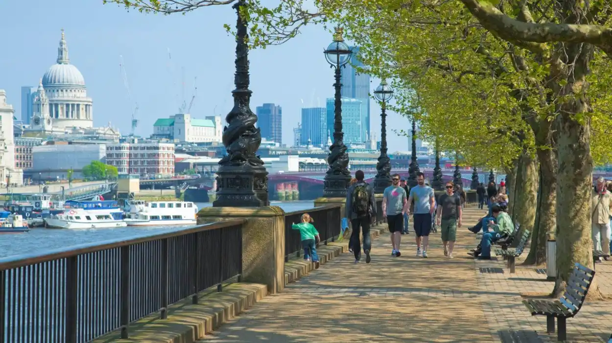
The Westminster to Tower Bridge riverside walk provides London’s most comprehensive historical introduction because it connects royal government, religious institutions, commercial districts, museums, bridges, and medieval landmarks through one continuous riverside route spanning approximately six kilometres.
This route begins at Westminster, where political authority has centred for centuries. The surrounding area reflects London’s evolution from a medieval royal settlement into the administrative heart of the United Kingdom.
Walking eastward along the South Bank reveals successive historical periods. The riverside includes the Southbank Centre, Shakespeare’s Globe, Tate Modern, and historic wharves adapted for cultural use.
Crossing or viewing the river introduces several iconic bridges representing different engineering eras. Westminster Bridge, Blackfriars Bridge, Millennium Bridge, Southwark Bridge, London Bridge, and Tower Bridge each illustrate changing construction techniques from the eighteenth through twentieth centuries.
The walk concludes near the Tower of London and Tower Bridge, where medieval defensive architecture meets Victorian engineering.
This route illustrates London’s transformation from Roman trading settlement to global financial capital while maintaining continuous pedestrian access beside the river.
To experience this historic riverside corridor in person today, consult our comprehensive [Medieval Alleyways of Old London and Their Role in Everyday City Life] for itineraries and visiting parameters.
What historical landmarks define the Westminster riverside?
Westminster contains Britain’s most important constitutional, religious, and ceremonial landmarks, including Parliament, Westminster Abbey, Whitehall, and historic government buildings that demonstrate nearly one thousand years of continuous national governance beside the River Thames.
Westminster became politically significant after Edward the Confessor established Westminster Abbey during the eleventh century. Following the Norman Conquest in 1066, the surrounding district evolved into England’s political centre.
The Palace of Westminster occupies the site of earlier medieval royal residences. After the devastating fire of 1834, architects Charles Barry and Augustus Pugin designed the current Gothic Revival structure, completed primarily during the nineteenth century.
Nearby Westminster Abbey has hosted every English and British coronation since 1066 except two disputed successions. The church also contains the tombs and memorials of monarchs, scientists, military leaders, poets, and national figures.
The riverside promenade provides uninterrupted views across the Thames toward the South Bank, illustrating how London’s urban planning gradually expanded beyond the original medieval city.
Victoria Tower Gardens preserves open green space immediately beside the river while commemorating national events and historical figures through carefully positioned monuments.
How does the South Bank reflect London’s cultural transformation?
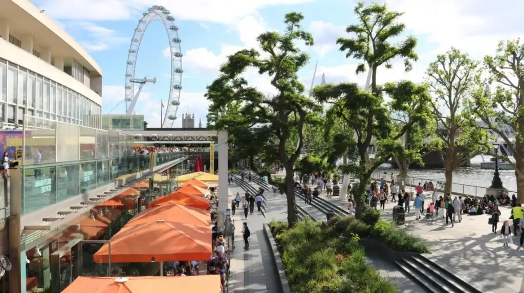
London’s South Bank evolved from industrial wharves and warehouses into one of Europe’s leading cultural districts through twentieth-century regeneration, preserving historic riverside access while introducing museums, theatres, galleries, public art, and recreational spaces.
Historically, the southern riverbank remained outside the medieval City of London. Industries considered unsuitable within city walls, including theatres, breweries, and entertainment venues, concentrated here.
During the Tudor period, Bankside became famous for playhouses, bear-baiting arenas, inns, and riverside commerce. William Shakespeare’s Globe Theatre originally stood nearby during the late sixteenth century.
Industrial expansion transformed the area during the eighteenth and nineteenth centuries. Warehouses, docks, and manufacturing facilities dominated much of the waterfront.
The Festival of Britain in 1951 initiated large-scale regeneration. The event encouraged new cultural institutions, public spaces, and riverside improvements that fundamentally changed public perceptions of the district.
Today, the South Bank combines modern architecture with reconstructed historical sites, creating one of London’s busiest pedestrian environments while preserving important archaeological remains beneath the surrounding streets.
Why is the Tower Bridge and Tower of London riverside historically significant?
The Tower of London and Tower Bridge represent nearly nine centuries of military defence, royal authority, engineering innovation, and international commerce, making this section of the Thames one of Britain’s most historically important waterfront landscapes.
The Tower of London originated shortly after the Norman Conquest. William the Conqueror commissioned the White Tower during the 1070s to establish military control over London.
The surrounding fortress expanded across subsequent centuries through additional walls, towers, defensive gates, and riverside fortifications.
Adjacent river access enabled secure movement of royal supplies, military equipment, and prisoners. The famous Traitors’ Gate connected the fortress directly to the Thames.
Tower Bridge opened in 1894 after eight years of construction. Engineers Sir John Wolfe Barry and Sir Horace Jones designed its combined bascule and suspension system to accommodate increasing river traffic while maintaining road connections across the Thames.
Together, these landmarks demonstrate London’s evolution from medieval fortress city to industrial metropolis without losing its historical identity.
How does Greenwich preserve Britain’s maritime heritage?
Greenwich preserves Britain’s naval, scientific, and royal history through historic dockyards, the Royal Observatory, maritime museums, royal architecture, and protected riverside landscapes recognised collectively as a UNESCO World Heritage Site.
Greenwich developed as an important royal residence during the late medieval and Tudor periods. Several monarchs, including Henry VIII and Elizabeth I, maintained close associations with the area.
The Royal Naval Hospital, designed by Sir Christopher Wren and Nicholas Hawksmoor, replaced the earlier Palace of Placentia during the late seventeenth century.
The Royal Observatory, established in 1675 by King Charles II, advanced astronomical research and navigation. The Prime Meridian, designated at Greenwich in 1884, remains the international reference for longitude and global timekeeping.
The National Maritime Museum documents Britain’s naval history through extensive collections of charts, ship models, navigational instruments, and archival records.
Walking between Greenwich Pier, the Old Royal Naval College, and Greenwich Park provides exceptional views across the Thames toward the rapidly developing Canary Wharf skyline.
This juxtaposition illustrates London’s continuing economic transformation while preserving internationally recognised historic landscapes.
What makes Richmond and Kew among the Thames’ most peaceful walking destinations?
Richmond and Kew combine protected landscapes, royal parks, botanical collections, historic riverside villages, and abundant wildlife, offering quieter Thames walks that preserve the river’s natural character within Greater London’s metropolitan boundaries.
Unlike central London, western sections of the Thames retain broader riverbanks, mature woodland, wetlands, and extensive open spaces.
Richmond became popular among royalty during the Tudor period. Richmond Palace once served as an important royal residence before gradually disappearing during the seventeenth century.
Richmond Green, riverside terraces, and nearby Richmond Park preserve much of the historic landscape associated with aristocratic country living.
Further downstream, Kew developed international importance through the Royal Botanic Gardens.
Founded during the eighteenth century and expanded throughout the nineteenth century, Kew Gardens now maintains one of the world’s largest botanical collections while contributing internationally recognised scientific research.
The surrounding riverside features rowing clubs, historic pubs, Georgian houses, and tree-lined pathways that provide a markedly different walking experience from the dense urban core.
Wildlife frequently observed includes mute swans, grey herons, cormorants, kingfishers, and Egyptian geese, demonstrating the Thames’ ecological importance despite its urban setting.
How has the Thames shaped London’s architecture and bridges?
The Thames determined London’s architectural growth by directing settlement patterns, commercial development, bridge construction, flood management, and engineering innovation across successive historical periods from Roman Britain through contemporary urban planning.
For centuries, London Bridge remained the city’s only permanent river crossing. This constraint concentrated commercial activity within the medieval City of London.
Population growth required additional bridges.
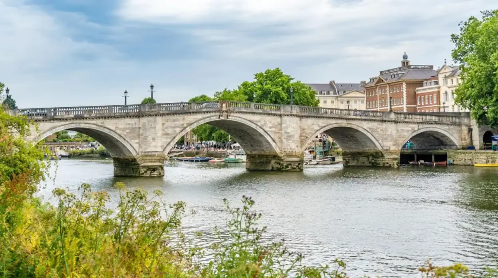
Examples include Westminster Bridge (1750), Blackfriars Bridge (1769), Waterloo Bridge (1817), Southwark Bridge (1819), Hungerford Bridge (1845), Chelsea Bridge (1858), Tower Bridge (1894), and the Millennium Bridge (2000).
Each bridge reflects prevailing engineering technologies.
Stone arches dominated eighteenth-century construction.
Iron and steel enabled longer spans during the Industrial Revolution.
Modern suspension and cable-supported systems characterise recent additions.
Architectural diversity along the Thames similarly reflects changing economic priorities.
Examples include Roman remains, medieval churches, Tudor palaces, Georgian warehouses, Victorian railway infrastructure, Art Deco commercial buildings, Brutalist cultural complexes, and contemporary glass skyscrapers.
Together, these structures create one of Europe’s most architecturally varied waterfront environments.
What wildlife and natural environments can visitors experience along the Thames?
The Thames supports diverse ecosystems including tidal mudflats, freshwater habitats, reed beds, wetlands, urban parks, and protected reserves that sustain hundreds of bird species, fish populations, mammals, and important plant communities throughout Greater London.
Although heavily modified through centuries of development, the Thames remains an ecologically significant river.
Environmental improvements since the 1950s dramatically increased biodiversity after extensive pollution reduction programmes.
More than 125 fish species have been recorded within the Thames estuary and river system.
Examples include Atlantic salmon, European eel, sea bass, and smelt.
Birdlife remains particularly diverse.
Examples include little egrets, cormorants, common terns, tufted ducks, and peregrine falcons nesting on modern buildings overlooking the river.
Marine mammals occasionally enter tidal sections.
Examples include harbour seals, grey seals, bottlenose dolphins, and harbour porpoises.
Protected riverside habitats such as WWT London Wetland Centre and Thames marshes contribute significantly to regional biodiversity conservation.
These ecological improvements demonstrate successful environmental restoration alongside continued urban development.
How have conservation and regeneration preserved the Thames for future generations?
Conservation policies, heritage legislation, archaeological research, environmental restoration, and carefully managed redevelopment have preserved historic riverside landscapes while improving public access, ecological health, and cultural appreciation throughout modern London.
Historic England identifies hundreds of listed buildings and scheduled monuments bordering the Thames.
Conservation areas protect historic streetscapes from inappropriate redevelopment while encouraging sympathetic restoration.
Archaeological investigations conducted before major construction projects continue revealing Roman docks, medieval waterfront structures, Tudor shipyards, and industrial infrastructure buried beneath modern developments.
The Thames Discovery Programme has encouraged volunteers to document exposed archaeological remains revealed during low tides.
Urban regeneration projects increasingly integrate heritage preservation with modern public spaces.
Former warehouses have become museums, residential buildings, cultural venues, and commercial centres without erasing their historical character.
Flood management infrastructure, including the Thames Barrier completed in 1982, protects central London from tidal flooding while allowing continued navigation and riverside access.
Long-term environmental monitoring has significantly improved water quality, supporting wildlife recovery and expanding recreational opportunities.
These combined initiatives ensure that future generations can continue exploring the Thames as both a living river and an open-air historical archive.
The River Thames remains London’s defining geographical and historical feature. Its riverside walks provide an exceptional opportunity to understand more than two thousand years of continuous urban development through accessible public spaces that connect royal palaces, medieval fortifications, maritime landmarks, industrial heritage, cultural institutions, parks, and ecological habitats.
Each section of the river tells a distinct chapter of London’s story. Westminster illustrates constitutional history. The South Bank demonstrates cultural regeneration. Tower Bridge and the Tower of London reveal military and engineering achievements. Greenwich preserves Britain’s maritime legacy. Richmond and Kew showcase the Thames’ natural landscapes and royal heritage.
Together, these riverside routes form one of the world’s richest urban walking networks, combining scenic beauty with historical depth. Their preservation through conservation, archaeology, environmental restoration, and thoughtful planning ensures that residents, visitors, educators, and researchers can continue discovering the many layers of London’s evolving relationship with the River Thames for generations to come.
What is the best riverside walk along the Thames for first-time visitors?
The Westminster to Tower Bridge route is widely considered the best introduction to London. It connects iconic landmarks such as the Palace of Westminster, the South Bank, Shakespeare’s Globe, Tate Modern, the Tower of London, and Tower Bridge in one continuous riverside walk.