Medieval alleyways of Old London formed the connective network that shaped commerce, housing, religion, governance, and social interaction for centuries. These narrow passages linked major streets, markets, churches, river wharves, workshops, and residential courts, creating a dense urban landscape that reflected London’s economic growth from the Norman period through the late Middle Ages. Although many disappeared through redevelopment, fire, and modern construction, surviving alleyways continue to preserve valuable evidence of medieval urban planning, architecture, and everyday life.
- What were the medieval alleyways of Old London?
- Why did medieval London develop so many narrow alleyways?
- How did medieval alleyways shape everyday city life?
- Which occupations and industries were concentrated around medieval alleyways?
- How did medieval alleyways influence public health and sanitation?
- What role did medieval alleyways play during major historical events?
- Which medieval alleyways still survive in modern London?
- How do archaeologists study medieval alleyways today?
- Why are medieval alleyways important for understanding London’s history?
- How have medieval alleyways influenced modern London?
What were the medieval alleyways of Old London?
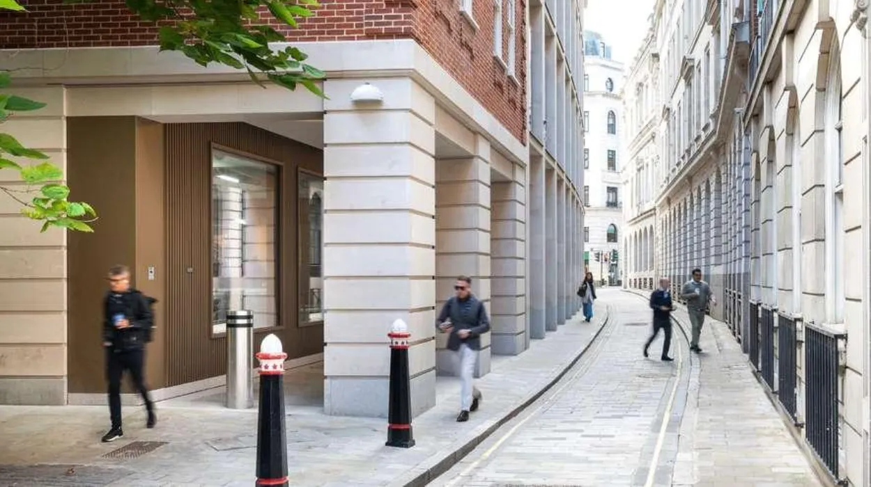
Medieval alleyways of Old London were narrow public passages built between buildings that connected streets, markets, churches, homes, and commercial districts. They reflected the city’s medieval street pattern and supported daily movement, trade, craftsmanship, and community life from the eleventh century onward.
The medieval alleyway was a defining feature of London’s historic urban fabric. Unlike modern roads designed for wheeled traffic, medieval lanes primarily served pedestrians, pack animals, and small carts transporting goods between markets and riverside docks.
Many alleyways originated organically rather than through planned development. Property owners constructed buildings along established routes, leaving narrow spaces that gradually became permanent public or semi-public passages. Others followed older Roman streets, property boundaries, streams, or paths leading toward religious institutions.
The City of London occupied approximately one square mile within the surviving Roman walls. As the population expanded after the Norman Conquest of 1066, available land became increasingly limited. Narrow passageways maximised access to plots without requiring wide streets, allowing commercial and residential buildings to occupy valuable urban land efficiently.
Alleyways received distinctive names based on occupations, notable residents, religious institutions, nearby landmarks, or commercial activities. Many names have survived for centuries despite substantial rebuilding, preserving historical evidence of medieval occupations and neighbourhood identities.
Why did medieval London develop so many narrow alleyways?
London developed numerous medieval alleyways because population growth, limited land inside the city walls, expanding commerce, and irregular property ownership required efficient pedestrian connections between streets, markets, homes, churches, and the River Thames throughout the medieval period.
Urban density shaped London’s medieval street network. Following Norman rule, London’s commercial importance increased significantly as merchants, craftsmen, and officials settled within the city. Housing and businesses competed for limited building space enclosed by Roman defensive walls.
Property subdivision became increasingly common. Large estates divided into smaller plots over generations, producing irregular building layouts separated by narrow access routes. These passages ensured every property retained access to public streets.
Trade also influenced street development. Merchants required direct connections between warehouses, guild halls, riverside wharves, and markets such as Cheapside. Narrow passages shortened travel distances and improved movement within densely built commercial districts.
The medieval legal system recognised many rights of way. Certain alleyways remained publicly accessible because long-term use established customary legal access. Municipal authorities occasionally regulated maintenance, paving, drainage, and obstruction of important passages.
Topography also contributed. London’s hills, streams, former Roman infrastructure, and existing property boundaries influenced the alignment of many lanes, producing an irregular street pattern that differed from later planned urban developments.
How did medieval alleyways shape everyday city life?
Medieval alleyways connected homes, workplaces, markets, churches, and civic institutions, making them essential spaces for commerce, transportation, communication, neighbourhood interaction, religious activities, and municipal administration within London’s densely populated medieval environment every day.
Daily life depended on constant movement through these passages. Residents walked between homes and workplaces several times each day because few people travelled long distances within the city using horses or carts.
Craft production concentrated in specialised districts. Goldsmiths, bakers, fishmongers, tailors, leatherworkers, and other guild members occupied workshops opening directly onto streets and alleyways. Customers regularly used narrow lanes to access these businesses.
Religious observance also relied upon the medieval street network. Parish churches served neighbourhood communities, and worshippers reached services through interconnected passages. Processions during important feast days followed established routes linking churches and civic buildings.
Water remained essential for domestic life. Residents carried water from public conduits, wells, and the River Thames through alleyways into surrounding homes and businesses.
Neighbourhood identity developed around shared passageways. Residents encountered neighbours daily, exchanged commercial information, discussed civic matters, and participated in community activities within these confined public spaces.
Which occupations and industries were concentrated around medieval alleyways?
Medieval alleyways supported specialised occupations including goldsmiths, merchants, fishmongers, butchers, tailors, printers, apothecaries, brewers, and legal professionals. Occupational clustering strengthened guild regulation, commercial cooperation, and efficient distribution across London’s expanding medieval economy.
Guilds regulated professional standards, apprenticeships, production quality, and commercial conduct. Members often established workshops near colleagues practising the same trade.
Cheapside became London’s principal commercial street, surrounded by interconnected lanes serving specialised retail activities. Nearby alleyways housed jewellers, textile merchants, food sellers, and financial services supporting long-distance trade.
Near the River Thames, warehouse districts handled imported goods arriving from continental Europe. Wine, spices, wool, timber, cloth, and luxury goods passed through riverside lanes connecting docks with inland markets.
Legal professionals increasingly occupied areas surrounding the Inns of Court. Narrow passages linked chambers, courts, residences, and administrative buildings serving England’s developing legal system.
Printing expanded after William Caxton introduced the printing press to England during the late fifteenth century. Printers, booksellers, and stationers later concentrated within specific streets and courts, transforming parts of the medieval city into publishing centres.
How did medieval alleyways influence public health and sanitation?
Medieval alleyways reflected both practical urban design and significant sanitation challenges. Limited drainage, dense housing, animal waste, household refuse, and restricted airflow affected health, while municipal regulations attempted to improve cleanliness and public safety.
Population density created substantial environmental pressures. Houses frequently extended over narrow lanes through upper-storey projections known as jetties, reducing sunlight and air circulation.
Domestic waste disposal remained inconsistent. Household refuse, food waste, ash, and wastewater often entered street gutters running through alleyways before eventually reaching larger drainage channels or the River Thames.
Livestock formed part of everyday urban life. Horses, pigs, poultry, and cattle frequently occupied streets, contributing additional waste requiring municipal management.
City authorities introduced regulations requiring residents to maintain frontages, remove obstructions, and reduce refuse accumulation. Enforcement varied depending upon neighbourhood resources and administrative capacity.
Public health crises exposed urban vulnerabilities. Repeated plague outbreaks, including the Black Death beginning in 1348, affected densely populated neighbourhoods throughout London. Although medieval understanding of disease transmission differed from modern science, authorities increasingly recognised the importance of street cleanliness and waste removal.
What role did medieval alleyways play during major historical events?
Medieval alleyways served as routes for commerce, royal ceremonies, religious processions, emergencies, military defence, and disaster response. Their strategic importance became especially visible during plague outbreaks, political unrest, fires, and periods of economic expansion.
The Norman Conquest reshaped London’s political importance while preserving much of its earlier street network. Successive monarchs relied upon established routes connecting royal residences, administrative centres, and commercial districts.
During medieval festivals, civic processions travelled through principal streets and adjoining lanes linking guild halls, churches, and marketplaces. These events reinforced London’s civic identity and religious traditions.
The Black Death transformed demographic patterns across London. Labour shortages, economic restructuring, and changing property ownership influenced neighbourhood development and the occupation of urban spaces.
The Great Fire of London in 1666, although occurring after the medieval period, destroyed approximately 13,200 houses, 87 parish churches, and numerous medieval alleyways within the City of London. Reconstruction introduced wider streets in selected areas while preserving portions of the earlier street pattern elsewhere.
For readers interested in exploring surviving historic routes today, consult our comprehensive [Best Riverside Walks Along the Thames for Scenic Views and Relaxing Outdoor Adventures] for itineraries and visiting parameters.
Which medieval alleyways still survive in modern London?
Several medieval alleyways survive within the modern City of London, preserving historic street alignments despite extensive rebuilding. These surviving passages provide valuable archaeological evidence and allow visitors to experience London’s medieval urban landscape firsthand.
Many surviving lanes retain medieval origins despite Victorian and modern architectural alterations. Their alignments frequently reflect property boundaries established hundreds of years ago.
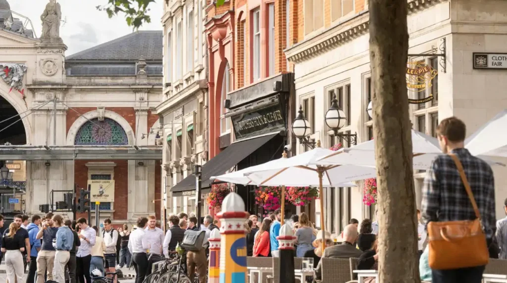
Examples include St Mary’s Alley, Staining Lane, Ironmonger Lane, Cloth Fair, and parts of Bow Lane. Although buildings have changed substantially, these routes preserve elements of London’s medieval circulation network.
Some passages escaped destruction during the Great Fire because they lay beyond its main boundary or formed part of later reconstruction preserving earlier alignments.
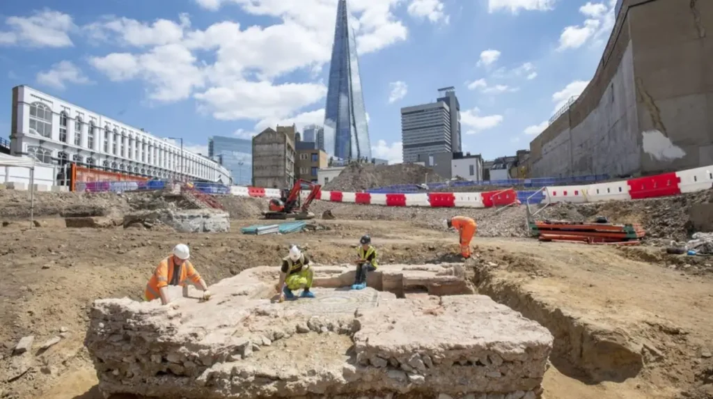
Archaeological excavations beneath modern buildings regularly uncover medieval foundations, drainage systems, property divisions, and street surfaces associated with historic alleyways.
Modern conservation policies increasingly recognise these surviving passages as significant heritage assets contributing to London’s historical character and cultural identity.
How do archaeologists study medieval alleyways today?
Archaeologists investigate medieval alleyways through excavations, building surveys, historical mapping, documentary research, environmental analysis, and digital reconstruction. These methods reveal changing street layouts, property boundaries, commercial activity, and everyday urban life across successive centuries.
Urban archaeology presents unique challenges because modern infrastructure overlays earlier remains. Excavations usually occur before redevelopment projects or infrastructure construction.
Researchers compare medieval tax records, parish documents, wills, property deeds, guild registers, and municipal archives to reconstruct neighbourhood development.
Historic mapping provides additional evidence. Although detailed cartography became more common after the medieval period, early modern maps often preserve street layouts inherited from earlier centuries.
Material evidence recovered from excavations includes pottery, leather shoes, metal tools, animal bones, coins, imported ceramics, and building materials. These discoveries help reconstruct domestic consumption, international trade, and occupational activities.
Scientific techniques including dendrochronology, radiocarbon dating, environmental sampling, and Geographic Information Systems enable increasingly precise reconstruction of London’s historical development.
Why are medieval alleyways important for understanding London’s history?
Medieval alleyways preserve evidence of London’s social organisation, commercial growth, architectural development, governance, and cultural identity. Their continued survival enables historians, archaeologists, educators, and visitors to understand how ordinary Londoners experienced urban life across centuries.
Grand monuments illustrate political power, while alleyways reveal ordinary urban experience. Everyday movement, neighbourhood interaction, small businesses, domestic routines, and local administration all depended upon these modest spaces.
Genealogical researchers benefit from preserved street names appearing in parish registers, tax records, apprenticeship documents, and probate records. Historic addresses frequently help reconstruct family histories spanning multiple generations.
Educational institutions use surviving alleyways to explain medieval urban planning, economic geography, architectural evolution, and archaeological methodology. These locations provide tangible connections between documentary evidence and physical landscapes.
Heritage conservation organisations increasingly emphasise protecting complete historic streetscapes rather than isolated buildings. Alleyways contribute essential context linking churches, guild halls, markets, and residential areas into coherent historical environments.
Tourism also benefits from preserving authentic urban landscapes. Visitors gain deeper understanding of medieval London by walking historic routes that retain their original scale, alignment, and relationship to surrounding landmarks.
How have medieval alleyways influenced modern London?
Modern London continues to reflect medieval alleyway patterns through preserved street alignments, protected heritage districts, archaeological conservation, place names, pedestrian routes, and planning policies that recognise the historical significance of the city’s earliest urban network.
The City of London’s distinctive street pattern differs markedly from later Georgian and Victorian districts because medieval routes remained embedded within subsequent development.
Historic place names preserve occupational and institutional memory. Even where original buildings disappeared, lane names continue recording medieval trades, religious foundations, and local landmarks.
Urban planners increasingly integrate heritage conservation into redevelopment strategies. Modern construction frequently incorporates archaeological investigations and preserves historically significant street alignments where practical.
Digital mapping, three-dimensional modelling, and archival digitisation continue expanding public access to historical evidence. Researchers, educators, and visitors can compare medieval layouts with present-day London using increasingly sophisticated technologies.
The continuing preservation of medieval alleyways demonstrates that urban history extends beyond monumental architecture. These narrow passages reveal how ordinary residents shaped one of Europe’s most influential cities through commerce, community, adaptation, and daily life over nearly one thousand years.
Medieval alleyways formed the essential framework of everyday life in Old London. They connected homes with workshops, markets with river docks, churches with neighbourhoods, and civic institutions with commercial districts. Their irregular layout reflected centuries of population growth, economic expansion, evolving property ownership, and practical adaptation within the confined space of the medieval City of London.
Although fire, redevelopment, and modern construction transformed much of the historic city, surviving alleyways continue to preserve invaluable archaeological and historical evidence. Their names, alignments, and associated records document the occupations, communities, religious practices, and commercial networks that shaped medieval London.
Today these historic passages remain significant not only as physical remnants of the past but also as educational resources that deepen understanding of urban development, heritage conservation, genealogy, and archaeological research. Medieval alleyways demonstrate that London’s history is preserved as much in its smallest streets as in its most celebrated landmarks, making them indispensable to understanding the evolution of one of the world’s greatest historic cities.
What are medieval alleyways in Old London?
Medieval alleyways are narrow pedestrian passages that developed between the 11th and 15th centuries, linking markets, churches, homes, workshops, guild halls, and the River Thames. They formed the backbone of everyday movement within the medieval City of London.