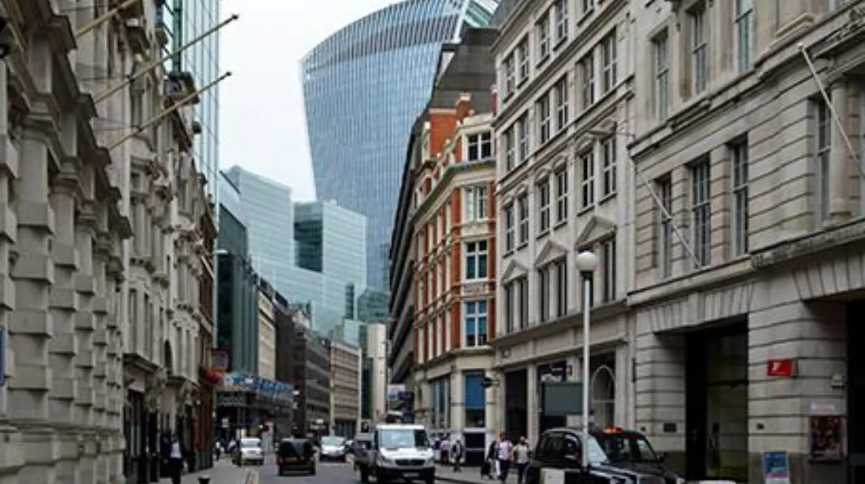
London’s streets are among the oldest continuously used urban routes in Europe. Their evolution reflects nearly 2,000 years of political authority, commercial expansion, engineering innovation, public health reform, and urban planning. From Roman military roads to medieval market lanes, Georgian squares, Victorian boulevards, and modern pedestrian corridors, London’s street network provides a living record of how cities adapt across centuries while preserving historical identity.
- Why are London’s streets historically significant?
- How did Roman London shape today’s street network?
- How did medieval streets influence London’s character?
- Why did the Great Fire of 1666 change London’s streets?
- How did Georgian planning redefine London’s urban landscape?
- How did Victorian engineering transform London’s streets?
- What role did London’s streets play during the twentieth century?
- How do London’s historic streets influence modern urban planning?
- Which historic streets still preserve London’s past?
- Why does preserving London’s streets matter for future generations?
Understanding London’s streets explains why the capital has an irregular street pattern, distinctive neighbourhoods, and a globally influential approach to balancing heritage with modern development. Today, urban planners, architects, historians, and conservationists continue to study London’s historical streets to inform sustainable city design throughout the world.
Why are London’s streets historically significant?
London’s streets preserve nearly 2,000 years of continuous urban development. Roman engineering, medieval commerce, Tudor rebuilding, Georgian planning, Victorian infrastructure, and modern regeneration all remain visible within the same street network, making London one of the world’s richest historical urban landscapes.
Unlike many modern capitals built according to comprehensive master plans, London’s street network developed gradually through successive historical periods. Each era introduced new routes while retaining much of the previous urban fabric.
When the Romans established Londinium around AD 47, they created a fortified settlement connected by carefully engineered roads. These roads linked London with important Roman settlements including Colchester, St Albans, Silchester, and Canterbury. Several modern streets still follow Roman alignments.
Following the Roman withdrawal in the early fifth century, Anglo-Saxon settlements reused surviving roads while developing new trading areas along the River Thames. Medieval London expanded organically around churches, markets, guild halls, and defensive walls rather than following geometric planning.
The Norman Conquest in 1066 introduced stronger administrative control, but London’s streets continued evolving through commerce rather than royal planning. Markets determined traffic patterns, while property ownership created winding lanes that remain visible today.
The Great Fire of 1666 destroyed approximately 13,200 houses, 87 parish churches, and most of medieval central London. Although Christopher Wren proposed a rational street grid inspired by Paris and Rome, rebuilding largely followed historic property boundaries because rapid reconstruction remained an economic priority.
Consequently, London’s modern street pattern combines ancient alignments with later improvements, producing an urban form that reflects every major historical period.
How did Roman London shape today’s street network?
Roman engineers established London’s earliest permanent road system around AD 47. Several principal streets still follow Roman alignments, demonstrating how durable infrastructure can influence urban development for nearly two millennia despite political, economic, and architectural transformation.
Roman road planning
Roman military engineers constructed roads using layered foundations of gravel, stone, and compacted materials designed for durability. Londinium became a strategic transportation hub connecting Britain with the wider Roman Empire.
Principal Roman roads included:
- Watling Street
- Ermine Street
- Stane Street
- Dere Street
These roads connected London to military forts, ports, administrative centres, and commercial settlements across Roman Britain.
Within Londinium itself, streets followed a relatively ordered pattern enclosed by defensive walls built around AD 200.
Surviving Roman alignments
Modern streets preserving Roman routes include sections near:
- Cannon Street
- Gracechurch Street
- Bishopsgate
- Lombard Street
Although buildings changed repeatedly, archaeological investigations confirm many present-day street alignments closely match Roman foundations.
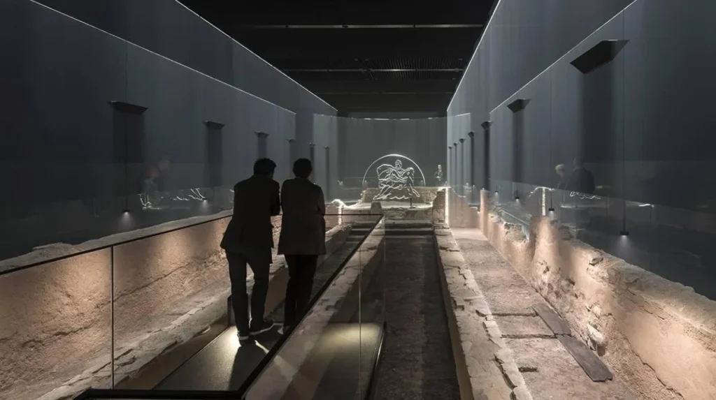
Excavations conducted during modern construction projects continue uncovering Roman road surfaces, drainage systems, and building remains beneath today’s financial district.
How did medieval streets influence London’s character?
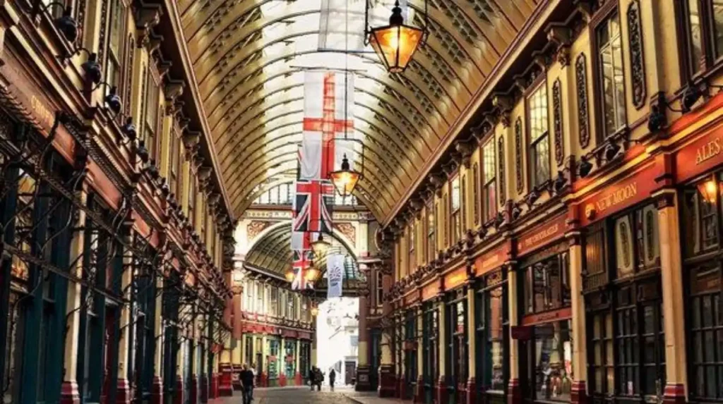
Medieval London’s streets developed around markets, churches, guilds, and trade rather than formal planning. Their narrow widths, irregular layouts, and specialised commercial districts continue defining many historic neighbourhoods throughout central London today.
Following the Norman period, London’s economy expanded rapidly through international trade.
Street names reflected occupations and local industries. Many names remain unchanged centuries later, including:
- Bread Street
- Milk Street
- Poultry
- Ironmonger Lane
- Threadneedle Street
These names provide valuable evidence of medieval economic geography.
Markets created highly concentrated commercial districts where merchants selling similar products clustered together. This arrangement simplified regulation by civic authorities while allowing buyers to compare goods efficiently.
Churches also shaped street patterns. Parish boundaries influenced neighbourhood development, while religious institutions owned significant urban land.
The resulting street network prioritised economic function over geometric order.
Modern visitors walking through areas surrounding the City of London still experience many medieval alignments despite successive rebuilding phases.
To experience these historic districts in person today, consult our comprehensive [Best Places for Night Photography in London With Stunning Illuminated Landmark Views] for itineraries and visiting parameters.
Why did the Great Fire of 1666 change London’s streets?
The Great Fire transformed London’s building regulations more than its street layout. While safer construction materials and wider thoroughfares emerged, economic necessity preserved many medieval street alignments that remain visible across the historic City today.
The Great Fire began on 2 September 1666 and burned for four days.
Its destruction created an opportunity for comprehensive urban redesign.
Architect Christopher Wren proposed:
- broad avenues
- formal squares
- radial boulevards
- organised commercial districts
Similar proposals came from John Evelyn and Robert Hooke.
However, reconstruction faced practical obstacles.
Property ownership remained fragmented among thousands of individuals.
Merchants required rapid rebuilding to restore economic activity.
Parliament prioritised practical reconstruction over ambitious redesign.
Instead, rebuilding legislation introduced important improvements.
The Rebuilding Act required:
- brick construction
- stone construction
- improved fire safety
- regulated building heights
- wider selected streets
These reforms improved resilience while preserving London’s historic street framework.
How did Georgian planning redefine London’s urban landscape?
Georgian planners introduced organised residential squares, elegant terraces, and coordinated street design during the eighteenth century. Their approach combined private development with public space, influencing urban planning across Britain and internationally for generations.
The eighteenth century witnessed London’s rapid westward expansion.
Large landowners developed planned estates using coordinated architectural standards.
Neighbourhoods including:
- Bloomsbury
- Mayfair
- Marylebone
featured carefully arranged squares connected by broad streets.
Georgian planning introduced several innovations.
Residential terraces created architectural consistency.
Garden squares provided communal green space.
Building regulations established harmonious streetscapes.
Controlled development enhanced property values while improving environmental quality.
This model became influential worldwide.
Cities throughout Britain, North America, Australia, and parts of Europe adopted similar planning principles during the eighteenth and nineteenth centuries.
Many Georgian streets remain protected conservation areas today because of their exceptional architectural integrity.
How did Victorian engineering transform London’s streets?
Victorian infrastructure modernised London’s streets through sewers, underground railways, improved lighting, bridges, and traffic management. These engineering achievements supported rapid population growth while establishing many principles of modern urban infrastructure still applied internationally.
During the nineteenth century London’s population increased dramatically.
Between 1801 and 1901, London’s population expanded from approximately one million residents to over 6.5 million.
Rapid growth created severe public health challenges.
Engineer Joseph Bazalgette designed London’s comprehensive sewer network following repeated cholera outbreaks and the Great Stink of 1858.
Street improvements accompanied underground infrastructure.
Victorian developments included:
- gas lighting
- granite paving
- improved drainage
- wider carriageways
- organised intersections
The opening of the Metropolitan Railway in 1863 fundamentally altered urban mobility by separating surface and underground transport.
Major bridges crossing the Thames also improved connectivity between expanding districts.
Victorian engineering demonstrated how infrastructure investment could reshape entire metropolitan regions.
What role did London’s streets play during the twentieth century?
Twentieth-century planning balanced wartime reconstruction, motor vehicle expansion, heritage conservation, and pedestrian improvements. London gradually shifted from prioritising automobiles toward creating safer, more accessible public streets while preserving historic character.
The Second World War caused extensive bombing damage across London.
Post-war reconstruction introduced modern housing estates, office developments, and transport improvements.
From the 1950s through the 1970s, urban planners increasingly designed roads to accommodate growing automobile ownership.
Several historic streets experienced widening schemes, while new arterial routes improved suburban connectivity.
By the late twentieth century, priorities changed again.
Historic preservation gained stronger legal protection.
Traffic calming initiatives reduced vehicle dominance in many neighbourhoods.
Pedestrianisation improved accessibility in commercial districts.
Cycle infrastructure expanded alongside public transport investment.
The result became a more balanced approach combining mobility, environmental quality, and historical preservation.
How do London’s historic streets influence modern urban planning?
Urban planners study London’s historical streets because they demonstrate long-term adaptability. Mixed land uses, walkability, heritage conservation, transport integration, and incremental development continue informing sustainable planning strategies across major international cities.
Modern planning increasingly values characteristics once considered outdated.
Historic London demonstrates that walkable neighbourhoods encourage economic activity and social interaction.
Mixed residential and commercial uses reduce travel distances.
Dense street networks improve accessibility.
Conservation areas preserve cultural identity while supporting tourism economies.
Modern regeneration projects increasingly integrate historic street patterns rather than replacing them entirely.
International cities studying London’s development include examples across Europe, North America, Asia, and Australia.
Planning research frequently examines how historical continuity strengthens urban resilience.
Rather than viewing heritage as an obstacle, planners increasingly recognise historical streets as valuable infrastructure supporting sustainable growth.
Which historic streets still preserve London’s past?
Many historic London streets retain original alignments, historic names, archaeological evidence, and protected architecture. Together they provide exceptional evidence of Roman, medieval, Georgian, Victorian, and twentieth-century urban development within a continuously functioning global city.
Several streets illustrate different historical periods.
The Strand originated as the principal route linking medieval London with Westminster.
Fleet Street became synonymous with Britain’s newspaper industry.
Cheapside developed as London’s medieval commercial centre.
Whitehall evolved into Britain’s governmental heart.
The Mall represents ceremonial planning associated with the monarchy.
Piccadilly reflects eighteenth-century westward expansion.
Bishopsgate preserves Roman origins while serving today’s financial district.
Numerous smaller lanes also retain remarkable historical significance.
Examples include:
- St Mary’s Axe
- Cloth Fair
- Bow Lane
- Watling Street
Archaeological investigations continue revealing earlier phases beneath these streets during redevelopment projects.
This combination of continuous occupation and preservation remains exceptionally rare internationally.
Why does preserving London’s streets matter for future generations?
Preserving London’s streets protects historical evidence, architectural heritage, archaeological resources, cultural identity, and educational value. Conservation supports sustainable development by integrating historic environments with contemporary economic activity rather than replacing them with entirely new urban forms.
Historic streets function as open-air historical archives.
Every alignment, building line, paving material, and street name contributes evidence about earlier societies.
Conservation also generates measurable economic benefits.
Historic districts attract millions of visitors annually while supporting hospitality, retail, education, and cultural industries.
Legal protections including conservation areas and listed building legislation safeguard significant urban environments from inappropriate alteration.
Modern technologies further strengthen preservation.
Laser scanning, geographic information systems (GIS), digital archaeology, and three-dimensional modelling document historic streets with unprecedented accuracy.
These records assist restoration, planning, education, and future archaeological research.
As climate adaptation becomes increasingly important, London’s historical emphasis on compact development, walkability, and mixed land use continues offering valuable lessons for sustainable cities worldwide.
London’s streets represent far more than transportation corridors. They constitute an evolving historical record spanning Roman Britain, medieval commerce, Tudor rebuilding, Georgian planning, Victorian engineering, twentieth-century reconstruction, and twenty-first-century sustainability.
Every generation added new infrastructure while preserving elements inherited from earlier centuries, creating an urban landscape unmatched in historical continuity.
This layered development explains why London’s street network differs fundamentally from cities built according to a single master plan. Roman roads still influence modern routes. Medieval market streets remain commercial centres. Georgian squares continue functioning as residential neighbourhoods. Victorian engineering still supports essential infrastructure. Contemporary planners increasingly build upon rather than replace these historical foundations.
For historians, London’s streets provide primary evidence of political, economic, architectural, and social change across nearly two millennia. For educators, they offer tangible examples of urban evolution. For conservationists, they demonstrate the value of protecting historical environments while accommodating modern needs. For planners worldwide, London’s experience confirms that successful cities preserve their historical identity while continuously adapting to new challenges.
The enduring influence of London’s streets illustrates a central principle of urban development: resilient cities evolve through continuity as well as innovation. That balance has allowed London to remain one of the world’s most historically significant and economically dynamic capitals, with its streets continuing to shape both everyday life and future urban planning.
Why do London’s streets have an irregular layout?
London developed gradually over centuries rather than through a single master plan. Medieval markets, churches, property boundaries, and successive rebuilding phases created the city’s distinctive winding street pattern.