London’s districts represent the cumulative result of nearly two thousand years of political authority, commercial expansion, religious influence, industrial development, transport innovation, and planned urban growth. From the Roman foundation of Londinium in AD 47 to the creation of modern Greater London in 1965, every district reflects a distinct historical process shaped by geography, governance, migration, architecture, and economic change. Understanding how these districts emerged provides essential context for London’s heritage, contemporary identity, and ongoing urban evolution.
- What are London’s districts, and how did they originate?
- Why did the River Thames shape London’s district development?
- How did medieval villages become London’s modern neighbourhoods?
- How did royal influence transform Westminster and surrounding districts?
- What role did trade and markets play in creating distinctive districts?
- How did immigration influence London’s district identities?
- How did the Industrial Revolution change London’s districts?
- How did transport shape London’s expanding districts?
- How did London’s administrative boundaries evolve?
- What historic buildings and street patterns reveal district development today?
- Why does understanding London’s district history remain important today?
What are London’s districts, and how did they originate?
London’s districts originated through successive phases of Roman settlement, medieval villages, royal estates, market towns, industrial suburbs, and twentieth-century administrative reforms. Each district developed according to local geography, economic opportunity, political authority, and transport connections while gradually becoming part of a continuously expanding metropolis.
London’s districts are historically defined geographical communities rather than purely administrative boundaries. Their identities emerged long before modern boroughs existed, with many names surviving for hundreds or even thousands of years.
The earliest organised settlement was Roman Londinium, established around AD 47 shortly after the Roman conquest of Britain. Positioned beside the River Thames, the settlement became a provincial capital enclosed by defensive walls constructed during the late second century AD.
Outside Roman Londinium, small agricultural settlements and river crossings gradually developed. Following the decline of Roman administration in the fifth century, Anglo-Saxon communities established Lundenwic west of the former Roman city near present-day Covent Garden and the Strand.
During the late ninth century, King Alfred the Great reoccupied the Roman walled city after defeating Viking forces. This restored settlement became Lundenburh, laying foundations for the medieval City of London.
As London’s population increased, surrounding villages—including Westminster, Islington, Stepney, Chelsea, Lambeth, Southwark, Hampstead, and Greenwich—retained separate identities while gradually becoming connected through commerce, governance, and population growth.
Rather than replacing older settlements, urban expansion absorbed them. Their medieval parish boundaries, historic churches, marketplaces, and road networks continued influencing neighbourhood identities for centuries.
Why did the River Thames shape London’s district development?
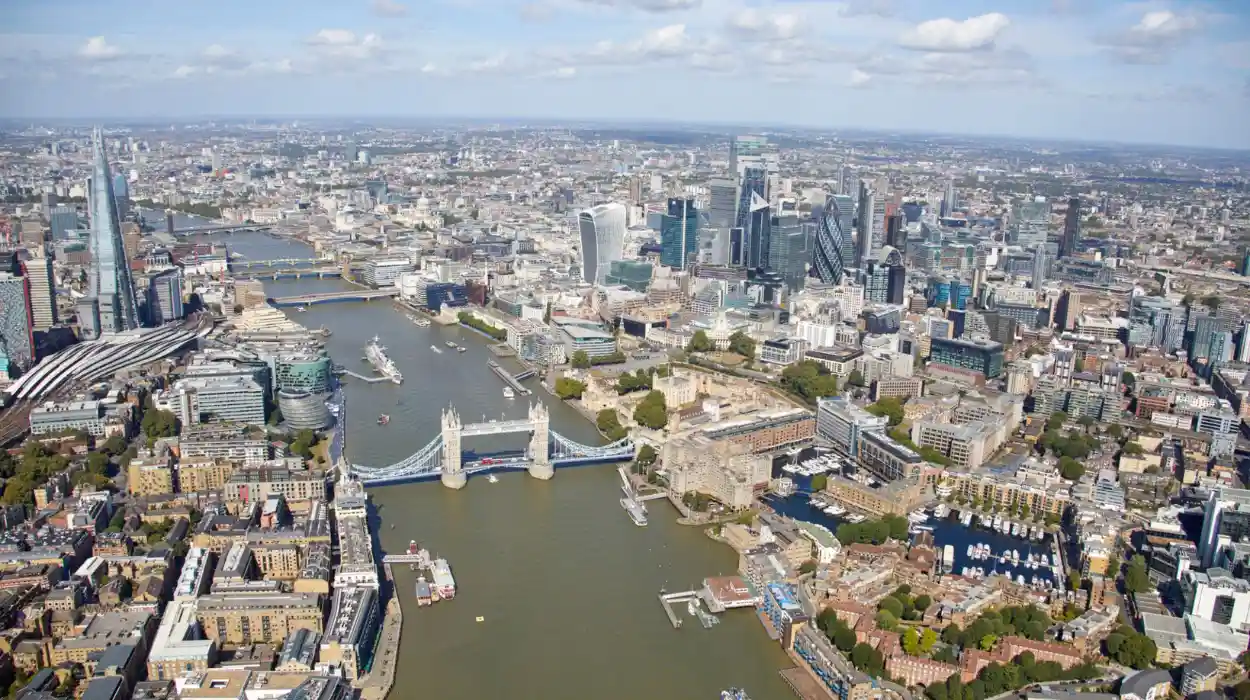
The River Thames determined London’s earliest settlement patterns by providing navigation, trade, freshwater access, defensive advantages, and commercial connectivity. Districts located beside the river became centres of government, shipping, manufacturing, commerce, and residential expansion throughout successive historical periods.
The River Thames is London’s defining geographical feature.
Roman engineers selected Londinium partly because the river offered one of the lowest practical bridging points while allowing sea-going vessels to travel inland.
The first London Bridge created a permanent crossing between the City and Southwark, stimulating economic activity on both banks.
Riverside districts developed specialised functions.
The City became London’s commercial centre.
Westminster emerged as England’s political and royal centre.
Southwark became known for inns, entertainment, theatres, and markets because activities restricted inside the City often relocated across the river.
Further downstream, districts including Greenwich and Deptford became major centres for shipbuilding, naval administration, and maritime trade.
The Thames also enabled imports of grain, timber, wine, coal, and manufactured goods, supporting rapid urban growth.
Floodplains influenced settlement patterns for centuries. Higher ground attracted wealthier residential development, while lower riverside land often supported docks, warehouses, and industry.
Even after railways reduced river transport’s dominance during the nineteenth century, historic waterfront districts retained distinctive economic and architectural identities.
How did medieval villages become London’s modern neighbourhoods?
Medieval villages surrounding the City of London gradually transformed into urban districts through population growth, market expansion, religious institutions, improved roads, and continuous residential construction between the eleventh and nineteenth centuries while preserving many historic place names and parish identities.
Following the Norman Conquest in 1066, London expanded beyond its Roman walls.
Independent villages maintained agricultural economies centred on farming, grazing, orchards, and local markets.
Each village possessed defining institutions including parish churches, manor houses, commons, and local marketplaces.
Examples include Chelsea, originally a riverside agricultural village; Islington, recognised for dairy farming and fresh water supplies; and Hampstead, known for elevated terrain and healthy air.
As London’s population increased during the Tudor and Stuart periods, urban development spread outward.
Landowners subdivided estates into housing plots.
Roads connecting villages became continuous urban streets.
Fields disappeared beneath residential terraces, workshops, and commercial buildings.
Despite physical integration, historic village centres often survived.
Churches remained community landmarks.
Street patterns reflected medieval routes.
Parish names continued defining local identity despite administrative change.
Many modern districts therefore preserve medieval origins within contemporary urban landscapes.
How did royal influence transform Westminster and surrounding districts?
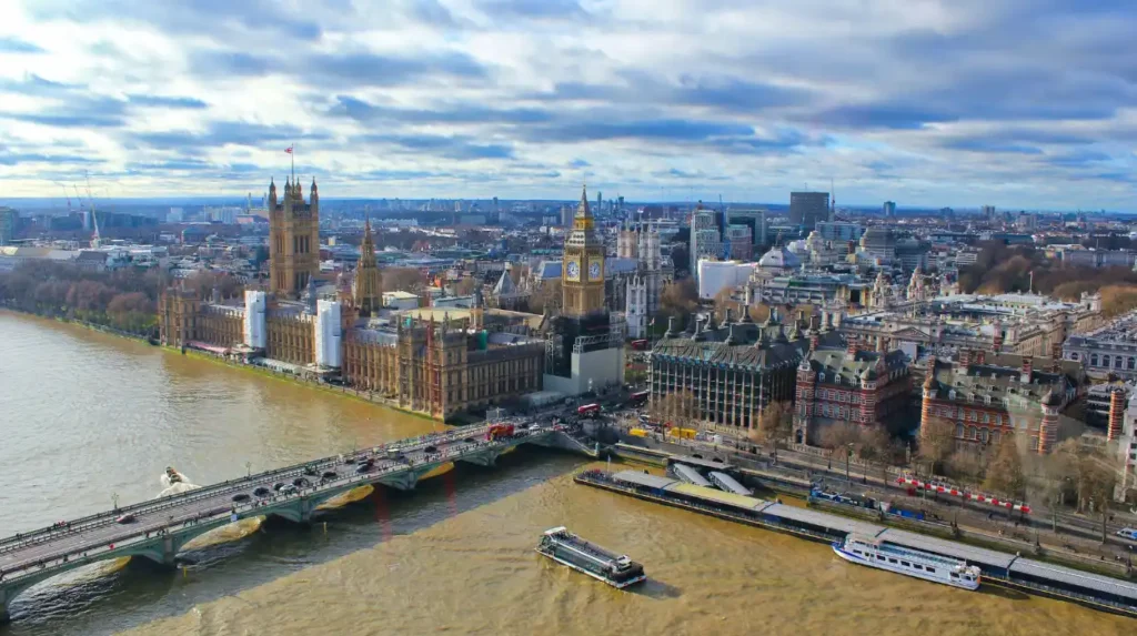
Royal authority transformed Westminster into England’s political centre through palace construction, religious institutions, parliamentary development, ceremonial routes, and government administration. Surrounding districts expanded to accommodate nobles, officials, merchants, artisans, and later professional middle-class residential communities.
Westminster developed independently from the City of London.
Its importance centred upon Westminster Abbey, originally founded during the tenth century and rebuilt extensively under King Edward the Confessor before the Norman Conquest.
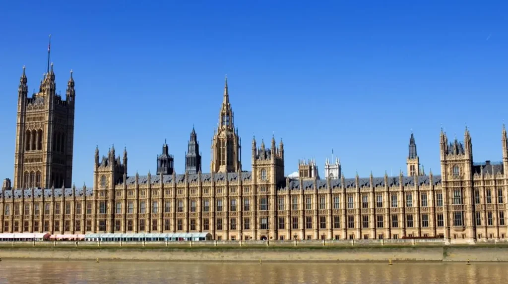
The nearby Palace of Westminster became England’s principal royal residence before evolving into the permanent home of Parliament.
Royal patronage encouraged construction of grand houses for aristocratic families.
Government departments gradually concentrated nearby.
Legal professions clustered around Westminster and the Inns of Court.
The ceremonial route linking Whitehall, St James’s, Buckingham Palace, and Parliament created one of Europe’s most significant political landscapes.
Urban expansion followed political importance.
Luxury housing appeared around Mayfair, St James’s, Belgravia, and Westminster during the eighteenth and nineteenth centuries.
These districts reflected increasing national wealth generated through commerce, imperial administration, and financial services.
What role did trade and markets play in creating distinctive districts?
Trade created specialised commercial districts by concentrating particular industries, occupations, wholesale markets, craft guilds, and financial institutions within defined neighbourhoods. Economic specialisation strengthened local identities that continued influencing district development long after original industries declined.
Medieval London’s economy relied upon occupational clustering.
Guild regulations encouraged artisans practising similar trades to locate near one another.
Street names preserve these historic functions.
Bread Street reflected bakers.
Milk Street reflected dairy trading.
Ironmonger Lane reflected metalworking.
Fish Street reflected fish merchants.
Markets also shaped neighbourhood growth.
Smithfield developed into England’s principal livestock market.
Billingsgate specialised in fish.
Covent Garden evolved into London’s central fruit and vegetable market.
Spitalfields became internationally recognised for textile production following Huguenot immigration during the seventeenth century.
The City became Europe’s leading financial district through banking, insurance, shipping finance, and international commerce.
Commercial concentration attracted supporting professions including accountants, solicitors, printers, warehouse operators, and merchants.
Economic geography therefore reinforced district identities over many centuries.
How did immigration influence London’s district identities?
Successive migration transformed London’s districts through new industries, religious institutions, housing patterns, businesses, languages, and cultural traditions. Immigrant communities contributed lasting architectural, commercial, culinary, and social characteristics that remain visible across numerous neighbourhoods today.
London has experienced continuous immigration throughout its recorded history.
Romans introduced continental administrative systems.
Normans reshaped governance after 1066.
Dutch and Flemish artisans contributed manufacturing expertise.
French Huguenots established silk weaving in Spitalfields after religious persecution during the seventeenth century.
Jewish communities expanded throughout the East End during the nineteenth century.
Irish migration increased following the Great Famine.
South Asian, Caribbean, African, Chinese, and Eastern European communities expanded significantly after the Second World War.
Migration influenced architecture through places of worship including synagogues, mosques, churches, and temples.
Commercial streets reflected new businesses and specialist retailers.
Food culture diversified through restaurants, markets, and imported goods.
These demographic changes enriched London’s districts while preserving evidence of successive migration waves within the urban landscape.
How did the Industrial Revolution change London’s districts?
Industrialisation fundamentally reshaped London’s districts through factory construction, railway expansion, dock enlargement, mass housing, public infrastructure, and population growth. Industrial employment transformed agricultural land into densely developed urban neighbourhoods during the eighteenth and nineteenth centuries.
Between approximately 1760 and 1914, London’s population expanded dramatically.
Population increased from roughly one million in 1801 to more than 6.5 million by 1901.
Industrial employment generated unprecedented demand for housing.
Terraced streets expanded rapidly across districts including Camden, Islington, Hackney, Lambeth, Battersea, and Poplar.
The West India Docks, East India Docks, Royal Docks, Surrey Commercial Docks, and Millwall Docks established East London as one of the world’s busiest port complexes.
Factories clustered near canals, railways, and rivers.
Gasworks, engineering firms, breweries, printing works, and food processing industries became major employers.
Industrial prosperity also generated severe overcrowding.
Public health challenges encouraged reforms involving sanitation, sewer construction, clean water supply, and housing regulation.
These improvements permanently altered London’s urban structure.
How did transport shape London’s expanding districts?
Transport innovation expanded London’s districts by reducing travel times, encouraging suburban housing, supporting commercial decentralisation, and connecting previously isolated communities. Roads, canals, railways, underground lines, trams, and buses each stimulated successive phases of urban growth.
Transport determined where London expanded.
Roman roads established enduring movement corridors.
Turnpike roads improved regional travel during the eighteenth century.
Canals facilitated industrial freight movement before railways became dominant.
Railway construction after the 1830s transformed metropolitan geography.
Major termini including Paddington, King’s Cross, St Pancras, Waterloo, Liverpool Street, Victoria, Euston, Charing Cross, and London Bridge became gateways linking London with Britain.
The Metropolitan Railway opened in 1863 as the world’s first underground railway.
Subsequent Underground expansion enabled suburban districts to grow rapidly.
Residential communities developed around stations because commuting became practical.
During the twentieth century, buses and electric railways further integrated outer districts into London’s metropolitan economy.
Transport therefore connected historic settlements while encouraging entirely new suburban communities.
Within today’s historic landscape, visitors can still trace these development patterns. To experience these historic neighbourhoods in person today, consult our comprehensive [Best Places to Escape London’s Crowds While Discovering Peaceful Hidden Attractions and Parks] for itineraries and visiting parameters.
How did London’s administrative boundaries evolve?
Administrative boundaries evolved through medieval parishes, metropolitan boards, county government, borough reforms, and the creation of Greater London. Governance gradually adapted to population growth while preserving numerous historic district names and long-established local identities.
The medieval City of London retained exceptional institutional continuity.
Outside the City, governance originally depended upon parishes, counties, and manorial authorities.
Rapid nineteenth-century growth created administrative challenges involving sanitation, policing, education, roads, and housing.
The Metropolitan Board of Works was established in 1855 to coordinate infrastructure improvements.
The County of London followed in 1889 under the London County Council.
Population growth beyond county boundaries required further reform.
The London Government Act 1963 created Greater London, which formally came into existence in 1965.
Thirty-two London boroughs were established alongside the historic City of London.
Although administrative structures changed, historic districts remained culturally significant.
Residents continue identifying strongly with neighbourhood names that predate modern borough boundaries by several centuries.
What historic buildings and street patterns reveal district development today?
Historic buildings, parish churches, street layouts, marketplaces, bridges, and archaeological remains preserve physical evidence of London’s district development. These surviving features enable researchers to reconstruct successive phases of urban growth across nearly two millennia of continuous occupation.
London contains remarkable historical continuity despite repeated rebuilding.
The medieval street pattern remains visible within the City of London.
Roman walls survive in several locations.
Historic parish churches mark medieval settlement centres.
Market squares continue defining commercial districts.
Georgian terraces characterise districts developed during the eighteenth century.
Victorian railway infrastructure illustrates nineteenth-century expansion.
Archaeological excavations regularly uncover Roman roads, domestic buildings, mosaics, pottery, and waterfront structures beneath modern developments.
Historic England records thousands of listed buildings across Greater London.
Conservation areas protect significant architectural character.
These measures preserve evidence demonstrating how successive generations shaped individual districts through adaptation rather than complete replacement.
Why does understanding London’s district history remain important today?
Understanding London’s district history explains modern settlement patterns, architectural diversity, transport networks, cultural identities, and heritage conservation. Historical knowledge supports education, tourism, urban planning, genealogy, archaeology, and preservation of one of the world’s most historically layered cities.
Modern London reflects cumulative historical development rather than a single planning process.
District identities influence community organisations, schools, businesses, cultural festivals, and local heritage initiatives.
Genealogists use parish records, census data, electoral registers, and local archives to trace family histories through historic districts.
Urban planners study historical land use when managing redevelopment.
Conservation specialists evaluate architectural significance using historical evidence.
Tourism also benefits from accurate historical interpretation.
Visitors gain deeper understanding by recognising how Roman foundations, medieval villages, royal institutions, industrial infrastructure, immigration, and transport collectively produced today’s metropolitan landscape.
Academic research continues expanding knowledge through archaeology, historical mapping, digital archives, and interdisciplinary urban studies.
Future redevelopment increasingly balances housing demand with preservation of historically significant environments.
London’s districts therefore remain living historical records rather than static monuments.
Their names, buildings, street networks, marketplaces, religious institutions, transport corridors, and public spaces collectively document nearly two thousand years of continuous urban evolution. This exceptional continuity distinguishes London among the world’s historic capitals, demonstrating how successive generations adapted existing settlements instead of repeatedly abandoning them. For historians, educators, cultural tourists, genealogists, and heritage professionals, London’s districts provide an enduring framework for understanding Britain’s political development, economic transformation, architectural heritage, and diverse community life across centuries of uninterrupted urban growth.
What is the oldest district in London?
The City of London is the oldest district, originating as the Roman settlement of Londinium around AD 47. It remains the historic and financial core of London and retains its own unique local government.