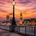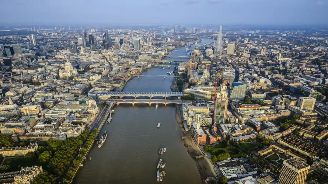
The River Thames is the defining natural feature of London and one of the most historically significant rivers in Europe. Stretching approximately 346 kilometres (215 miles) from its source in Gloucestershire to the North Sea, the Thames has shaped London’s settlement, commerce, defence, governance, engineering, and cultural identity for nearly two thousand years. Every major phase of London’s development—from the Roman occupation and medieval expansion to the Industrial Revolution and modern regeneration—has been closely connected to the river.
- Why has the River Thames been historically important to London?
- How did the River Thames shape Roman London?
- How did the River Thames influence medieval London?
- Why was the River Thames essential during the Tudor and Stuart periods?
- What happened during the famous Frost Fairs on the River Thames?
- How did the Industrial Revolution transform the River Thames?
- How did pollution affect the River Thames and how was it restored?
- What historic landmarks along the River Thames preserve London’s past?
- How does archaeology reveal the hidden history of the River Thames?
- Why does the River Thames remain historically significant today?
Today, the Thames remains both a working waterway and a protected historic landscape. Archaeological discoveries beneath its tidal mud, centuries-old bridges, historic docks, and riverside monuments continue to reveal new evidence about London’s past. Understanding the history of the River Thames provides insight into how geography influenced one of the world’s most influential cities.
Why has the River Thames been historically important to London?
The River Thames has served as London’s transportation corridor, commercial lifeline, defensive barrier, freshwater resource, and cultural landmark for nearly two millennia. Its strategic location enabled Roman settlement, medieval trade, industrial expansion, and the emergence of London as Britain’s political and economic capital.
The Thames occupies a central geographical position in southern England. Its tidal section extends through central London before flowing east into the Thames Estuary and the North Sea. This tidal characteristic allowed seagoing vessels to reach the city while inland navigation connected communities across southern England.
Before modern roads and railways, rivers formed the fastest transportation networks. The Thames linked agricultural regions, forests, ports, and markets, allowing food, timber, stone, wool, and manufactured goods to move efficiently throughout England.
Its broad channel also created a natural defensive feature. Early settlements controlled crossing points, giving rulers military and political advantages. London Bridge became the principal crossing for centuries, concentrating trade, taxation, and administration around the river.
Beyond commerce, the Thames supplied drinking water, supported fishing industries, powered mills, and provided employment for thousands of watermen, dock workers, shipbuilders, and merchants.
The river’s importance extended beyond economics. Royal ceremonies, civic celebrations, religious processions, and state events frequently took place along its banks, reinforcing its symbolic role in British national life.
How did the River Thames shape Roman London?
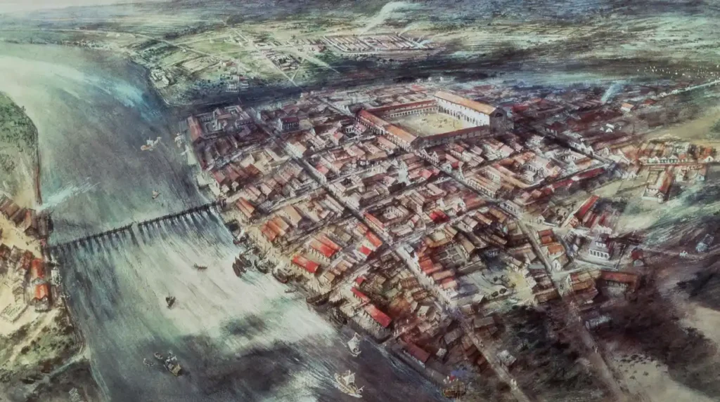
The Romans selected the Thames because it provided a secure crossing, navigable access for ships, and defensive advantages. Their settlement of Londinium around AD 47 transformed the river into the commercial centre of Roman Britain through ports, bridges, warehouses, and military infrastructure.
Roman Britain required an efficient administrative capital after the invasion initiated by Emperor Claudius in AD 43. Engineers identified the narrowest practical crossing point on the lower Thames, establishing Londinium around AD 47.
The first bridge enabled movement along the Roman road network while connecting southern and northern Britain. Around this bridge, markets, government buildings, temples, warehouses, and docks rapidly developed.
Archaeological excavations reveal extensive timber quays extending into the river. These structures allowed merchant vessels to unload imported goods including wine from Gaul, olive oil from Hispania, pottery from continental Europe, and luxury items from across the Roman Empire.
The Port of Londinium became Britain’s principal commercial gateway. Researchers estimate that tens of thousands of tonnes of goods passed through the harbour annually during the city’s peak.
Roman engineers also improved riverbanks with embankments and drainage systems that stabilised waterfront development. Many modern streets in the City of London follow Roman planning influenced by the river’s location.
Excavations continue to recover coins, weapons, pottery, writing tablets, leather shoes, and preserved timber structures from the Thames foreshore. These finds provide direct evidence of daily life in Roman London.
How did the River Thames influence medieval London?
During the medieval period, the Thames became London’s principal commercial highway, supplying food, construction materials, and imported goods while supporting markets, guilds, royal administration, and expanding urban populations between the eleventh and fifteenth centuries.
Following the Norman Conquest in 1066, London’s population and commercial influence expanded significantly. The Thames enabled continuous supplies of grain, fish, livestock, firewood, and building stone to reach the growing city.
London Bridge remained the only permanent crossing for over six centuries. Houses, chapels, and shops were built directly on the bridge, creating one of medieval Europe’s busiest commercial centres.
Wharves lined both banks of the river. Merchant guilds regulated imports and exports while collecting duties that generated substantial revenue for the Crown and municipal authorities.
Fishing formed an important economic activity. Salmon, eels, smelt, lampreys, and sturgeon were commonly harvested from the river and sold in London’s markets.
The Thames also became closely connected with royal government. Monarchs frequently travelled by barge because river transport was faster and more reliable than poorly maintained roads. Westminster Palace and the Tower of London both relied heavily on river access.
Monasteries, churches, hospitals, and charitable institutions established riverside properties to benefit from transportation and water access, shaping London’s medieval urban landscape.
Why was the River Thames essential during the Tudor and Stuart periods?
The Thames became the centre of England’s maritime expansion, royal pageantry, overseas trade, naval growth, and cultural development during the Tudor and Stuart eras, reinforcing London’s emergence as a global commercial and political capital.
Between the sixteenth and seventeenth centuries, England’s overseas exploration expanded rapidly. Merchant fleets departed from Thames ports carrying textiles, manufactured goods, and provisions while returning with spices, tobacco, sugar, and luxury imports.
The establishment of trading companies, including the English East India Company in 1600, increased London’s commercial importance through international maritime networks.
Royal ceremonies frequently used the river as a ceremonial route. Coronation processions, diplomatic receptions, and Lord Mayor’s Shows featured elaborate decorated barges carrying monarchs, officials, and civic leaders.
Watermen became one of London’s largest occupational groups. Before bridges multiplied, licensed boat operators transported thousands of passengers daily between Westminster, Southwark, and the City.
Theatres including Shakespeare’s Globe were located along the South Bank because strict regulations limited entertainment venues inside the City of London. River transport enabled audiences to reach performances efficiently.
The Thames also witnessed periods of political conflict, including troop movements during the English Civil War, demonstrating its continuing military importance.
What happened during the famous Frost Fairs on the River Thames?
The Frost Fairs occurred when exceptionally cold winters froze the tidal Thames, allowing temporary markets, entertainment venues, and public celebrations to operate directly on the river between the seventeenth and early nineteenth centuries.
The coldest phase of the Little Ice Age produced several severe winters across Europe. London’s old medieval bridge restricted water flow, while the river remained broader and shallower than today, making freezing more likely.
Historical records document major Frost Fairs during winters including 1608, 1683–84, 1716, 1739–40, and 1814.
Temporary streets appeared across the frozen river. Vendors sold food, books, souvenirs, hot drinks, and printed commemorative cards. Entertainers organised games, skating, music, and animal displays.
Printers even operated movable presses directly on the ice, producing certificates that recorded visitors’ attendance at the fairs.
The final major Frost Fair occurred in 1814. Subsequent construction of the new London Bridge, deeper navigation channels, improved embankments, and changing climatic conditions prevented the river from freezing extensively again.
The Frost Fairs remain one of London’s most distinctive historical traditions, illustrating both climatic history and urban life.
How did the Industrial Revolution transform the River Thames?
Industrialisation converted the Thames into one of the world’s busiest commercial waterways through dock construction, steam navigation, engineering innovation, and expanding international trade, while also causing severe pollution and environmental degradation during the nineteenth century.
Industrial growth dramatically increased London’s population. By 1801, approximately one million people lived in the city. By 1901, the population exceeded six million.
Existing wharves became inadequate for larger ships. New enclosed dock systems—including the West India Docks (1802), London Docks (1805), East India Docks (1806), and later Royal Docks—expanded cargo capacity significantly.
The Port of London became one of the world’s busiest ports, handling goods from across the British Empire including tea, coffee, rubber, cotton, timber, grain, and manufactured products.
Steam-powered vessels gradually replaced sailing ships, improving reliability and reducing travel times.
Large engineering projects reshaped the river. Embankments designed by Sir Joseph Bazalgette stabilised riverbanks while incorporating London’s revolutionary sewer system.
Industrialisation also created major environmental problems. Untreated sewage, factory waste, and household refuse polluted the Thames extensively, producing dangerous public health conditions.
How did pollution affect the River Thames and how was it restored?
Industrial pollution severely damaged the Thames during the nineteenth century until major engineering, environmental legislation, wastewater treatment, and ecological restoration transformed it into one of Europe’s most successful examples of urban river recovery.
Rapid population growth overwhelmed London’s sanitation infrastructure. Human waste flowed directly into the river, contaminating drinking water and spreading diseases including cholera.
The Great Stink of 1858 represented the pollution crisis’s most famous episode. Hot summer temperatures intensified odours from untreated sewage, disrupting parliamentary proceedings near Westminster.
Engineer Sir Joseph Bazalgette designed an integrated sewer network exceeding 2,100 kilometres in total length, including main interceptor sewers that diverted waste away from central London.
Construction between 1859 and 1875 dramatically improved sanitation while reducing disease outbreaks.
Despite improvements, industrial pollution continued throughout much of the twentieth century. By the 1950s, scientists declared sections of the Thames biologically dead because dissolved oxygen levels had become critically low.
Extensive environmental regulation, wastewater treatment upgrades, habitat restoration, and continuous monitoring reversed this decline.
Today, researchers have recorded more than 125 fish species in the Thames Estuary, alongside seals, porpoises, and numerous migratory birds, demonstrating one of Europe’s most successful river restoration programmes.
What historic landmarks along the River Thames preserve London’s past?
The Thames preserves London’s history through bridges, fortifications, palaces, docks, churches, museums, and archaeological sites that collectively document nearly two thousand years of political, commercial, architectural, and cultural development along its banks.
Numerous historic structures remain closely connected to the river’s evolution.
The Tower of London protected London’s eastern approach while controlling river traffic entering the medieval city.
Westminster Palace developed beside the Thames because river transport enabled efficient royal and governmental access.
Tower Bridge, completed in 1894, represents Victorian engineering innovation while accommodating both road traffic and commercial shipping.
Historic docklands preserve evidence of Britain’s maritime empire through surviving warehouses, cranes, and navigation infrastructure.
Southwark Cathedral reflects centuries of religious history linked to riverside communities.
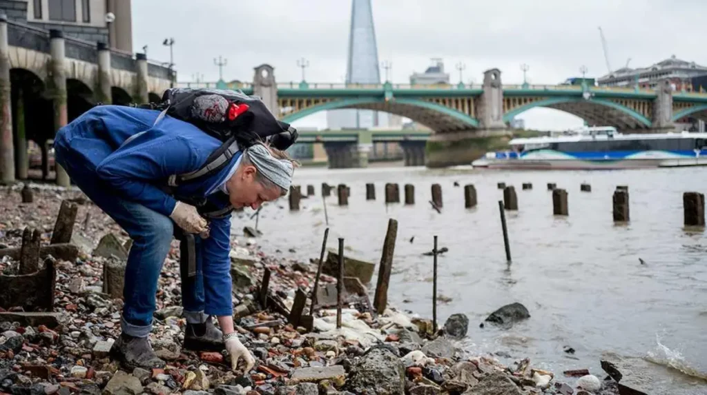
The Thames foreshore itself functions as an archaeological archive. Thousands of artefacts—including Roman coins, medieval pottery, Tudor pipes, and industrial tools—continue to emerge during licensed archaeological investigations.
To experience this historic landscape in person today, consult our comprehensive [London’s Best Photography Locations for Capturing Iconic Landmarks and Beautiful City Skylines] for itineraries and visiting parameters.
How does archaeology reveal the hidden history of the River Thames?
Archaeological research demonstrates that the Thames preserves exceptionally well-preserved organic materials, artefacts, and waterfront structures because tidal mud protects wood, leather, textiles, and other fragile historical evidence rarely surviving elsewhere.
The Thames foreshore represents one of Britain’s richest archaeological environments. Waterlogged sediments create low-oxygen conditions that slow decomposition.
Archaeologists recover thousands of artefacts annually through controlled excavations and systematic recording programmes.
Significant discoveries include Roman writing tablets, Saxon weapons, medieval pilgrim badges, Tudor footwear, clay tobacco pipes, industrial machinery, and ceremonial objects.
Dendrochronology, the scientific dating of timber using tree-ring analysis, enables researchers to determine precise construction dates for ancient waterfront structures.
Geoarchaeological studies examine sediment layers to reconstruct historical shorelines, flooding events, and human modification of the river environment.
Citizen archaeology initiatives also contribute valuable research. Licensed mudlarks record discoveries through established heritage programmes, helping preserve archaeological information before tidal erosion removes it permanently.
Research conducted by museums and heritage organisations continues to expand understanding of London’s economic, environmental, and social history through evidence recovered from the river.
Why does the River Thames remain historically significant today?
The River Thames continues to define London’s identity through protected heritage, environmental restoration, archaeological research, cultural traditions, tourism, and ongoing conservation that connects modern communities with two thousand years of continuous urban history.
The Thames remains central to London’s planning, conservation, and cultural identity. Historic riverfront districts combine preserved architecture with modern development while maintaining visual connections to significant landmarks.
National heritage protections safeguard historic bridges, embankments, docks, churches, and riverside buildings that illustrate successive periods of London’s growth.
Museums, universities, archaeological institutions, and conservation organisations continue documenting new discoveries from the river and its surrounding landscapes.
Educational programmes use the Thames to teach Roman Britain, medieval commerce, industrialisation, environmental science, engineering, and urban planning.
The river also supports one of Europe’s largest concentrations of protected historic environments. Conservation policies balance navigation, tourism, biodiversity, flood management, and heritage preservation.
Climate adaptation strategies increasingly incorporate historical knowledge of flooding patterns, tidal behaviour, and previous engineering interventions, demonstrating how historical evidence informs modern infrastructure planning.
The River Thames therefore represents far more than a geographical feature. It serves as a continuous historical record linking Roman Londinium, medieval commerce, imperial expansion, industrial innovation, environmental recovery, and twenty-first-century conservation. Few urban rivers have influenced the development of a global capital as profoundly or preserved such an extensive archaeological and cultural legacy. Through its landscapes, monuments, and surviving historical evidence, the Thames continues to explain how London evolved into one of the world’s most influential cities.
What is the best riverside walk along the Thames for first-time visitors?
The Westminster to Tower Bridge route is widely considered the best introduction to London. It connects iconic landmarks such as the Palace of Westminster, the South Bank, Shakespeare’s Globe, Tate Modern, the Tower of London, and Tower Bridge in one continuous riverside walk.