London’s River Thames has shaped the city’s identity for more than 2,000 years. The river served as the foundation of Roman Londinium, supported medieval commerce, powered the growth of the British Empire, and continues to define the capital’s cultural landscape. Historic riverside locations preserve centuries of architecture, engineering, maritime heritage, and public spaces, allowing visitors to experience London’s history while overlooking one of Europe’s most important waterways.
- Why is the River Thames central to London’s historic identity?
- Which historic riverside locations offer the best Thames views?
- How did London’s riverside architecture evolve over two millennia?
- What makes Westminster one of the finest historic Thames viewpoints?
- Why does Greenwich preserve London’s greatest maritime riverside landscape?
- How did Tower Bridge and the Pool of London become global symbols?
- Why are Richmond and Chelsea important historic riverside districts?
- What role did the Thames play in London’s commercial and industrial history?
- How are London’s historic riverside locations protected today?
- What can visitors learn by exploring London’s historic Thames viewpoints?
Today, many sections of the Thames combine preserved historic landmarks with accessible promenades, gardens, bridges, and viewpoints. These locations provide opportunities to understand how London’s riverfront evolved from defensive settlements into global commercial centres and modern public spaces.
To experience these historic landmarks in person today, consult our comprehensive [History of Family Entertainment in London From Victorian Era to Modern Attractions] for itineraries and visiting parameters.
Why is the River Thames central to London’s historic identity?
The River Thames formed the geographical, economic, military, and cultural foundation of London. Since Roman times, the river has supported trade, transportation, defence, governance, and urban expansion, making its historic riverside locations among Britain’s most significant surviving heritage landscapes and archaeological environments.
The River Thames stretches approximately 346 kilometres (215 miles), making it England’s second-longest river. Within Greater London, the river has determined settlement patterns for almost two millennia.
Roman engineers established Londinium around AD 47 because the Thames offered a navigable crossing and access to the North Sea. Archaeological excavations reveal Roman quays, warehouses, roads, and waterfront engineering beneath modern London.
Throughout the medieval period, riverside districts became centres of shipping, taxation, customs administration, and international trade. By the sixteenth century, thousands of vessels entered London’s Pool annually, carrying goods from Europe, Africa, Asia, and the Americas.
During the Industrial Revolution, examples including steamships, dock construction, and railway connections transformed the Thames into one of the world’s busiest commercial waterways.
Modern conservation policies protect extensive sections of London’s riverside through listed-building status, conservation areas, scheduled monuments, and UNESCO World Heritage designation.
Which historic riverside locations offer the best Thames views?
Several historic riverside locations preserve original architectural settings while providing uninterrupted Thames views. Examples include Westminster, South Bank, Greenwich, Tower Bridge, Richmond, Chelsea, and Wapping, each representing different periods of London’s political, commercial, maritime, and social development.
Westminster
Westminster represents Britain’s political heart.
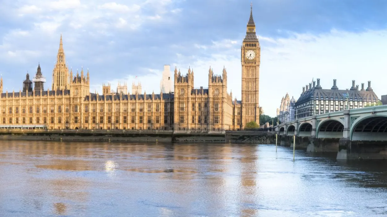
The riverside includes the Palace of Westminster, Westminster Bridge, Victoria Tower Gardens, and historic embankments constructed during the nineteenth century by engineer Sir Joseph Bazalgette.
These viewpoints combine Gothic Revival architecture with sweeping river panoramas.
South Bank
The South Bank evolved from medieval entertainment districts into a modern cultural quarter.
Historic remnants survive alongside twentieth-century cultural institutions, demonstrating continuous riverside adaptation.
Pedestrian walkways offer uninterrupted views towards Westminster and the City of London.
Greenwich
Greenwich preserves one of Europe’s finest historic maritime landscapes.
The riverside contains the Old Royal Naval College, Queen’s House, Greenwich Park, and the Royal Observatory.
UNESCO designated Maritime Greenwich as a World Heritage Site in 1997 because of its architectural and scientific significance.
Tower Bridge and Tower Wharf
The area surrounding Tower Bridge combines medieval fortifications with Victorian engineering.
Visitors enjoy direct views of the Thames while observing London’s evolution from Norman fortress to modern financial centre.
Richmond
Richmond offers one of London’s most natural historic river settings.
The riverside has changed relatively little since the eighteenth century, preserving Georgian architecture, public gardens, and traditional riverside activity.
Chelsea
Chelsea Embankment reflects Victorian urban planning combined with earlier riverside history.
Historic churches, examples including Chelsea Old Church, and riverside mansions illustrate London’s residential expansion during the seventeenth and eighteenth centuries.
Wapping
Wapping preserves narrow streets, converted warehouses, historic docks, and former maritime buildings.
The district illustrates London’s commercial river history more clearly than many central locations.

How did London’s riverside architecture evolve over two millennia?
London’s riverside architecture reflects continuous adaptation from Roman engineering to Victorian infrastructure. Defensive walls, medieval wharves, Tudor palaces, Georgian embankments, Victorian bridges, and modern conservation projects demonstrate successive phases of urban development alongside the River Thames.
Roman builders constructed timber quays supported by oak piles driven into the riverbed.
Medieval merchants replaced many Roman structures with stone warehouses, parish churches, and commercial docks.
During the Tudor era, aristocratic residences lined parts of the river because water transport remained London’s fastest travel method.
The seventeenth century introduced improved waterfront houses, merchant buildings, and expanding dock facilities.
The nineteenth century transformed the river dramatically.
Sir Joseph Bazalgette designed the Victoria Embankment between 1864 and 1870, incorporating new sewer infrastructure beneath landscaped public spaces.
Victorian engineers also completed iconic bridges including Tower Bridge in 1894.
Twentieth-century regeneration prioritised heritage conservation while improving pedestrian access.
Modern developments respect protected sightlines established under London’s planning framework.
What makes Westminster one of the finest historic Thames viewpoints?
Westminster combines nationally significant political institutions, historic bridges, royal ceremonial spaces, and Victorian engineering beside the River Thames. Its concentration of protected landmarks creates one of London’s most historically important riverside environments with exceptional panoramic viewing opportunities.
The Palace of Westminster occupies the site of the medieval royal palace destroyed by fire in 1834.
Architect Charles Barry and Augustus Pugin designed the present Gothic Revival building completed during the nineteenth century.
Westminster Bridge, first opened in 1750 and rebuilt in 1862, remains one of London’s most recognisable crossings.
Nearby Victoria Tower Gardens preserve open river views alongside monuments commemorating national history.
Across the river, visitors observe the complete Westminster skyline, including the Elizabeth Tower and Westminster Abbey.
This riverside setting demonstrates the close relationship between government, ceremonial tradition, and river transport throughout British history.
Why does Greenwich preserve London’s greatest maritime riverside landscape?
Greenwich preserves Britain’s most complete historic maritime landscape through royal architecture, naval institutions, scientific heritage, and protected riverside spaces. The district demonstrates how naval power, exploration, astronomy, and commerce shaped Britain’s global influence across several centuries.
Greenwich developed as a royal residence during the fifteenth century.
Henry VIII was born at the Palace of Placentia located on this site.
Following the palace’s decline, Sir Christopher Wren designed the Royal Hospital for Seamen between 1696 and 1712.
Today, this complex forms the Old Royal Naval College.
Nearby stands the Queen’s House, designed by Inigo Jones beginning in 1616.
The Royal Observatory established the Prime Meridian in 1884, creating the international reference for longitude and global timekeeping.
Greenwich Park offers elevated views across the Thames towards Canary Wharf, illustrating London’s transition from historic port to modern financial centre.
How did Tower Bridge and the Pool of London become global symbols?
Tower Bridge and the Pool of London represent centuries of international trade, engineering innovation, and military defence. Their preserved infrastructure illustrates London’s emergence as the world’s largest port during the nineteenth century and Britain’s principal commercial gateway.
The Pool of London once handled thousands of commercial ships every year.
Imports included tea, sugar, spices, timber, silk, tobacco, and manufactured goods.
Tower Bridge opened officially in 1894.
Its combined bascule and suspension design allowed large ships to continue navigating upstream.
The nearby Tower of London, founded by William the Conqueror around 1078, protected this strategic river crossing.
Modern riverside pathways enable visitors to appreciate how military security, customs administration, and international commerce operated within a concentrated historic landscape.
Why are Richmond and Chelsea important historic riverside districts?
Richmond and Chelsea preserve distinctive residential landscapes reflecting aristocratic, artistic, and civic development. Their surviving riverside architecture demonstrates how London’s western Thames evolved into prestigious communities while retaining public access to historically significant waterfront environments and green spaces.
Richmond became popular with royalty after Henry VII established Richmond Palace during the late fifteenth century.
Although little of the palace survives, the surrounding landscape retains its historic character.
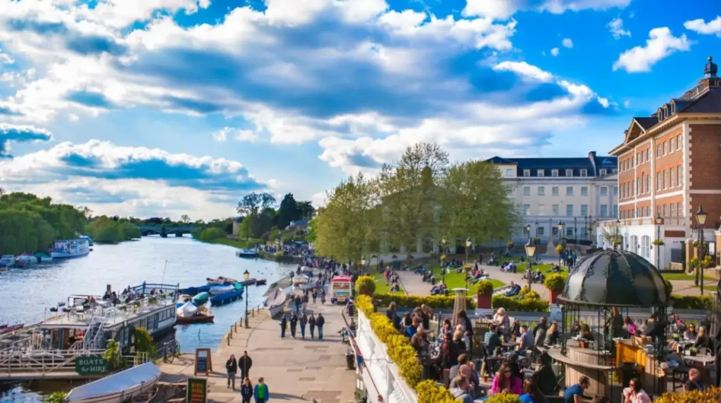
Richmond Riverside contains Georgian terraces, historic inns, and public gardens overlooking the Thames.
Chelsea developed from a rural village into an affluent district during the seventeenth century.
Chelsea Embankment improved flood protection while creating attractive public walkways.
Historic churches, examples including Chelsea Old Church, survived wartime bombing and subsequent restoration.
These districts demonstrate the relationship between riverside living, landscape design, and urban expansion.
What role did the Thames play in London’s commercial and industrial history?
The River Thames enabled London’s transformation into one of the world’s largest trading cities. Port infrastructure, warehouses, shipbuilding facilities, customs systems, and dock engineering generated economic growth that influenced Britain’s industrial expansion and international commercial networks for centuries.
Roman merchants established London’s earliest commercial waterfront.
By the medieval period, river traffic connected London with regional markets throughout England.
The establishment of enclosed docks during the nineteenth century revolutionised cargo handling.
Examples include West India Docks, East India Docks, and St Katharine Docks.
By the early twentieth century, the Port of London handled tens of millions of tonnes of cargo annually.
Containerisation later shifted shipping downstream, allowing historic docklands to undergo regeneration.
Former warehouses now accommodate museums, residential developments, offices, and cultural institutions while preserving industrial architecture.
How are London’s historic riverside locations protected today?
Historic riverside locations receive legal protection through conservation policies, listed-building legislation, archaeological monitoring, and international heritage recognition. These measures preserve architectural integrity while allowing public access, education, tourism, and sustainable urban regeneration along the River Thames.
Historic England maintains extensive records of listed riverside structures.
Many waterfront buildings receive Grade I, Grade II*, or Grade II listing.
Conservation Areas regulate development affecting historic character.
Archaeological excavations accompany major construction because buried Roman and medieval remains frequently survive beneath modern streets.
The UNESCO World Heritage Sites of Maritime Greenwich and the Palace of Westminster recognise London’s international historical significance.
The Thames Path National Trail improves public accessibility while encouraging appreciation of riverside heritage.
Environmental agencies also monitor tidal conditions, flood defences, and ecological restoration to ensure long-term sustainability.
What can visitors learn by exploring London’s historic Thames viewpoints?
Historic Thames viewpoints provide direct evidence of London’s political, architectural, commercial, maritime, and cultural evolution. Observing preserved riverside environments reveals how geography influenced urban development, governance, engineering, international trade, conservation policy, and public life across two thousand years.
Each riverside district represents a distinct historical period.
Westminster illustrates constitutional government.
Greenwich demonstrates maritime science and naval history.
Tower Bridge represents Victorian engineering.
Richmond reflects royal landscape planning.
Chelsea showcases residential development.
Wapping preserves commercial dock history.
Walking these riverside locations reveals continuous adaptation rather than isolated historical events.
Modern public spaces occupy former industrial sites while retaining visible evidence of earlier infrastructure.
The Thames therefore functions both as a natural river and as an open-air historical archive documenting London’s development from Roman frontier settlement to global capital.
Preserved embankments, bridges, churches, warehouses, royal buildings, and public gardens collectively illustrate more than twenty centuries of continuous urban history. This combination of accessibility, authenticity, and architectural diversity makes London’s historic riverside among the most significant cultural landscapes in Europe.
For historians, educators, researchers, and cultural tourists alike, the Thames remains the most comprehensive place to understand London’s evolution. Every bend in the river connects visible landmarks with documented historical events, ensuring that the capital’s riverside atmosphere continues to educate future generations while preserving one of Britain’s richest concentrations of historic heritage.
What are the best places to watch the River Thames in London?
The best historic locations include Westminster, the South Bank, Greenwich, Tower Bridge, Richmond Riverside, Chelsea Embankment, and Wapping. Each offers distinctive river views alongside important historic landmarks.