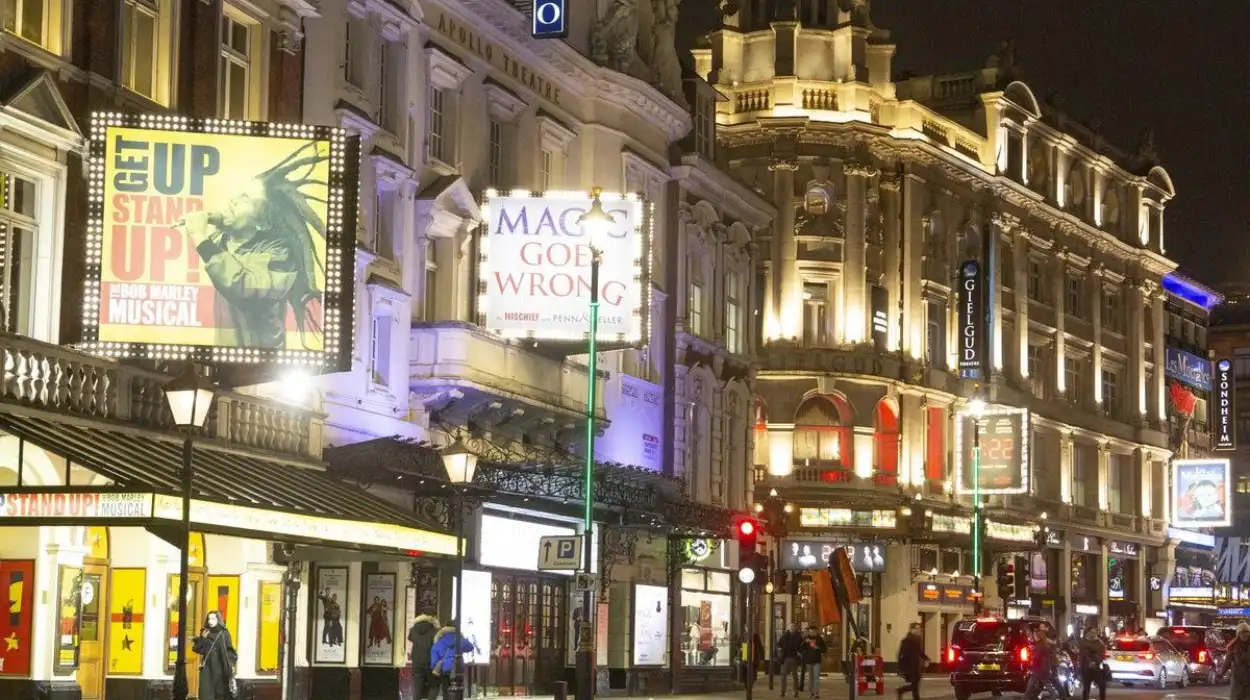
Soho is one of London’s most recognisable entertainment districts, but its present identity developed over several centuries. The area began as open fields north of Westminster before becoming a planned residential district in the late seventeenth century. Its later transformation involved migration, commerce, theatres, restaurants, music, nightlife, media, and changing urban planning.
- What was Soho before it became an urban district?
- How did seventeenth-century development establish modern Soho?
- Why did Soho lose its fashionable residential status during the eighteenth century?
- How did nineteenth-century urban planning change Soho?
- How did immigration help transform Soho into a cultural and food district?
- When did theatres and nightlife make Soho an entertainment district?
- How did twentieth-century Soho develop its reputation for nightlife and alternative culture?
- Why does historic Soho still retain its entertainment identity today?
- How can Soho’s centuries of entertainment history be understood through its surviving heritage?
- What does Soho’s historical evolution reveal about London’s wider urban history?
- Frequently Asked Question
The historical development of Soho demonstrates how London’s central districts changed when residential neighbourhoods became commercial and cultural centres. Its street pattern still preserves evidence of seventeenth- and eighteenth-century development, while Victorian roads and twentieth-century entertainment venues reveal later phases of urban change.
What was Soho before it became an urban district?
Before urban development, Soho was predominantly open countryside known as Soho Fields and St Giles Field. The land included medieval estates, later became associated with royal hunting, and remained largely undeveloped until London’s rapid post-Restoration expansion began during the seventeenth century.
The earliest documented landscape was rural. Historic maps identify the area as open land before its transformation into streets and houses. A 1585 plan of St Giles Field records the district as undeveloped land. The medieval landscape included holdings connected with institutions such as the Abbey of Abingdon and the Hospital of Burton St Lazar.
During the Tudor period, the land entered royal ownership during the Reformation. Henry VIII incorporated it into a hunting landscape associated with Whitehall Palace. The hunting use declined, leaving a largely open area north of Westminster.
By the middle of the seventeenth century, buildings remained limited. A track corresponding broadly with the later route of Wardour Street crossed the area. This rural setting changed after the Restoration of Charles II in 1660.
London was expanding beyond its older built-up core. The Great Fire of London in 1666 accelerated demand for housing outside the devastated City. An estimated 100,000 families lost their homes in the disaster, creating intense pressure for new residential development.
Soho became one of the areas available for expansion. Development began during the 1660s and accelerated during the 1670s. Golden Square, Gerrard Street, Old Compton Street and other streets emerged during this period. Soho Square was laid out in the 1680s.
The significance of this transition is fundamental to Soho’s later history. The district did not begin as an entertainment quarter. It began as a residential development created within London’s expanding West End.
How did seventeenth-century development establish modern Soho?
Seventeenth-century development established Soho as a planned residential neighbourhood through streets, squares and terraced houses. Soho Square, Golden Square, Gerrard Street and Old Compton Street created the physical framework that later supported shops, restaurants, theatres, clubs and entertainment businesses.
The first major phase of urbanisation followed the Restoration. Large landholdings were divided into building plots, and developers constructed houses for London’s growing professional and affluent population.
Soho Square became a central feature of the new neighbourhood. Westminster City Council dates the square to the 1680s and records its location within the former Soho Fields. The square remains an important surviving open space inside the densely developed West End.
The new houses varied in scale. Larger residences appeared around Soho Square, Golden Square, Great Marlborough Street and Great Pulteney Street. Smaller houses occupied narrower plots elsewhere.
This distinction shaped Soho’s later architectural character. The district retained many small building plots instead of developing exclusively into large aristocratic estates. The resulting mixture of narrow frontages and compact streets remains visible today.
Soho initially competed with neighbouring Mayfair and St James’s as a fashionable residential address. Its central position placed residents close to Westminster, St James’s, Oxford Street and other important parts of the West End.
The neighbourhood’s early prosperity did not last. During the eighteenth century, the quality and planning of some development contributed to declining residential prestige. Wealthier residents increasingly preferred other parts of London’s West End.
This demographic shift was crucial. Houses that lost their elite residential role became available to people with different economic backgrounds. Artists, tradespeople, immigrants and commercial workers increasingly occupied the district.
The transformation created the social diversity that later supported Soho’s entertainment economy. Residential decline did not mean abandonment. It produced a different urban population and a broader mixture of uses.
Why did Soho lose its fashionable residential status during the eighteenth century?
Soho lost much of its fashionable residential status because other West End districts attracted wealthier residents while Soho experienced overcrowding, mixed development and commercial growth. Its large houses were subdivided, lower-income residents moved in, and workshops, shops and other businesses expanded.
By the eighteenth century, Soho’s social geography had changed significantly. The neighbourhood remained densely occupied, but its housing increasingly served residents with more modest incomes.
The subdivision of large houses increased population density. Buildings originally designed for individual households accommodated several families or lodgers. Commercial premises occupied ground floors and courtyards.
The district also attracted immigrant communities. Huguenots, Greeks, French residents and other migrant groups contributed to Soho’s commercial and cultural development. Later migration included Italians, Germans, Polish people and Russian Jews.
Food became an important part of this multicultural economy. Continental restaurants and specialist food businesses developed alongside other trades. These establishments later became central to Soho’s reputation as an international dining district.
Artists also became associated with the area. Westminster City Council’s heritage assessment records that Soho became increasingly popular with people of lesser means, including artists, as its residential status declined.
The district’s economic diversification was equally important. Houses were converted into workshops, shops, restaurants, lodging houses and other commercial premises.
Berwick Street Market dates from the eighteenth century, with its origins placed in the 1770s. Formal recognition followed in 1892. The market remains an important surviving example of Soho’s long commercial tradition.
The eighteenth century therefore created a foundation for the entertainment district that appeared later. Soho developed a dense population, varied businesses, migrant communities and a central location beside London’s expanding West End.
How did nineteenth-century urban planning change Soho?
Nineteenth-century urban planning changed Soho by introducing major roads through its older street pattern. Shaftesbury Avenue and Charing Cross Road improved movement, created development sites, supported theatres and strengthened Soho’s connection with London’s expanding West End entertainment economy.
Soho entered the nineteenth century as a densely populated mixed neighbourhood. Commercial activity increased as property values and residential prestige declined.
Wardour Street became associated with specialist commerce, including antique furniture businesses, workshops and showrooms. Other parts of Soho contained manufacturing, brewing and small industrial enterprises.
Population density also created serious social problems. By the 1850s, Soho ranked among London’s most densely populated and deprived districts. Overcrowding and poor sanitation produced pressure for reform.
Between 1850 and 1875, six hospitals and charitable institutions were established in Soho. Model dwellings were also constructed following clearance of some of the worst housing conditions. Surviving examples include buildings around Brewer Street and Ingestre Place.
The most important physical intervention arrived later in the century. Shaftesbury Avenue was constructed in 1884–1886. Charing Cross Road followed in 1887.
These roads cut through the older urban fabric. They connected major parts of the West End and improved access to Soho. They also created larger development plots that were unsuitable for the narrow seventeenth-century street pattern.
The new roads directly influenced entertainment. Theatres appeared along Shaftesbury Avenue, creating a concentrated theatrical environment. Victorian theatre architecture introduced a larger scale than the small Georgian houses inside Soho.
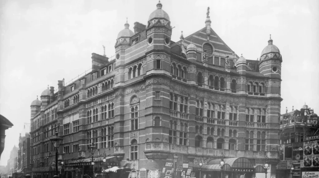
Westminster’s conservation documentation identifies the contrast clearly: the inner conservation area retains small-scale seventeenth- and eighteenth-century buildings, while Victorian roads and theatres form a larger-scale ring and cross-section around them.
This combination remains one of Soho’s defining characteristics. The entertainment district exists within an older residential street framework rather than replacing it completely.
To experience this historic district in person today, consult our comprehensive [Best Attractions in Notting Hill Beyond Colourful Houses and Portobello Road Market] for itineraries and visiting parameters.
How did immigration help transform Soho into a cultural and food district?
Immigration transformed Soho by introducing new languages, businesses, cuisines and social networks. Huguenot, Greek, French, Italian, German, Polish and Russian Jewish communities contributed to the district’s commercial diversity, helping restaurants, specialist shops and cultural venues become lasting features.
Migration was a continuous feature of Soho’s development. Different communities arrived during different periods and established businesses within the existing street network.
French Huguenots were among the earlier migrant communities associated with Soho. Their presence contributed to the district’s international character during its residential and commercial phases.
During the nineteenth century, Italian and German communities became increasingly prominent. Westminster’s heritage research records significant Italian settlement during the 1890s, including migrants from Piedmont and Lombardy who worked as cooks, waiters, porters and kitchen staff.
This labour supported Soho’s restaurant economy. Restaurants required cooks, kitchen workers, suppliers and specialist food retailers. The concentration of these businesses reinforced the area’s identity as a dining district.
After the First World War, changes in domestic service also affected eating habits. More London residents ate outside the home, increasing demand for restaurants.
The restaurant economy then became connected with the wider entertainment economy. Visitors could combine dining with theatre, music, clubs and nightlife within a relatively compact area.
Soho’s cultural identity therefore did not develop from one entertainment industry. It emerged from overlapping commercial systems. Food, migration, theatre, retail and nightlife occupied the same streets.
This pattern also explains why Soho retained a strong international identity. Its cultural history is the product of repeated migration and economic adaptation rather than a single founding community.
The district’s restaurants became historical institutions in their own right. Quo Vadis opened on Dean Street in 1927 after Peppino Leoni developed his career within Soho’s restaurant industry. The establishment became part of the area’s long restaurant tradition.
When did theatres and nightlife make Soho an entertainment district?
Soho’s entertainment identity strengthened during the late nineteenth and early twentieth centuries as theatres, music halls, restaurants, dance venues and nightclubs occupied its streets. Shaftesbury Avenue provided major theatre infrastructure, while older streets supported smaller and more varied entertainment businesses.
Theatre became central to Soho’s identity after the construction of Shaftesbury Avenue. New theatres appeared along the avenue and strengthened the connection between Soho and the West End theatre district.
The nineteenth-century theatre economy also benefited from technological and social changes. Gas lighting improved evening visibility, while improved transport allowed larger audiences to travel into central London.
Westminster’s current historical research identifies the nineteenth century as a period when Westminster’s evening economy expanded rapidly. Theatre districts, music halls, lighting and transport all contributed to increased nighttime activity.
Soho’s entertainment economy expanded beyond formal theatres. Public houses, restaurants, clubs, dance venues and music establishments occupied smaller streets.
During the 1920s, music venues and nightclubs became increasingly important. Gerrard Street, Coventry Street, Meard Street and Dean Street developed associations with nightlife.
Jazz became particularly important during the post-war period. Ronnie Scott’s, founded in Soho in 1959 after the club’s earlier 1959 opening in Gerrard Street, became one of the district’s most significant jazz institutions. Westminster conservation research identifies the venue as a major expression of Soho’s post-war jazz culture.
Film also contributed to the district’s entertainment economy. Wardour Street became increasingly significant to Britain’s film industry after the First World War. The street’s connection with film production, distribution and related businesses strengthened Soho’s role within London’s creative industries.
This created a layered entertainment economy. Theatre operated alongside cinema, music, restaurants, clubs, publishing and specialist commercial businesses.
How did twentieth-century Soho develop its reputation for nightlife and alternative culture?
Twentieth-century Soho developed its nightlife reputation through clubs, music venues, restaurants, erotic entertainment, artistic communities and LGBTQ+ social spaces. These activities created a distinctive cultural district positioned between formal West End theatre and London’s alternative urban nightlife.
The twentieth century intensified Soho’s entertainment identity. Nightclubs and underground bars expanded during the early decades of the century.
Historic England describes Soho as a district where artists, wealthy social groups and nightlife communities encountered each other. Jazz clubs, dining clubs, queer venues and underground bars contributed to its reputation as a cosmopolitan and bohemian district.
The Second World War marked another important phase. The Windmill Theatre became associated with erotic entertainment, while other venues developed similar programmes.
This contributed to Soho’s reputation as London’s most famous red-light district during the mid-twentieth century. The reputation reflected prostitution and commercial erotic entertainment alongside legitimate theatre, restaurants and music venues.
The Colony Room Club provides another example of Soho’s alternative cultural history. Muriel Belcher opened the private members’ club at 41 Dean Street in 1948. Artists and cultural figures used the venue as a social meeting place. Historic England identifies the club as part of Soho’s twentieth-century bohemian heritage.
LGBTQ+ history also became central to Soho. Old Compton Street and surrounding venues developed into important spaces for London’s gay community. Coffee bars, pubs, private clubs and later dedicated venues provided social environments for LGBTQ+ Londoners.
This history is significant because Soho’s entertainment culture extended beyond commercial performance. The district also provided spaces for communities that faced discrimination elsewhere.
During the 1960s, Carnaby Street became associated with London’s youth culture and the phenomenon known as Swinging London. Boutique shops and coffee bars attracted visitors and contributed to the area’s international cultural reputation. Westminster’s conservation research records Carnaby Street as a recognised centre of 1960s fashionable culture.
Soho’s twentieth-century identity was therefore multi-layered. Music, theatre, restaurants, fashion, nightlife, LGBTQ+ culture and erotic entertainment existed within the same compact urban environment.
Why does historic Soho still retain its entertainment identity today?
Historic Soho retains its entertainment identity because its seventeenth-century street pattern, Victorian theatres, surviving listed buildings, restaurants, music venues, markets and cultural businesses continue to support mixed urban activity within a compact central London neighbourhood.
Soho’s physical heritage remains unusually visible. Westminster’s conservation documentation identifies almost all seventeenth- and eighteenth-century buildings in the conservation area as listed, alongside Victorian theatres.
The conservation area contains four Grade I listed buildings, 35 Grade II* buildings and approximately 300 Grade II listed buildings according to Westminster’s heritage guidance. The House of St Barnabas and 26, 27 and 28 Dean Street are among the Grade I buildings identified in the council’s documentation.
Soho Square remains one of the area’s most recognisable historic spaces. Its gardens date from the 1680s, while the central half-timbered building was constructed in 1895. The square demonstrates how an eighteenth-century urban open space continues to function within a modern entertainment district.
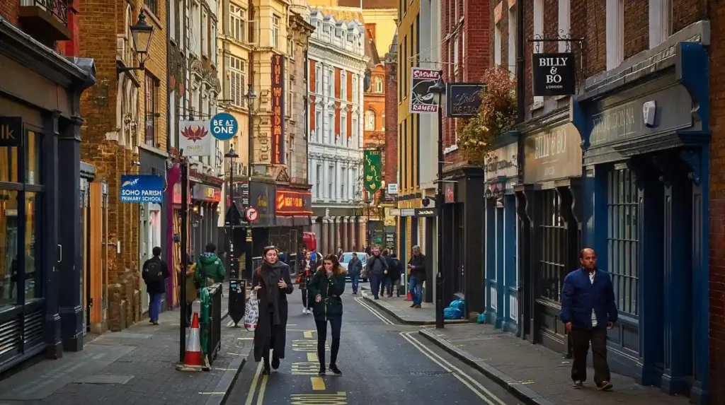
The street pattern is equally important. Narrow plots and compact streets preserve the scale of the original residential development. Later Victorian roads such as Shaftesbury Avenue and Charing Cross Road provide a contrasting urban scale.
The mixture of old and new uses supports Soho’s continuing adaptability. Restaurants occupy historic buildings. Entertainment venues operate alongside offices and residential properties. Retail businesses remain embedded in streets first developed for housing.
Planning policy now recognises culture and entertainment as important parts of Soho’s identity. Westminster City Council adopted the Soho Neighbourhood Plan on 8 October 2021. The statutory plan includes policies covering culture, heritage, commercial activity, entertainment and the night-time economy.
This modern planning framework reflects the historical evolution of Soho. The district’s entertainment role is not separate from its architectural heritage. The two developed together through centuries of adaptation.
How can Soho’s centuries of entertainment history be understood through its surviving heritage?
Soho’s surviving heritage can be understood through its streets, squares, churches, theatres, markets, restaurants and listed buildings. These physical remnants connect the modern entertainment district with residential development, migration, commerce, theatre, music and nightlife across several centuries.
The most important surviving evidence is the street network. Soho Square, Dean Street, Frith Street, Greek Street, Wardour Street, Old Compton Street and surrounding roads preserve elements of the seventeenth- and eighteenth-century layout.
Soho Square provides direct evidence of the original residential planning. St Anne’s Church, founded to serve the developing parish, represents the religious infrastructure that accompanied urban expansion.
Berwick Street Market demonstrates the long commercial history of the district. Its origins in the eighteenth century connect today’s market activity with the period when Soho’s residential identity was already changing.
The Victorian theatres along Shaftesbury Avenue demonstrate another historical layer. Their construction followed major road improvements and helped convert the area into a concentrated entertainment environment.
Twentieth-century venues provide additional evidence. Music clubs, restaurants, cinemas, nightclubs and LGBTQ+ establishments transformed the social meaning of Soho without completely removing its older buildings.
Westminster Archives preserves documentary evidence for this history. Its collections include theatre books, playbills, programmes and prints documenting London’s West End theatre development. The archives also preserve material relating to William Blake, who was born in Soho and spent much of his life in Westminster.
Historic maps provide another research source. Westminster Archives holds a Richard Horwood map covering Soho Square, Seven Dials and Bedford Square, dated 1792–1799. Such maps allow researchers to compare historical street patterns with the modern city.
The preservation of these records matters for historians, educators and genealogical researchers. Soho’s history is recorded not only in buildings but also in maps, parish records, theatre documents, commercial evidence and municipal archives.
Its heritage therefore operates at several levels. The architecture records physical change. Archives record people and institutions. Businesses record economic transformation. Cultural venues record changing patterns of leisure and social life.
Soho’s historical importance comes from this combination. It is not simply an entertainment district with old buildings. It is a surviving urban environment where successive economic, demographic, architectural and cultural changes remain visible.
What does Soho’s historical evolution reveal about London’s wider urban history?
Soho’s evolution shows how central London districts change when residential development, migration, commerce, transport, entertainment and planning interact. Its history demonstrates that London’s cultural districts emerge through cumulative urban change rather than through a single planned transformation.
Soho began as open land and became a residential neighbourhood after the Restoration. Its eighteenth-century decline as an elite address encouraged commercial and social diversification.
The nineteenth century introduced overcrowding, industrial activity, migration and public-health challenges. Reform institutions, model housing and major road projects changed the district’s physical and social structure.
Victorian infrastructure then strengthened entertainment. Shaftesbury Avenue and Charing Cross Road improved access and created sites for theatres and commercial buildings.
The twentieth century expanded the entertainment economy through restaurants, film businesses, music venues, nightclubs, erotic entertainment and LGBTQ+ social spaces. Carnaby Street added fashion and youth culture to the district’s cultural profile.
The twenty-first century has brought a stronger emphasis on heritage protection, planning and management of the night-time economy. The Soho Neighbourhood Plan formally recognises culture, heritage, commercial activity, entertainment and nightlife as important planning considerations.
The historical pattern is clear. Soho’s entertainment identity developed because the area repeatedly adapted to changing economic and social conditions.
Its original houses created a dense street framework. Its migrant communities created commercial and culinary diversity. Victorian infrastructure connected it with the wider West End. Theatres established entertainment infrastructure. Twentieth-century clubs and music venues expanded nightlife. Conservation policies now protect much of the historic environment within which these activities continue.
For historians, Soho provides a concentrated example of London’s urban transformation from rural land to residential development, from residential neighbourhood to mixed commercial district, and from commercial district to internationally recognised cultural and entertainment centre.
Its continuing significance rests on the survival of both physical and cultural evidence. Soho Square, historic streets, listed buildings, theatres, markets, restaurants, archives and music venues preserve different stages of the district’s development.
The result is a neighbourhood where several centuries of London’s history remain geographically connected. The entertainment district visible today is therefore the latest phase of a much longer process that began with the development of Soho Fields in the seventeenth century and continued through every subsequent generation.
Frequently Asked Question
How did Soho become London’s entertainment district?
Soho evolved from open fields into a residential neighbourhood during the late 17th century. As wealthier residents moved elsewhere, the area developed diverse communities, restaurants, theatres, music venues, clubs and nightlife businesses.