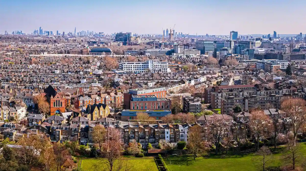
London is not a single historical landscape. It is a collection of neighbourhoods formed by settlement, trade, migration, transport, industry, housing, religion, politics, and community organisation. Places such as Greenwich, Spitalfields, Brixton, Notting Hill, Hampstead, Hackney, and the Docklands developed distinct identities because different economic and social forces shaped their streets.
- How did London neighbourhoods develop from medieval settlements into an urban metropolis?
- How did the Industrial Revolution transform London’s neighbourhoods?
- How did transport reshape London’s neighbourhood identities?
- How did migration shape London’s neighbourhood culture and community life?
- How did markets, churches, schools, and public spaces build community?
- How did twentieth-century housing and planning change London communities?
- How did Docklands and East London regeneration reshape historic neighbourhoods?
- How are historic London neighbourhoods preserved today?
- How can historical neighbourhood research explain London’s population growth today?
- Frequently Asked Question
The word “neighbourhood” also has a flexible historical meaning. A neighbourhood can describe a village absorbed by urban growth, a parish with long-established boundaries, a market district, an industrial quarter, a housing estate, or a modern locality recognised mainly through community identity. Administrative boundaries changed repeatedly, so present-day boroughs do not always correspond with older communities.
The modern understanding of London emerged through centuries of expansion beyond the medieval City of London. The first official census of England and Wales took place in 1801, while the 1841 census is regarded by the Office for National Statistics as the first modern census because it operated alongside the new civil registration system.
London’s physical expansion accelerated during the nineteenth century. Railways, roads, bridges, docks, factories, markets and new housing connected previously separate settlements to the metropolitan economy. Academic research examining London’s street network from 1786 to 2010 shows how the city’s urban structure evolved over more than two centuries as its built environment expanded and reorganised.
Neighbourhood history therefore provides a practical way to understand London. It connects national events with ordinary streets and explains why different parts of the capital developed different social and architectural characters.
How did London neighbourhoods develop from medieval settlements into an urban metropolis?
London neighbourhoods developed from medieval parishes, villages, manors, markets, river settlements, and trading districts that gradually became connected by roads, bridges, commerce, and later railways as London expanded beyond its historic City boundaries.
The medieval City of London formed the commercial and political core. Outside the walls, settlements developed along roads leading toward important destinations. Westminster became a centre of royal government and ecclesiastical power. Southwark developed around the southern approach to London Bridge. Clerkenwell, Shoreditch, Whitechapel, Bermondsey, Chelsea and other districts developed distinctive functions as the urban area expanded.
Parishes were particularly important. A parish was an ecclesiastical and administrative unit responsible for local institutions such as churches and poor relief. Parish boundaries influenced taxation, welfare, property records and community organisation. These records remain valuable to genealogists because they document births, marriages, burials, occupations and household relationships.
Markets also created neighbourhood identities. A market concentrated commercial activity and encouraged associated trades, workshops, housing and transport. The resulting streets often survived after the original economic function changed.
River access created another major pattern. The Thames supported ports, warehouses, shipyards and manufacturing. Neighbourhoods along the river therefore developed different economic relationships with central London from districts located on the northern or western edges of the metropolis.
By the eighteenth century, London had expanded substantially beyond the medieval City. Westminster, Southwark and surrounding settlements were increasingly connected through continuous urban development. The process was not uniform. Wealthier residential districts developed alongside industrial areas and densely occupied working-class neighbourhoods.
The distinction between neighbourhood and administrative authority remained important. A historic community could survive even when its official governing structure changed. The Office for National Statistics notes that London’s administrative geography changed repeatedly, making long-term comparison difficult when boundaries do not remain consistent.
How did the Industrial Revolution transform London’s neighbourhoods?
Industrialisation transformed London neighbourhoods through factories, docks, warehouses, railways, dense housing, commercial streets, and new employment, producing major population growth while creating sharp differences between industrial districts, suburban areas, and wealthier residential neighbourhoods.
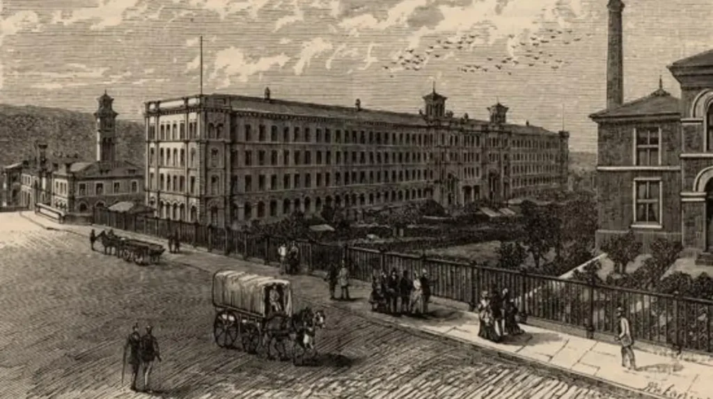
The nineteenth century produced one of the greatest transformations in London’s history. Industrial production, international trade and transport created employment that attracted people from Britain and overseas.
The docks were especially important. East London districts such as Poplar, Limehouse, Stepney and Wapping became closely connected to maritime trade. Workers lived near docks because employment depended on proximity to warehouses, wharves and transport routes.
Factories created similar effects elsewhere. Bermondsey developed leather, food-processing and manufacturing industries. Southwark retained strong connections with brewing, food production and other trades. Clerkenwell became associated with clockmaking, metalworking and printing.
Industrial growth also created pressure on housing. Large numbers of workers required accommodation near employment. Terraced housing, courts and densely occupied streets expanded rapidly. Sanitation became a major public issue because overcrowding and inadequate drainage contributed to poor living conditions and disease.
The Metropolitan Board of Works was created in 1855 and became responsible for major metropolitan infrastructure. Its work included sewer construction, street improvements and river embankments. These projects changed the physical environment of numerous neighbourhoods.
Transport accelerated the process. Railway companies built termini and lines that reorganised London’s geography. Stations became economic centres, while railway access encouraged suburban development beyond the most densely occupied inner districts.
The social geography of London therefore became increasingly complex. Employment, housing costs, transport access and environmental conditions influenced where different groups lived.
This period also established neighbourhood characteristics that remain visible. Victorian terraces, industrial buildings, railway arches, public houses, churches, schools and markets survive across many districts and provide physical evidence of nineteenth-century community development.
How did transport reshape London’s neighbourhood identities?
Transport reshaped London neighbourhoods by reducing travel times, connecting workers with employment, encouraging suburban expansion, creating new commercial centres, and turning railway stations, Underground stations, bridges, and major roads into lasting elements of local identity.
The railway transformed London’s relationship with distance. Before extensive rail transport, daily movement depended heavily on walking, horse-drawn vehicles and river transport. Railways expanded the practical area in which residents could live while working elsewhere.
The Metropolitan Railway opened in 1863 between Paddington and Farringdon. It formed part of the development of London’s Underground network and established a model for rapid urban transport beneath and around the capital.
Railway expansion encouraged residential development in districts such as Hampstead, Highgate, Ealing and suburban parts of south and southeast London. Developers marketed new housing partly through access to transport.
The Underground later reinforced this pattern. Stations became local reference points. Shops, cafés, offices and services concentrated around transport interchanges. Some neighbourhood names became closely associated with particular stations even when the historical locality was older.
Road infrastructure also mattered. New bridges connected communities divided by the Thames. Westminster Bridge, Blackfriars Bridge, Tower Bridge and other crossings altered movement between districts.
Transport therefore affected more than commuting. It influenced property development, employment patterns, retail activity and social interaction.
Academic research into London’s street network demonstrates the scale of this transformation. Researchers analysed nine historical time slices between 1786 and 2010 to examine how London’s road network changed as the metropolitan area expanded.
The result was a city in which neighbourhoods became increasingly interconnected without losing all local distinction. Transport created metropolitan mobility while markets, institutions and community organisations continued to produce local identities.
How did migration shape London’s neighbourhood culture and community life?
Migration reshaped London neighbourhoods by introducing languages, religions, businesses, foods, associations, festivals, artistic traditions, and family networks that became permanent parts of local culture across districts such as Spitalfields, Soho, Brixton, Notting Hill, Hackney, and Southall.
Migration is fundamental to London’s neighbourhood history. Different periods brought different communities, often concentrating in particular districts because of employment, housing availability, family networks or religious institutions.
Spitalfields provides a major historical example. French Huguenots, Protestant refugees from France, settled in the area during the late seventeenth and early eighteenth centuries. Many became involved in silk weaving. Their presence influenced local employment, architecture, religious institutions and commercial life.
Later migration produced new communities. Jewish migration from Eastern Europe transformed parts of the East End during the late nineteenth and early twentieth centuries. Markets, synagogues, workshops and community organisations became part of local life.
Soho developed a different pattern. Its central location attracted artists, entertainers, immigrants, restaurants and specialist businesses. The district became associated with a concentration of international communities and cultural industries.
Post-war migration created another major transformation. Caribbean migration, including members of the Windrush generation, reshaped neighbourhoods such as Brixton and Notting Hill. The Windrush generation refers to Caribbean migrants who arrived in Britain during the post-war period, beginning with the arrival of HMT Empire Windrush in 1948.
Notting Hill provides particularly clear evidence of how community organisation influenced cultural identity. The London Museum records that the first outdoor Notting Hill Carnival took place in 1966 and developed from the area’s Caribbean community, after earlier racial tensions and community activism.
The carnival became a major expression of Caribbean culture through music, costume, food and public performance. It also demonstrates how a neighbourhood can convert difficult social history into an enduring cultural institution.
Hackney offers another important example. Hackney Museum holds more than 8,500 objects, artworks, images and oral-history recordings documenting everyday life and migration in the borough. Its collections explicitly preserve the experiences of people who migrated from different parts of the world.
Neighbourhood culture therefore developed through accumulated migration rather than a single founding event. Shops, places of worship, community centres, schools, markets and festivals preserved connections between successive generations.
How did markets, churches, schools, and public spaces build community?
Markets, churches, schools, libraries, parks, public houses, clubs, and community organisations created everyday meeting places where residents exchanged goods, learned local customs, organised services, maintained religious practices, and developed neighbourhood identities across generations.
Community institutions gave neighbourhoods practical structures for daily life. A market supplied food and employment. A church provided worship, education and social support. A school connected children from nearby households. A public park created shared recreational space.
Markets were especially influential because they combined economic and social functions. Borough Market, Spitalfields Market, Portobello Road and Brixton Market developed different commercial identities while serving local populations.
Religious buildings also acted as community anchors. Anglican churches dominated many historic districts, but London’s religious landscape later expanded through synagogues, mosques, Hindu temples, Sikh gurdwaras and other institutions.
Schools preserved another layer of local history. Their admissions records, photographs, registers and buildings help researchers reconstruct patterns of residence and migration.
Public libraries became important civic institutions during the late nineteenth and twentieth centuries. They provided access to books, newspapers, education and public information without requiring private ownership.
Parks influenced neighbourhood quality and development. London’s historic open spaces include royal parks, commons, heaths and public parks. Historic England’s research into London’s historic environment has identified the importance of numerous heaths, commons, greens, cemeteries and public parks in the capital’s landscape.
Greenwich demonstrates how royal, scientific, maritime and public institutions can combine to define a neighbourhood. The area has been connected with English royalty since the fifteenth century, while its later significance developed through maritime science, education and naval activity.
The Royal Museums Greenwich group preserves the National Maritime Museum, Royal Observatory and Queen’s House, documenting connections between the sea, navigation, science, architecture and national history.
These institutions created more than physical landmarks. They established repeated patterns of community interaction that helped neighbourhood identities survive urban change.
How did twentieth-century housing and planning change London communities?
Twentieth-century housing and planning changed London through council estates, suburban development, slum clearance, garden suburbs, rebuilding after wartime destruction, and large regeneration schemes that altered housing patterns and reshaped established communities.
The twentieth century brought extensive intervention in London’s housing environment. Local authorities built council housing to address overcrowding and improve living conditions.
Slum clearance removed many densely occupied streets. Replacement estates introduced larger homes, planned layouts, communal spaces and modern infrastructure. These schemes improved physical conditions in many areas but also disrupted established social networks when residents were relocated.
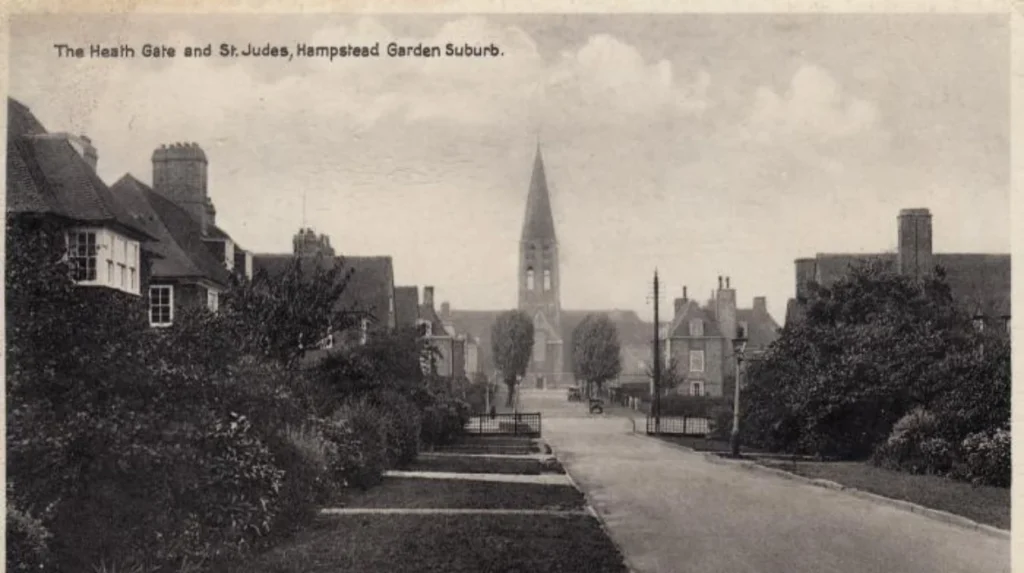
The garden suburb movement produced another model. Hampstead Garden Suburb, established from 1907, combined planned housing with open spaces, community facilities and architectural principles influenced by the garden city movement.
Post-war reconstruction created further change. Bomb damage during the Second World War affected residential and commercial districts. Reconstruction introduced modern housing, widened roads and new public buildings.
Planning also reshaped neighbourhood boundaries. The London Government Act 1963 created Greater London as a new administrative structure. It abolished the administrative counties of London and Middlesex and incorporated parts of Kent, Essex, Surrey and Hertfordshire. The new system came into operation in 1965.
This change established the modern framework of London’s 32 boroughs alongside the City of London. It also made neighbourhood history more complicated because modern administrative boundaries do not always match historic communities.
Housing policy therefore influenced both the physical and social structure of London. Buildings could be demolished, streets redesigned and populations relocated, while local identities continued through schools, businesses, family networks and community organisations.
How did Docklands and East London regeneration reshape historic neighbourhoods?
Docklands regeneration transformed former industrial and port districts through new transport infrastructure, commercial development, housing, public spaces, and employment, creating new urban centres while also changing property markets and long-established community relationships.
The decline of London’s docks created one of the capital’s largest twentieth-century urban challenges. Containerisation changed port operations because modern freight handling required deeper water, larger sites and different transport arrangements.
Many traditional docks became economically unviable. Employment declined and industrial premises closed. Communities that depended on dock work experienced substantial economic disruption.
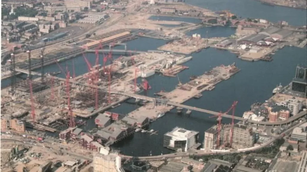
The London Docklands Development Corporation was established in 1981 to promote regeneration across major parts of Docklands. Its programme supported infrastructure, commercial development, housing and transport.
The Docklands Light Railway became a central component of regeneration. It connected former dock areas with wider London transport networks. Canary Wharf developed into a major commercial district, while the Isle of Dogs experienced extensive residential and office construction.
East London’s transformation continued through projects associated with the 2012 Olympic Games. Academic research examining the effects of Olympic regeneration found changes in venue density and improvements in several measures of deprivation in host boroughs, while also identifying housing affordability as an ongoing issue.
Regeneration therefore demonstrates that neighbourhood change has both physical and social dimensions. New buildings, transport links and employment can alter the economic position of an area while raising questions about housing costs and the continuity of existing communities.
The Docklands story is significant because it shows how industrial neighbourhoods can transition into service-based and residential districts within a single generation.
How are historic London neighbourhoods preserved today?
Historic London neighbourhoods are preserved through listed buildings, conservation areas, local heritage registers, historic-area assessments, archives, museums, community organisations, planning controls, and continued use of historic streets, buildings, markets, parks, and cultural institutions.
Preservation does not mean freezing a neighbourhood in one historical period. Historic England defines conservation areas as places designated because of their special architectural or historic interest. Local planning authorities use conservation-area policies to manage change while protecting distinctive character.
Conservation-area management involves appraisal, planning policies and community participation. Historic England guidance states that historic-area assessments help explain how and why places developed their present appearance.
London contains a substantial concentration of conservation areas. Historic England’s 2024 data records 9,907 conservation areas across England and states that 32% are located in London and the South East combined.
Historic buildings also preserve evidence of community history. A former workshop can reveal an area’s industrial economy. A synagogue can document migration. A market hall can demonstrate commercial continuity. A public house can preserve social history.
Local museums are equally important. Hackney Museum’s collections demonstrate how oral histories, photographs and everyday objects can preserve community experiences that are not always visible in major architectural landmarks.
Greenwich provides another preservation model. Maritime Greenwich is recognised as a UNESCO World Heritage Site, reflecting its combined royal, architectural, scientific and maritime importance.
Conservation also depends on continued community involvement. Historic England states that local communities often work with councils on conservation-area appraisals and management plans.
To experience this historic landscape in person today, consult our comprehensive [Unique London Experiences Tourists Often Miss While Exploring Famous and Hidden Attractions] for itineraries and visiting parameters.
How can historical neighbourhood research explain London’s population growth today?
Historical neighbourhood research explains modern London by connecting population growth with migration, transport, housing, employment, redevelopment, administrative change, and cultural institutions that accumulated over centuries and continue to influence where people live and how communities function.
London remains a changing metropolis. Census data provides a measurable record of that change, but neighbourhood history explains the processes behind the figures.
The 2021 Census recorded significant differences between London local authorities. The City of London population increased from about 7,400 in 2011 to about 8,600 in 2021, representing growth of roughly 16.4%. Tower Hamlets increased by 22.1%, while Barking and Dagenham increased by 17.7%. London overall grew by 7.7%.
These differences reflect different forms of development. Tower Hamlets contains historic docklands, dense inner-city districts and major redevelopment zones. Barking and Dagenham experienced substantial housing and population growth on London’s eastern edge.
Other areas recorded population decline. Kensington and Chelsea decreased by 9.6% between 2011 and 2021, while Camden decreased by 4.6% during the same period.
Such statistics demonstrate that London does not experience population change uniformly.
Neighbourhood research also helps genealogists. Parish registers, census returns, electoral registers, maps, directories, school records, cemetery records and property documents can connect individuals to particular streets and institutions.
For historians, neighbourhoods provide smaller geographic units through which larger processes become measurable. Industrialisation can be studied through factory districts. Migration can be traced through religious buildings and businesses. Transport expansion can be examined through station development. Housing policy can be investigated through estate construction.
For educators, neighbourhood history provides a direct connection between national history and local evidence. Students can examine buildings, maps, photographs and archives rather than relying only on national narratives.
For cultural tourists, neighbourhoods demonstrate that London’s history extends beyond major monuments. Streets, markets, terraces, stations, parks and community institutions preserve evidence of everyday life.
London’s neighbourhoods therefore function as historical records in physical form. Their identities were produced through repeated interactions between geography, infrastructure, population, economic activity and community organisation.
The long-term significance of neighbourhood history lies in this accumulated structure. A railway station built in the nineteenth century can influence a district’s development in the twenty-first century. A market established generations ago can remain a commercial and cultural institution. A community festival founded during a period of social tension can become an internationally recognised cultural event.
The history of London’s neighbourhoods is consequently a history of continuous adaptation. Communities changed as people moved, industries expanded or disappeared, transport systems developed, housing policies shifted and new institutions emerged.
Understanding those changes provides a clearer explanation of modern London. The capital’s contemporary cultural diversity, architectural variety and uneven population growth are products of historical processes that operated at neighbourhood level over centuries.
From the medieval parish to the Victorian suburb, from the industrial dock to the post-war estate, and from migrant community to regenerated urban quarter, London’s neighbourhoods preserve the mechanisms through which a city grows.
That makes neighbourhood history essential to understanding London’s past, its present communities and the heritage decisions that will shape its future.
Frequently Asked Question
What shaped the development of London neighbourhoods?
London neighbourhoods developed through settlement, trade, migration, transport, industry, housing, religion and local institutions. Medieval parishes and villages gradually became connected to the expanding metropolitan area through roads, bridges, markets and railways.