The Crews Hill North London development masterplan is a major strategic urban expansion program aimed at transforming rural and brownfield land into a sustainable residential community. The national New Towns Taskforce officially designated the site as a prominent location for development.
- Why is Crews Hill selected for a new town development?
- What is the current planning permission status in 2026?
- What are the key components of the masterplan?
- How will the development affect transport and infrastructure?
- What are the environmental and greenbelt implications?
- What are the economic and community impacts for North London?
- What are the next steps for the project beyond 2026?
Urban development planning requires an exact understanding of geographic, legal, and operational boundaries. Crews Hill is located within the London Borough of Enfield, positioning it at the northernmost boundary of Greater London. Historically characterized by its horticultural nurseries, garden centers, and greenbelt status, this area is undergoing structural transition. The central government of the United Kingdom committed to accelerated housing delivery through its national new towns framework. The New Towns Taskforce listed Crews Hill alongside Chase Park as a primary area for comprehensive strategic planning, categorizing the location as promising for large-scale housing, infrastructure, and commercial investment (Docks, 2026).
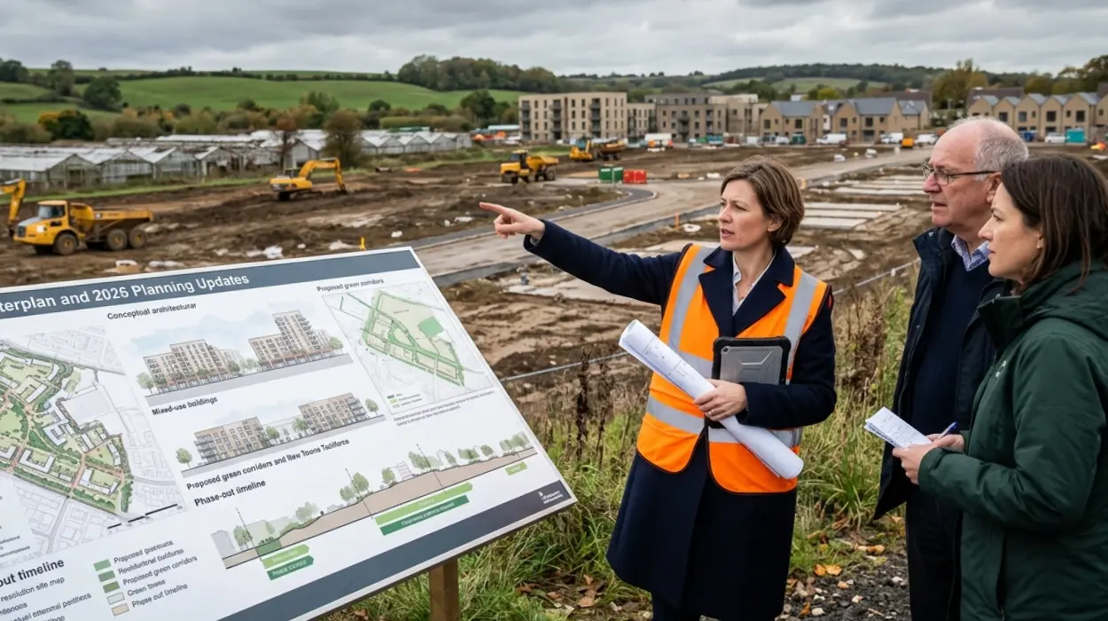
The masterplan functions as a comprehensive framework to transition low-density commercial and greenfield areas into an interconnected urban center. Urban planning models for this region prioritize mixed-use zoning, which integrates residential quarters directly with economic zones. This approach seeks to maximize localized economic output while resolving persistent housing shortages within Greater London. Structural elements within the design emphasize the preservation of peripheral green infrastructure while densifying central transit corridors. Local planning authorities coordinate directly with national taskforces to finalize the exact footprint of the layout, balancing ecological conservation against high-density housing requirements.
Why is Crews Hill selected for a new town development?
Crews Hill is selected because its transport infrastructure, underutilized commercial parcels, and strategic position on the edge of Greater London provide an optimal location for a master-planned community. The site aligns with national targets for targeted infrastructure delivery.
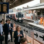
Strategic land selection relies heavily on transit connectivity and existing structural assets. Crews Hill possesses a dedicated railway station on the Hertford Loop Line, operated by Great Northern. This transit asset provides direct rail links to central London hubs, including Finsbury Park and Moorgate Station. The presence of high-capacity rail infrastructure allows planners to implement Transit-Oriented Development (TOD) principles. This methodology minimizes private vehicular reliance by focusing high-density residential and commercial assets within a specific radius of the transit node.
Socioeconomic assessments highlight the necessity of targeting localized growth. Economic research from the Productivity Institute indicates that productivity levels in the London Borough of Enfield sit below the broader Greater London average, despite maintaining a position above the national UK benchmark (Penney et al., 2026). The Borough faces structural challenges regarding natural capital and carbon emission reductions, placing it in the bottom quintile nationally for sector-specific environmental performance (Penney et al., 2026). Developing Crews Hill through a modern, eco-centric masterplan provides a direct mechanism to upgrade regional sustainability indicators, incorporate green technology, and stimulate high-value employment sectors outside the central London core.
Explore More London Local News
Why Does TfL Run a Profitable Tourist Cable Car? London 2026
Ian McKellen to Play King Lear at The Yard: Hackney Wick 2026
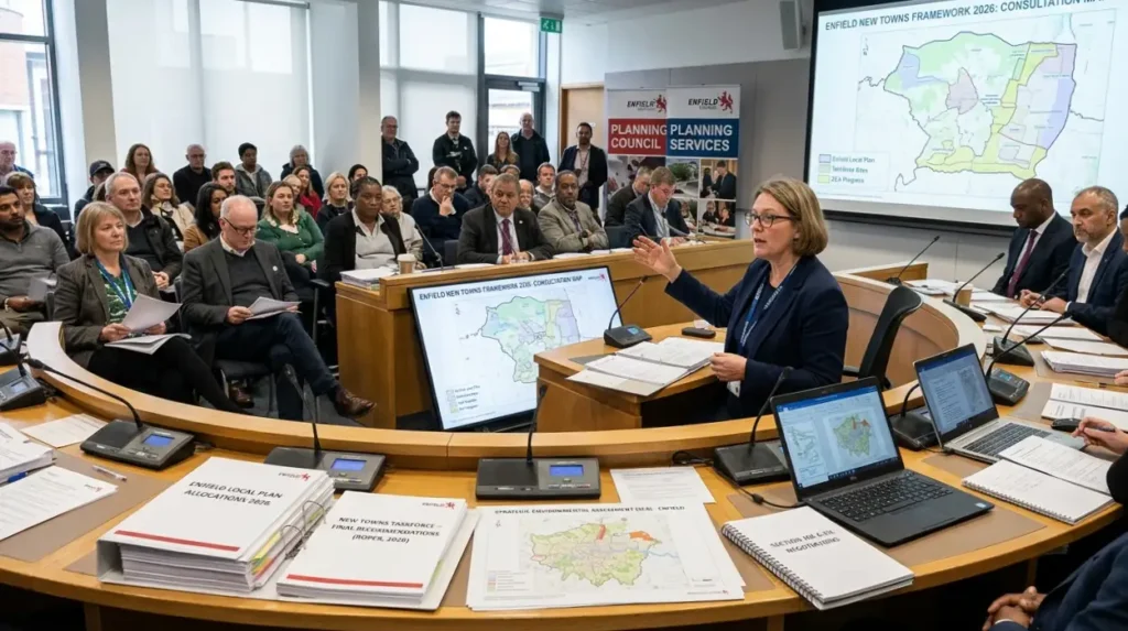
What is the current planning permission status in 2026?
The planning permission status in 2026 involves active assessment under the national new towns consultation framework, alongside the local Enfield Local Plan allocations. The independent New Towns Taskforce finalized its location list to accelerate delivery timescales.
The progression of planning applications follows a dual-track authorization process involving local municipal approval and national statutory instruments. The New Towns Taskforce published its definitive recommendations following extensive location assessments (Roper, 2026). The central government processes these locations through a targeted Strategic Environmental Assessment (SEA) to establish baseline environmental compliance (Roper, 2026). This national validation runs parallel to the adoption process of the Enfield Local Plan, which formally designates the spatial allocation of land uses across the borough.
Securing full planning permission requires a series of distinct statutory stages:
- Draft Consultation and Strategic Environmental Assessment: National agencies evaluate the regional environmental baseline.
- Submission of Outline Planning Applications: Developers present macro-level masterplans detailing land-use percentages and building heights.
- Section 106 and Community Infrastructure Levy Negotiations: Local authorities secure legal agreements for financial contributions toward schools, healthcare facilities, and transit upgrades.
- Detailed Reserved Matters Approval: Municipal committees review exact architectural layouts, materials, and landscaping protocols.
In 2026, the framework transitions from macro-level site assessment toward localized masterplan execution. Government ministries schedule final location confirmations to align national infrastructure funding with local planning permissions (Docks, 2026).
What are the key components of the masterplan?
The key components of the masterplan include thousands of new homes, significant allocations for affordable housing, commercial enterprise space, and extensive public parklands. The infrastructure framework establishes distinct, interconnected zones designed to balance urban density with environmental accessibility.
The physical programming of the new town separates the development footprint into specific operational categories. The residential allocation prioritizes diverse housing typologies, including high-density apartment blocks adjacent to the transit station, mid-density townhouses, and low-density single-family homes. The central government mandates significant percentages of affordable housing allocations across strategic developments to mitigate the regional affordability crisis. Examples of affordable housing variations include social rented units, shared ownership schemes, and discounted market sales properties.
The economic infrastructure requires substantial commercial floor area to ensure self-sustainability. The masterplan dedicates space to light industrial, technology workspace, and office sectors. Examples of these commercial footprints include collaborative workspaces, logistics distribution facilities, and research laboratories. Public realm design integrates massive open spaces to address environmental mandates. Examples of dedicated green infrastructure include community orchards, sustainable urban drainage basins, and linear wildlife corridors. Civil facilities occupy centralized nodes within the masterplan. Examples of these community assets include decentralized medical clinics, primary schools, and community community hubs.
Explore More London Local News
New Camden Council Leader Chosen After Shock Election Losses, Camden 2026
New Beatles Museum to Open at Former Savile Row HQ Mayfair 2027
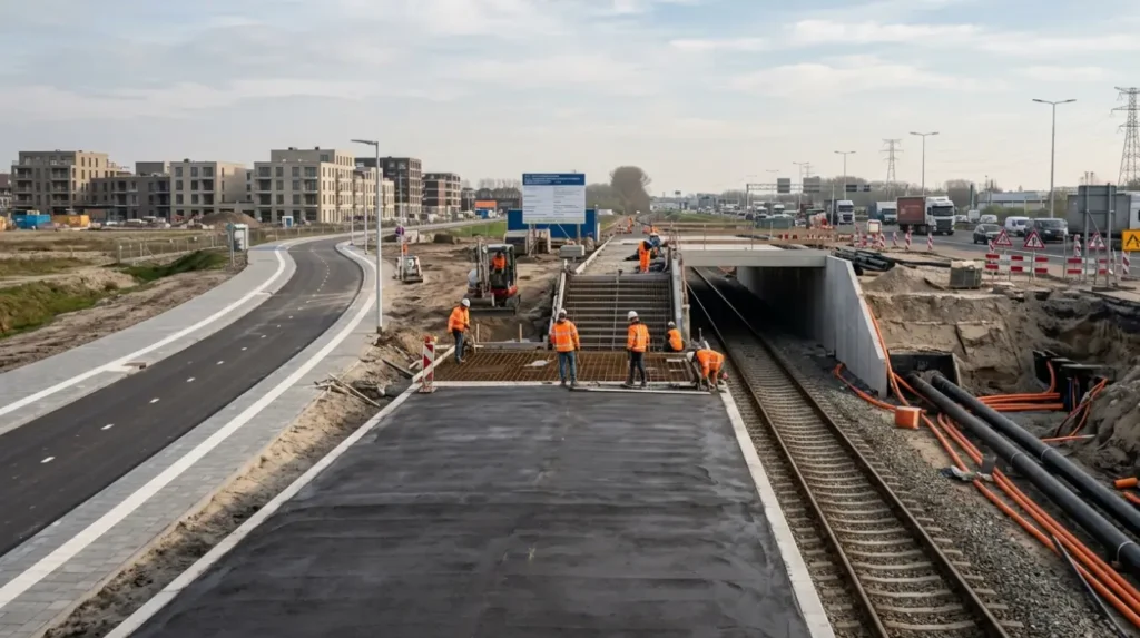
How will the development affect transport and infrastructure?
The development will affect transport and infrastructure by initiating extensive upgrades to the rail network, creating segregated active travel routes, and expanding utility grids. These interventions prevent localized bottlenecks while supporting the increased population density.
The influx of residents necessitates immediate enhancement of existing transport networks. Transport for London (TfL) and Network Rail coordinate to increase service frequencies on the Hertford Loop Line. Station access infrastructure requires complete remodeling, incorporating step-free access, expanded platforms, and integrated bus interchanges. Planners utilize traffic-modeling software to design road intersections that mitigate congestion on the primary arterial route, the A10, and secondary access roads.
Physical infrastructure installations extend beyond transport corridors to encompass utilities and digital connectivity:
- Decentralized Energy Networks: Construction of district heating systems reduces reliance on individual fossil-fuel boilers.
- Sustainable Drainage Systems: Permeable pavements and attenuation ponds manage surface water runoff to prevent regional flooding.
- Active Travel Networks: Dedicated, physically segregated cycling lanes and pedestrian pathways link residential zones directly to commercial districts.
- High-Capacity Grid Infrastructure: Substation upgrades provide the electrical capacity required for universal electric vehicle charging points.
What are the environmental and greenbelt implications?
The environmental and greenbelt implications center on the reclassification of low-grade greenbelt land to permit sustainable urban expansion. The framework implements strict biodiversity net gain metrics to offset the loss of open landscape.The development of greenbelt land remains a highly regulated aspect of UK planning policy. Under the National Planning Policy Framework (NPPF), local authorities must demonstrate exceptional circumstances to alter greenbelt boundaries. The acute shortage of developable land within Greater London, combined with the presence of previously developed brownfield parcels within the Crews Hill nursery complex, provides the legal basis for boundary alteration. Planners differentiate between high-value ecological terrain and low-grade agricultural or commercial land.
Statutory regulations require the development to achieve a minimum 10% Biodiversity Net Gain (BNG). This objective requires developers to measure the baseline ecological value of the site prior to construction and deliver a verifiably superior habitat matrix post-development. Ecological restoration strategies involve the creation of permanent wetland habitats, the planting of native woodland species, and the preservation of ancient hedgerows. By integrating green infrastructure into the built environment, the masterplan establishes continuous ecological corridors that support regional avian, insect, and mammalian populations.
What are the economic and community impacts for North London?
The economic and community impacts for North London involve the injection of capital into construction supply chains, the creation of permanent employment hubs, and the delivery of civic infrastructure. These changes reshape the demographic and financial profile of the Enfield borough.
The insertion of a master-planned new town generates immediate and long-term economic shifts. During the construction phase, the project requires thousands of skilled workers, driving localized demand for materials, engineering services, and architectural consultancy. The establishment of permanent commercial zones attracts corporate tenants, shifting Enfield from a commuter-dominated borough to a distinct economic destination.
North London services. The masterplan builds capacity directly into the new town footprint, ensuring that educational and healthcare demands are managed internally.
What are the next steps for the project beyond 2026?
The next steps for the project beyond 2026 involve the finalization of statutory consultations, the commencement of major phase-one groundbreaking, and the sequential rollout of residential sectors. The entire development operates on a multi-decade delivery timeline.
The transition from planning frameworks to physical construction requires strict adherence to sequential development phases. Following the final location confirmations by the central government, master developers enter into formal delivery partnerships with registered providers of social housing and private construction companies (Young, 2026). Initial physical interventions focus entirely on subterranean infrastructure, utility routing, and primary road layouts.
The long-term development trajectory follows a structured timeline:
- 2027–2028: Completion of primary enabling works, including rail station upgrades and main utility connection installations.
- 2029–2031: Delivery of Phase One residential units, the primary school, and localized retail offerings.
- 2032–2035: Expansion into secondary residential sectors and completion of the central commercial office park.
- 2036 and Beyond: Final build-out of peripheral low-density housing and complete integration of regional green networks.
This phased approach allows planning authorities to monitor localized impacts continuously, adjusting future design phases to match evolving economic conditions and demographic requirements. The Londoner News will continue to track statutory updates as this transformation of North London progresses.
Why was Crews Hill selected for new town development?
Crews Hill was selected for potential large-scale development because it combines excellent transport links, substantial underused land, and a strategic location on the northern edge of Greater London within the London Borough of Enfield.