The strategic alignment of urban architecture and natural topography across Greater London determines the visibility and clarity of dawn illumination across the metropolis. Evaluating the historical geographic coordinates, land use changes, and municipal preservation laws reveals specific elevated areas and structural vantage points that offer uninterrupted sightlines for solar ascents. For researchers, cultural tourists, and educators tracing London lineages or evaluating architectural transformations, these high points represent vital links to the socio-political evolution of the capital.
Why is Greenwich Park considered the primary historical sunrise location?
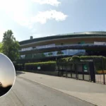
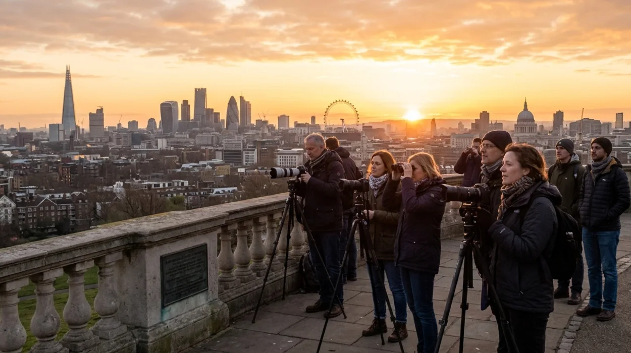
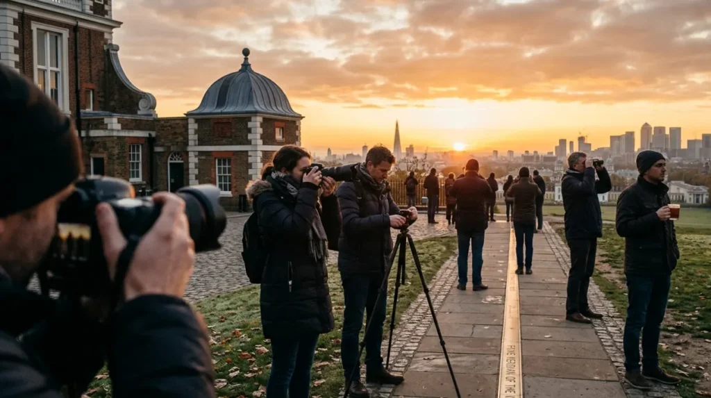
Greenwich Park serves as the foundational sunrise location due to its intersection with zero degrees longitude, established by the International Meridian Conference in October 1884, which codifies the site as the precise origin point for global time zoning and solar observations.
The Royal Observatory, situated within the park boundaries, was established by King Charles II on June 22, 1675, to correct the charts of navigation and determine longitude at sea. Designed by Sir Christopher Wren and Robert Hooke, the facility functioned as a scientific research hub where consecutive Astronomers Royal, beginning with John Flamsteed in 1675, mapped solar transits. The elevation of the Great Venturing Ridge, rising 41 metres above the River Thames, ensured that early modern astronomical observations remained free from the low-lying valley fog and urban coal smoke of central London.
The socio-political context of the late 19th century directly influenced the global formalisation of this site. In October 1884, 41 delegates from 25 nations convened in Washington, D.C., to designate a single, universal prime meridian. Because 72% of global maritime commerce already relied on British Admiralty charts calculated from Greenwich, the conference voted to formalise the cross-hairs of the Airy Transit Circle telescope, constructed by Sir George Biddell Airy in 1850, as the definitive 0° 0′ 0″ coordinate. Consequently, observing the dawn from this perimeter bridges chronological science with structural heritage.
To experience this historic landmark in person today, consult our comprehensive [guide to outdoor activities and scenic walking routes in London] for itineraries and visiting parameters.
How did the English Civil War influence the view from Parliament Hill?
The vantage point of Parliament Hill achieved historical prominence in 1642 during the English Civil War when Parliamentarian forces fortified the 98-metre summit as a strategic defensive lookout to monitor Royalist military advancements towards the City of London.
Originally known as Traitors’ Hill, the topography of this southeastern sector of Hampstead Heath provided an uninterrupted operational panoramic window over the London Basin. The legislative forces loyal to the Long Parliament deployed defensive detachments and signaling apparatus at this location to guard the northern approaches against the cavalry forces of King Charles I. The natural clay ridge, standing 98 metres (321 feet) above sea level, allowed military scouts to visually detect smoke, troop concentrations, and transit patterns across the city outskirts.
During the 18th and 19th centuries, the land shifted from an active military perimeter to a part of the sprawling Kenwood Estate, which limited public access and protected the natural contour lines from early industrial housing developments. In 1888, the Hampstead Heath Act formally incorporated the hill into public ownership under the jurisdiction of the London County Council, shielding the summit from the brick-and-mortar expansion of Victorian suburban estates. This specific protection prevented private construction from obstructing the visual plane between the northern heights and core urban structures.
The preservation of this historical dawn panorama relies heavily on modern statutory instruments. In 1965, the view from Parliament Hill toward the dome of St Paul’s Cathedral received official designation as a “Protected Vista” under local planning policies. This framework, managed through the London View Management Framework (LVMF), imposes strict statutory height restrictions on all geographic zones falling within the Landmark Viewing Corridor. Consequently, any proposed real estate development exceeding the defined threshold plane between the Hampstead Heath summit and central London faces immediate prohibition, preserving the precise sightlines utilized by 17th-century lookouts.
Explore More Things To Do
Air Cooler vs Portable Air Conditioner Choice for Homes in London
Polestar EV Strategy Shifts and Technological Evolution Impacts London
What historical rituals occurred at the summit of Primrose Hill?
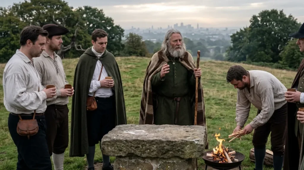
Primrose Hill served as the operational site for the resurrection of ancient Druidic ceremonies on June 21, 1792, when Welsh radical poet Iolo Morganwg founded the Gorsedd of the Bards of the Isles of Britain during the summer solstice.
The summit, rising 64 metres (210 feet) within the modern London Borough of Camden, was originally part of the extensive hunting chases appropriated by King Henry VIII in the 1530s. By the late 18th century, the isolated topography made it an ideal location for activities requiring seclusion from municipal authorities, including political assemblies and armed duels. On June 21, 1792, Iolo Morganwg (born Edward Williams) gathered a group of Welsh antiquarians at the highest point to perform rituals intended to replicate pre-Roman Celtic assemblies, arranging a circle of small stones to represent the sacred precinct.
The choice of Primrose Hill for solar and solstice gatherings combined romanticist historical interpretation with radical political subversion. Morganwg utilized the open public space to blend Celtic mythology with the egalitarian ideals of the French Revolution, positioning the high hill as a symbol of uncorrupted natural liberty. The gathering occurred at solar dawn, aligning the bards with the early morning rays to symbolise the illumination of truth over political tyranny.
The transformation of the site into an organised municipal park occurred via the Primrose Hill Act of 1842, which officially transferred ownership from Eton College to the British Crown to create a “park for the people.” Following this enactment, public works engineers drained and leveled parts of the surrounding clay slopes after 1851 to handle rising recreational visitor numbers. Like Parliament Hill, the summit is protected by the London View Management Framework, which legally preserves the specific sightlines toward the Palace of Westminster and St Paul’s Cathedral, ensuring that the morning sun still illuminates the urban topography exactly as observed by the 18th-century bards.
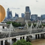
Why does Tower Bridge provide a distinct architectural frame for the dawn?
Tower Bridge provides a distinct frame for the dawn because its twin Gothic revival towers and high-level open-air walkways, constructed between 1886 and 1894, align directly with the eastward flow of the River Thames, positioning the structure to intercept the low-angle morning sun.
The bridge was engineered by Sir John Wolfe Barry and designed by architect Sir Horace Jones to address the severe congestion caused by rapid industrialisation and demographic growth in the East End of London during the late 19th century. The City of London Corporation mandated that any crossing design must allow the continuous transit of large masted vessels to the busy docks of the Upper Pool of London. The resulting layout combined a bascule mechanism with elevated structural walkways hanging 42 metres above the high-water mark, creating a rigid steel and granite framework that directly straddles the aquatic transport corridor.
The construction phase, lasting from 1886 to 1894 under Resident Engineer Edward Cruttwell, required over 11,000 tons of structural steel to build the internal framework. This metallic skeleton was subsequently clad in Cornish granite and Portland stone to protect the underlying engineering elements and appease public aesthetic demands for harmony with the nearby Tower of London. The specific geographical positioning of the central spans crosses the river on a north-south axis, meaning that the morning sun rises directly downriver to the east, casting the silhouette of the structures across the historic commercial pool.
When the bridge opened to the public on June 30, 1894, more than 140,000 citizens crossed the structures during the inaugural week. The high walkways were initially built to allow pedestrians to cross the river when the bascules were raised, but they quickly gained a reputation as secluded zones before being closed in 1910 due to low foot traffic. Today, the preserved river crossing functions as a clear point for watching the sunrise, where the low-angled early rays illuminate the late-Victorian stonework and reflect off the surface of the Thames.
What is the best place to watch the sunrise in London?
Many visitors consider Greenwich Park one of London’s finest sunrise locations because of its elevated viewpoint, open eastern horizon, and proximity to the Royal Observatory. Other popular options include Parliament Hill, Primrose Hill, and Tower Bridge.