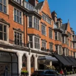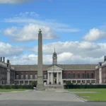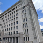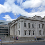
Marylebone is one of central London’s most distinctive historic districts, combining Georgian planning, aristocratic estates, winding older lanes, major institutions and a long-established local high street. Its elegant streets developed from a former rural parish that was gradually absorbed into the expanding metropolis while retaining a recognisable village identity.
- How did Marylebone begin as a rural settlement?
- Why did aristocratic estates shape Marylebone’s elegant streets?
- How did eighteenth-century London transform Marylebone?
- What made Marylebone’s Georgian streets architecturally distinctive?
- Why did Marylebone retain its historic village character?
- How did Marylebone High Street develop into a local centre?
- How did Harley Street become internationally associated with medicine?
- How did Victorian social change affect Marylebone?
- How did transport and railways reshape Marylebone?
- What happened to Marylebone during the twentieth century?
- How is Marylebone’s historic character protected today?
- Why does Marylebone’s history still matter to London?
- Frequently Asked Question
The history of Marylebone explains an important feature of London’s urban development: central districts did not grow through one uniform process. Marylebone contains traces of several historical periods, including the medieval settlement around St Mary, eighteenth-century estate planning and nineteenth-century commercial expansion. These layers remain visible in its street patterns, buildings, institutions and landownership.
The district developed from the historic parish of St Marylebone, whose name derived from St Mary at the Bourne, referring to the River Tyburn. The former stream shaped the earliest landscape and influenced the irregular route of surviving streets such as Marylebone Lane. Westminster planning records also identify Marylebone Village as an area of archaeological importance because of the potential survival of evidence connected with the earlier settlement.
How did Marylebone begin as a rural settlement?
Marylebone began as a rural settlement outside medieval London, centred on the parish church and the River Tyburn. Open fields, manorial land and scattered buildings dominated the area before eighteenth-century estate development transformed the former countryside into an important part of London.
The origins of Marylebone predate its elegant Georgian streets by several centuries. The area developed around the historic parish associated with St Mary and a small watercourse known as the Tyburn or bourne.
The name Marylebone developed from the expression “St Mary at the Bourne.” Over time, the name became shortened and altered into St Marylebone and eventually Marylebone. This linguistic history preserves evidence of the landscape that existed before the district became densely urban.
The River Tyburn was an important geographical feature in the development of the area. The stream flowed southward towards the River Thames. Although it now runs underground, its former course influenced parts of the historic street pattern.
Marylebone Lane provides one of the clearest surviving examples of this earlier geography. Its irregular and winding route differs sharply from the later planned streets laid out on estate grids. The lane preserves part of the physical relationship between the medieval settlement and the former Tyburn landscape.
The medieval and early modern district remained largely rural. Marylebone consisted of manorial land, agricultural fields and a relatively small settlement. Development along Oxford Street and Edgware Road began earlier because these routes already connected London with the surrounding countryside, but large areas between them remained open.
The history of Marylebone therefore begins with a fundamental contrast. The district now occupies a central position within London, yet its original identity was that of an outlying parish beyond the densely developed city.
This rural foundation remained important long after urbanisation began. It influenced property boundaries, estate ownership and the distinction between the older village centre and the planned residential streets that appeared later.
Why did aristocratic estates shape Marylebone’s elegant streets?
Aristocratic landownership shaped Marylebone because large estates controlled extensive areas and directed their development through leases, building agreements and planned streets. The Portman and Howard de Walden estates created organised urban landscapes whose ownership structures influenced architecture, street names and land use.
Large private estates played a central role in transforming Marylebone from agricultural land into an urban district.
The Portman family became particularly important in western Marylebone. Sir William Portman acquired fields in the Marylebone area during the sixteenth century, establishing the landholding foundation from which the later Portman Estate developed.
Historical records associated with the estate describe Marylebone as containing the historic manors of Tyburn and Lilestone. The Portman Estate eventually controlled approximately 270 acres extending from Oxford Street towards the Regent’s Canal area, although much of this land remained undeveloped until the eighteenth century.
The eastern and central parts of Marylebone followed a related but separate pattern of estate ownership. Land associated with the Newcastle, Oxford-Harley, Portland and later Howard de Walden estates became the framework for major residential development.
This estate system shaped London through long leases rather than widespread freehold subdivision. Landowners granted building leases to developers, who constructed houses according to agreed plans and estate requirements.
The system created continuity across extensive areas. Streets could be planned together. Building lines could be controlled. Architectural standards could be maintained. Estate names also entered the geography of Marylebone through streets and squares associated with families such as Cavendish, Harley, Portland and Bentinck.
The result was a district with a strong relationship between landownership and urban form. Marylebone’s elegant streets were not created randomly. They emerged through coordinated estate development during London’s rapid eighteenth-century expansion.
How did eighteenth-century London transform Marylebone?
Eighteenth-century London transformed Marylebone through population growth, speculative building and aristocratic estate planning. New squares, terraces and streets replaced fields, while fashionable residential development connected the former parish to the expanding West End and permanently changed its economic and social structure.
The eighteenth century was the decisive period in Marylebone’s physical transformation.
At the beginning of the century, the district still retained many characteristics of an outer settlement. Maps and estate records show a parish with fields, small-scale buildings and recreational spaces.
A major change began after the sale and reorganisation of significant landholdings. Development plans expanded southward and northward from the established West End.
Cavendish Square became one of the important symbols of this transformation. Planned squares represented a major form of elite London development. They combined private residential buildings with controlled communal space and created prestigious addresses for wealthy residents.
The development of the surrounding estate produced streets that reflected the social and economic ambitions of Georgian London. Georgian urban planning emphasised regularity, frontage and coordinated architectural composition.
Marylebone developed alongside other expanding districts, but it retained its own hierarchy of spaces. Grand squares and broad planned streets existed beside older routes connected with the historic village.
The New Road, begun in 1756, also changed Marylebone’s relationship with the wider city. The route was created along the northern edge of London’s built-up area and later became part of Marylebone Road, Euston Road and Pentonville Road.
Its construction improved movement around London and encouraged further development near the northern boundary of the district. Estate history records describe the New Road as an important catalyst for the development of the Portman lands during the eighteenth century.
By the late Georgian period, Portman Square, Manchester Square, Baker Street and Gloucester Place had become important elements of fashionable residential London. Academic research by the Survey of London identifies these planned spaces as among the prestigious addresses created through estate development in Marylebone.
What made Marylebone’s Georgian streets architecturally distinctive?
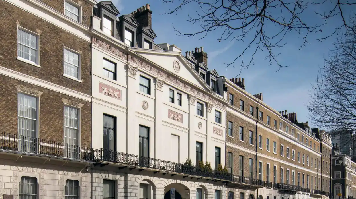
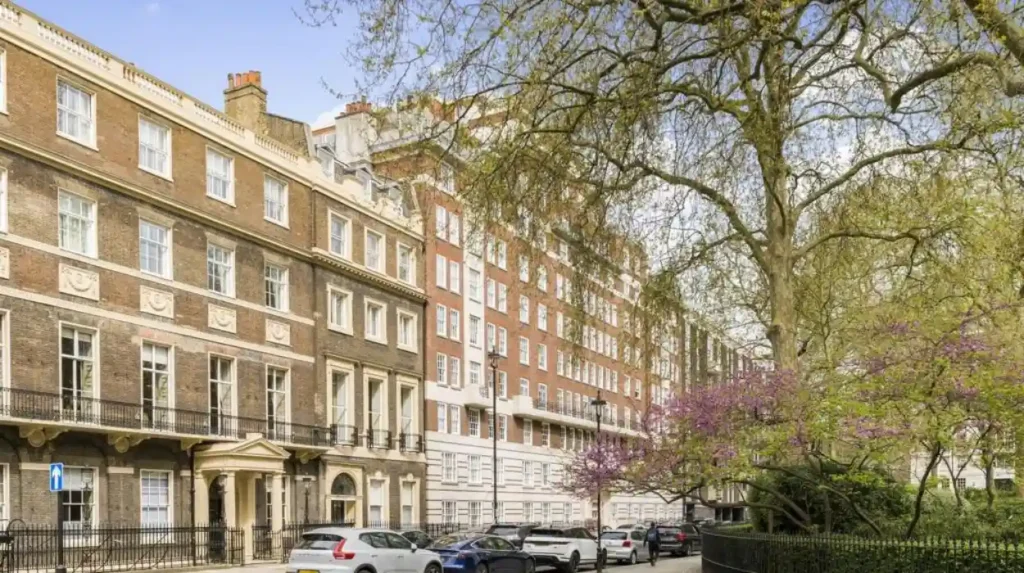
Marylebone’s Georgian streets became distinctive through planned grids, terraces, squares and consistent building lines. Brick townhouses created visual order, while differences in scale, decoration and function reflected the social hierarchy of London’s expanding residential districts and the requirements of estate development.
Georgian architecture provided Marylebone with much of its enduring visual identity.
The period from the early eighteenth century through the early nineteenth century saw extensive construction across the district. Estate planning established streets with coordinated relationships between buildings, pavements and public routes.
Terraced housing became a dominant form. Individual houses stood beside one another but formed continuous architectural compositions. Builders commonly used brick construction and regular window arrangements.
The visual effect depended on repetition and proportion rather than dramatic individual buildings.
Squares formed another major component of Georgian urban planning. They provided open space within dense residential districts and organised prestigious houses around controlled landscapes.
Portman Square and Manchester Square demonstrate the importance of this model in western Marylebone. Cavendish Square performed a similar role in the eastern estate landscape.
Marylebone’s architectural character also developed through variation.
Not every street followed the same pattern. Grander addresses accommodated wealthier households. Smaller streets provided housing and commercial opportunities for other sections of the urban population.
This mixture explains why Marylebone developed as more than a uniform aristocratic enclave.
The district contained professionals, tradespeople, servants and labourers alongside wealthy residents. Its buildings reflected these economic relationships.
The planned Georgian street therefore represented both architectural order and a system of social organisation.
Why did Marylebone retain its historic village character?
Marylebone retained village character because its older parish centre, winding streets, local institutions and concentrated high street survived alongside metropolitan expansion. Estate boundaries and controlled redevelopment also preserved distinctive neighbourhood patterns, allowing the district to remain recognisable despite its central London location.
The expression “Marylebone village” describes a historical and urban reality rather than an isolated rural survival.
Marylebone became part of a vast capital, but its historic centre continued to function as a local neighbourhood.
Marylebone High Street became the principal focus of this identity. The street developed around the parish centre and remained important as the district changed.
Unlike the monumental commercial avenues associated with other parts of central London, the high street retained a strong relationship with local shops, services and residential streets.
Its scale contributed to the area’s distinctive character.
Older routes also survived alongside planned Georgian development. Marylebone Lane remained narrower and less regular than the surrounding estate streets because its route originated before the large-scale Georgian grids.
This contrast between the irregular lane and the formal streets is historically important. It demonstrates the coexistence of different stages of London’s development within one district.
Marylebone’s village identity was also strengthened by institutional continuity.
The parish church remained an important geographical and cultural reference point. Schools, shops, inns and other local institutions connected residents with a recognisable neighbourhood centre.
The eighteenth-century Marylebone Gardens also contributed to the area’s early public identity. The gardens became an important recreational destination, attracting visitors to concerts and entertainment before urban development eventually surrounded and replaced the site.
This combination of historic routes, local institutions and controlled urban development created the conditions for Marylebone’s continuing village character.
To experience this historic district in person today, consult our comprehensive [Best Places to Visit in Chelsea for Art, Shopping, and Riverside Experiences] for itineraries and visiting parameters.
How did Marylebone High Street develop into a local centre?
Marylebone High Street developed from the historic village route into a commercial and residential centre serving the expanding parish. Shops, houses and public institutions gradually replaced earlier rural uses, while the street continued to provide Marylebone with a concentrated local identity.
The development of Marylebone High Street illustrates the transition from village economy to metropolitan neighbourhood.
By the late eighteenth century, the main street increasingly resembled the commercial route recognisable today. Houses and shops developed along its length.
The local economy included specialised trades. Historical estate records identify occupations such as apothecaries, bakers, goldbeaters, hairdressers, shoemakers and watchmakers.
These businesses demonstrate the growth of a more complex urban community.
Marylebone was no longer simply an agricultural parish. It had become a district capable of supporting specialised commercial activity.
Estate leasing played an important role in this process. The Portland Estate used 99-year leases, allowing different builders and occupiers to develop properties under estate supervision.
This arrangement produced architectural variety while maintaining the broader framework of landownership.
The nineteenth century brought further changes as older leases expired.
Properties were modernised or rebuilt. Small sites were sometimes combined into larger commercial premises with flats above.
This pattern remains historically significant because it established the mixed-use character still associated with Marylebone High Street.
The street also contained public institutions. Historical records identify a workhouse, schools and a police station opened in 1821 as part of the expanding infrastructure of the parish.
Marylebone High Street therefore developed through several connected processes: commercialisation, residential growth, institutional expansion and estate management.
Its continued role as a neighbourhood centre became one of the strongest foundations of Marylebone’s modern village identity.
How did Harley Street become internationally associated with medicine?
Harley Street became a major medical district during the nineteenth century as physicians and surgeons established private practices near wealthy residents, hospitals and transport routes. Its concentration of specialists created a professional identity that became one of Marylebone’s most internationally recognised historical characteristics.
Harley Street represents another important layer in the history of Marylebone’s elegant streets.
The street originated within the broader framework of aristocratic estate development, but its later history became strongly associated with medicine.
During the nineteenth century, doctors and surgeons increasingly established private consulting practices in the area.
The location offered practical advantages. Marylebone had strong connections to the West End and surrounding districts. The area also contained wealthy residents capable of supporting private medical services.
Hospitals and related institutions strengthened this professional concentration.
Early medical practices frequently combined work and domestic life within the same townhouse. A physician could use rooms on the lower floors for consultations while family members occupied accommodation above.
This arrangement suited the architecture of Georgian and later townhouses.
The concentration of doctors also encouraged related professions.
Opticians, pharmacists, dentists and therapists established businesses in nearby streets. A specialist economic district gradually developed around the medical profession.
Estate history records show the scale of this transformation. During the 1860s, Harley Street contained approximately a dozen private practices. By 2006, the wider Harley Street medical area contained more than 1,500 practices.
Harley Street demonstrates how an elegant residential street could acquire a specialised economic function without losing its historic architectural framework.
How did Victorian social change affect Marylebone?
Victorian social change exposed major inequalities within Marylebone as fashionable residences existed beside overcrowded and impoverished communities. Philanthropic housing reform, educational initiatives and redevelopment addressed some conditions while preserving evidence of the district’s complex social and economic history.
Marylebone’s history was never limited to affluent residents and elegant architecture.
The expanding parish contained significant social inequality.
Areas associated with the former Marylebone Gardens experienced decline after the recreational landscape disappeared and surrounding development intensified.
Historical records describe poverty, homelessness and overcrowded housing in parts of the district.
Victorian reformers responded to these conditions through organised housing and educational initiatives.
Octavia Hill became one of the most important figures associated with nineteenth-century housing reform in London. Her work promoted improved housing management and stronger relationships between landlords and tenants.
Lady Howard de Walden also participated in redevelopment and social improvement connected with Marylebone.
From the 1860s, housing around Grotto Passage and Paradise Street underwent redevelopment that created improved accommodation for poorer residents.
A ragged school for disadvantaged children had been established in 1846, while charitable organisations and clubs addressed the needs of poor and homeless people.
These developments demonstrate an essential historical fact.
Marylebone’s village image and elegant streets existed alongside serious urban social problems.
The district therefore provides evidence of the broader structure of Victorian London, where wealth, professional activity and poverty frequently existed within short distances of one another.
How did transport and railways reshape Marylebone?
Transport reshaped Marylebone by improving access, stimulating development and changing land use. The New Road created a major northern route, while the arrival of the Great Central Railway and Marylebone station in 1899 altered streets, required demolition and strengthened the district’s metropolitan connections.
Transport was a major force in Marylebone’s transformation.
The New Road of the eighteenth century provided an early route around the northern edge of London’s expanding urban area.
This road reduced pressure on older routes and established a major transport corridor that later became Marylebone Road.
Its existence affected patterns of development across northern Marylebone.
The nineteenth century introduced another major transformation through railways.
Marylebone Station opened in 1899 as the London terminus of the Great Central Railway.
The construction of the railway infrastructure required extensive changes to the surrounding built environment. Contemporary historical accounts record significant demolition of streets and houses in parts of the district.
Rail transport increased Marylebone’s connections with other parts of Britain.
The station also strengthened the district’s role as part of metropolitan London rather than a comparatively self-contained residential parish.
The impact of transport therefore produced a continuing tension.
Marylebone retained local streets and neighbourhood identity while becoming increasingly integrated into national and metropolitan systems of movement.
That tension remains central to understanding its modern character.
What happened to Marylebone during the twentieth century?
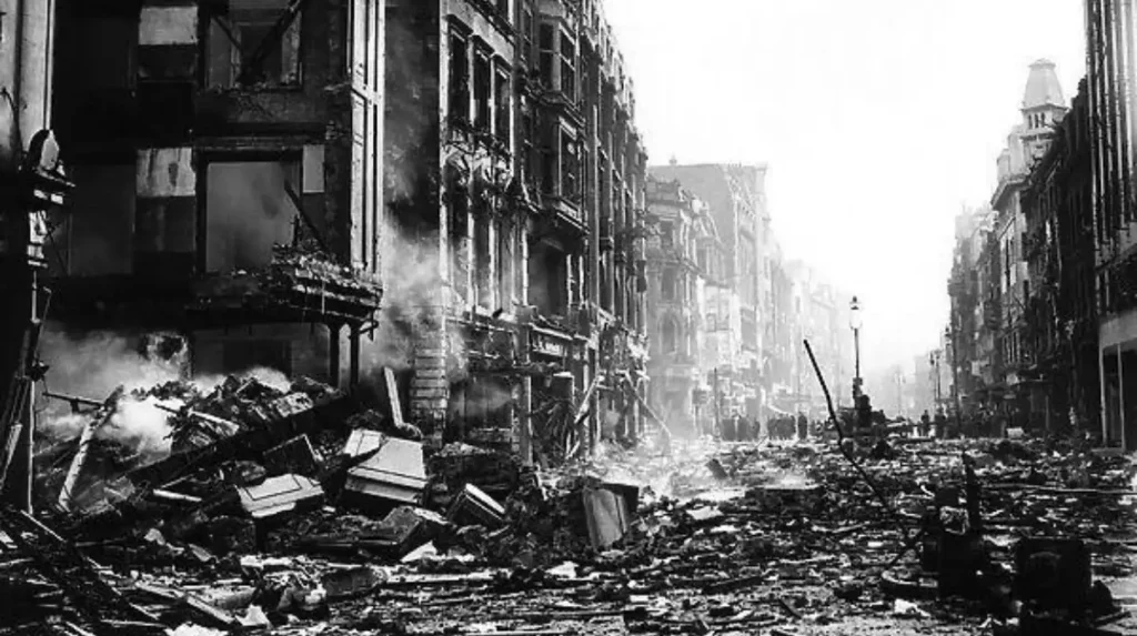
Twentieth-century Marylebone experienced war damage, rebuilding, commercial decline and planned regeneration. Bombing destroyed parts of the district during the Second World War, while later estate-led investment restored retail activity and reinforced the historic mixture of residential, professional and commercial uses.
The twentieth century created major challenges for Marylebone’s historic environment.
During the Second World War, bombing damaged parts of London, including sections of Marylebone.
Historical estate accounts record serious damage on the eastern side of Marylebone High Street and in parts of Harley Street.
Post-war reconstruction followed, but rebuilding did not immediately restore every damaged area.
Housing became a national priority. Some commercial properties remained in poor condition while planning debates affected future development.
Sites cleared during and after the war were sometimes used as temporary car parks.
New post-war buildings introduced architectural forms different from the Georgian and Victorian fabric.
By the later twentieth century, Marylebone High Street faced another challenge.
Parts of the retail area had declining occupancy during the mid-1990s.
The Howard de Walden Estate responded with a strategy focused on attracting a mixture of distinctive shops, restaurants and established retailers.
This regeneration reinforced the area’s local commercial identity rather than replacing it with a single uniform development model.
Marylebone Village was subsequently promoted as a renewed neighbourhood identity rooted in the district’s longer history.
The twentieth-century story therefore demonstrates that historic character requires active management.
Survival depends not only on preserving old buildings but also on maintaining viable uses for streets and properties.
How is Marylebone’s historic character protected today?
Marylebone’s historic character is protected through conservation policy, heritage planning, archaeological recognition and estate management. Westminster’s conservation framework regulates change in historically significant areas, while surviving street patterns, buildings and public spaces provide physical evidence of the district’s development.
Preservation is essential to the continuing identity of Marylebone.
Westminster contains 56 designated conservation areas created to protect locations of special architectural and historic interest.
Conservation area designation introduces additional planning controls and requires consideration of historic character when buildings and streets are altered. Westminster also prepares conservation area audits that identify the qualities contributing to each area’s appearance and significance.
Marylebone’s significance extends beyond visible architecture.
Planning documentation identifies Marylebone Village as one of Westminster’s areas of special archaeological priority.
This designation recognises the potential importance of buried evidence connected with earlier settlement and historical landscapes.
Surviving historic features provide several forms of evidence.
Older street routes preserve medieval and early modern geography. Georgian terraces demonstrate eighteenth-century estate planning. Victorian commercial buildings record changes in retail activity. Medical buildings illustrate the professional development of Harley Street.
Academic research also continues to document these layers.
The Survey of London has produced major research on Marylebone’s architectural history, including studies of Georgian planning, landmark churches, medical heritage and commercial development.
Its work on South-East Marylebone received the Colvin Prize from the Society of Architectural Historians of Great Britain, demonstrating the importance of systematic research into the district’s built environment.
Why does Marylebone’s history still matter to London?
Marylebone’s history matters because it demonstrates how London expanded from rural settlements into a global metropolis without completely erasing earlier landscapes. Its streets preserve evidence of estate planning, social change, professional specialisation, transport development and continuing heritage management across several centuries.
Marylebone provides an unusually clear example of London’s layered urban history.
Its development connects the medieval parish with the modern capital.
The River Tyburn explains part of the original landscape. The parish church explains the origin of the name. Aristocratic estates explain the creation of elegant Georgian streets.
Commercial development explains the evolution of Marylebone High Street.
Medical specialisation explains the international significance of Harley Street.
Railways explain the district’s growing integration with national transport.
Conservation policy explains how these historic layers continue to influence development.
The long-term importance of Marylebone lies in this continuity.
The district was not frozen at one moment in history. It changed repeatedly.
Agricultural land became a village settlement. The village became part of fashionable Georgian London. Residential streets acquired commercial and professional functions. Victorian reform addressed urban poverty. Twentieth-century rebuilding responded to war and economic change.
Yet earlier structures remained visible.
This survival gives Marylebone its distinctive identity.
Its elegant streets are the product of estate planning and architectural development. Its charming village character is the result of older geography, parish history, local institutions and the continued concentration of neighbourhood activity around Marylebone High Street.
For historians, cultural tourists, educators, students, heritage preservationists and genealogical researchers, Marylebone offers a concentrated record of London’s transformation.
The district demonstrates that urban history is preserved through more than monuments.
It survives in street patterns, property boundaries, parish names, commercial uses, professional districts and archaeological landscapes.
Marylebone’s enduring significance rests on the relationship between these elements. Its historic streets explain how elite planning shaped London. Its older lanes explain the survival of the pre-urban landscape. Its high street explains the persistence of local identity within a global city.
That combination continues to make Marylebone one of London’s most historically legible and architecturally distinctive districts.
Frequently Asked Question
What is Marylebone famous for?
Marylebone is famous for its elegant Georgian streets, historic village character, Marylebone High Street, Harley Street medical district, Regent’s Park connections and important aristocratic estates.