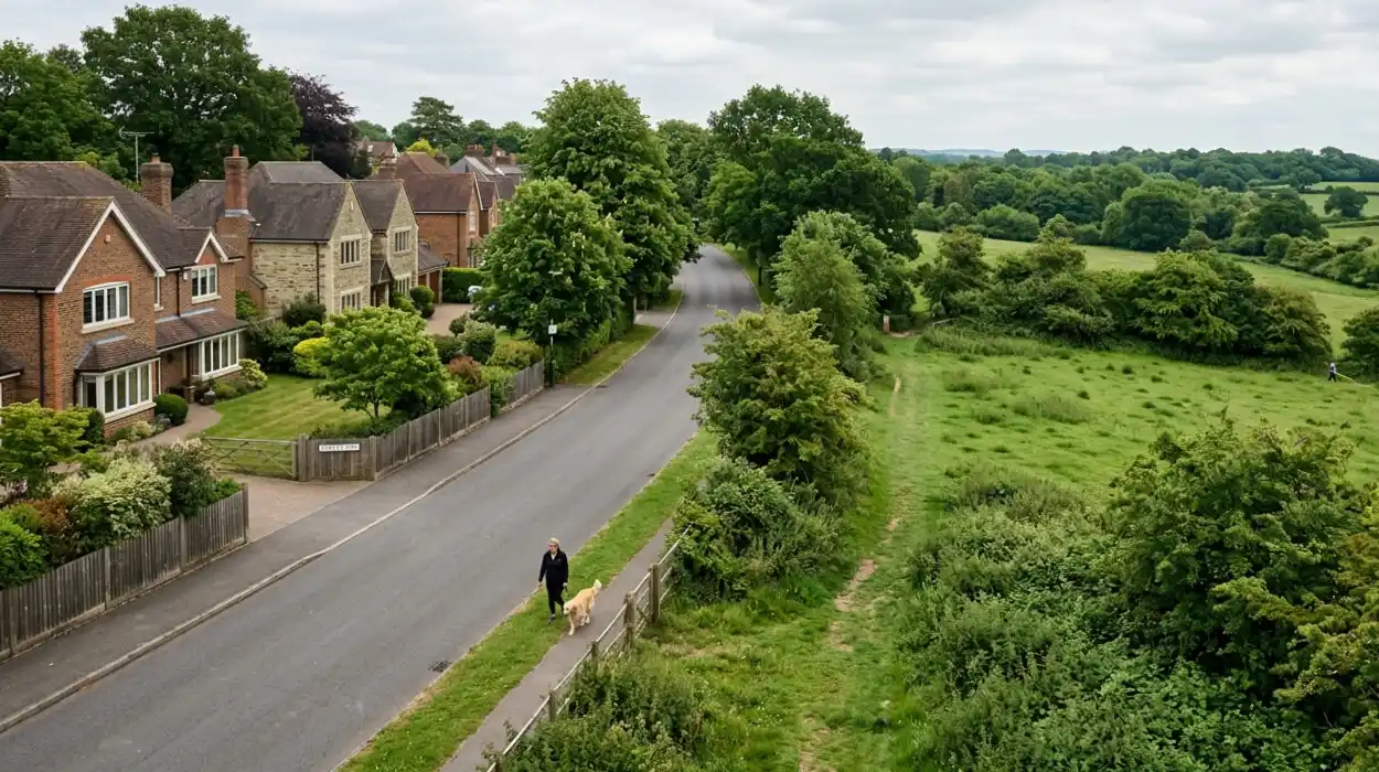
The balancing of suburban growth with environmental preservation is a central challenge for modern municipal governance. In the affluent northern London enclave of Hadley Wood, situated entirely within the London Borough of Enfield, this dynamic is governed by statutory framework documents, local administrative policies, and active community organizations. As spatial demands across Greater London escalate, the enforcement of Green Belt protections and the establishment of neighborhood planning protocols serve as the primary mechanisms to preserve the specific open character of the residential and natural landscape. This report by The Londoner News provides an objective, comprehensive analysis of the legal structures, historical context, environmental data, and municipal policies determining the future spatial planning of Hadley Wood.
- What is the Metropolitan Green Belt and how does it protect Hadley Wood?
- How does the Enfield Local Plan impact Hadley Wood development?
- What role does neighborhood planning play in community governance?
- What environmental benefits do Green Belt protections provide to residents?
- How can Hadley Wood residents participate in local planning decisions?
What is the Metropolitan Green Belt and how does it protect Hadley Wood?
The Metropolitan Green Belt is a statutory land-use designation encompassing 516,000 hectares of open space surrounding Greater London, established under the Town and Country Planning Act 1947 to prevent urban sprawl by maintaining permanent open land around the capital.
The primary function of the Metropolitan Green Belt is to preserve the open character of lands bordering urban areas. National planning policy mandates that inappropriate development is, by definition, harmful to the Green Belt and should not be approved except in very special circumstances. Hadley Wood is bordered closely by the historic remnants of Enfield Chase, an expansive area of former royal hunting forest that establishes the rural-suburban transition zone of the neighborhood (Pam, 1986). This geographical positioning places Hadley Wood at a critical urban edge where residential properties directly abut open countryside (Collins, 1989).
Statutory protections operate through a strict presumption against the construction of new buildings. National frameworks outline 5 core purposes of the Green Belt:
- To check the unrestricted sprawl of large built-up areas.
- To prevent neighboring towns from merging into one another.
- To assist in safeguarding the countryside from encroachment.
- To preserve the setting and special character of historic towns.
- To assist in urban regeneration by encouraging the recycling of derelict and other urban land.
In Hadley Wood, these principles restrict the conversion of agricultural fields, woodland, and recreational open spaces into residential sub-divisions. Local planning authorities evaluate any proposed structure based on its physical and visual impact on openness. The legal framework ensures that the boundary between the dense urban environment of London and the rural landscapes of Hertfordshire remains strictly defined, directly preventing the continuous outward expansion of suburban infrastructure.
Explore More Things to Do
New Town Masterplan and 2026 Planning Updates: Crews Hill
Hillingdon Council Boosts Neighborhood Safety Initiatives London Borough of Hillingdon
How does the Enfield Local Plan impact Hadley Wood development?
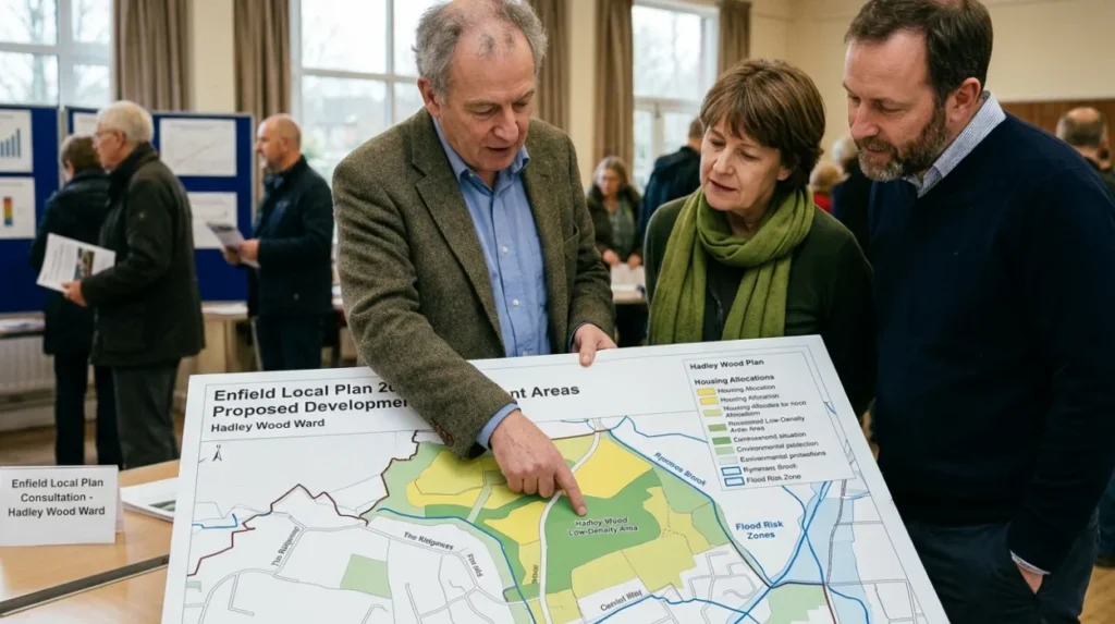
The Enfield Local Plan is a statutory development framework produced by Enfield Council that determines spatial strategy, housing targets, and land allocations across the borough, directly regulating building densities and environmental protections within Hadley Wood boundaries.
Enfield Council is legally required to maintain an up-to-date Local Plan to guide development over a multi-year horizon. This document establishes exactly where new infrastructure can be built and sets specific targets for housing delivery. For Hadley Wood, the Local Plan dictates the balance between meeting borough-wide housing demands and preserving the existing low-density character of the neighborhood. The spatial strategy historically funnels large-scale high-density residential developments toward town centers and brownfield regeneration zones, such as Meridian Water in the east of the borough, thereby minimizing immediate development pressures on northern suburban fringes.
The local planning guidelines enforce specific density controls and design parameters for any infill development or modifications within Hadley Wood. Under these guidelines, developers must demonstrate that new projects do not degrade local architectural heritage or cause adverse environmental impacts. The document integrates comprehensive flood risk assessments, noting that urban watercourses like the Pymmes Brook rise in Barnet and flow directly through Hadley Wood, necessitating strict surface water management and sustainable drainage systems for all approved developments (Plan, 2015).
What role does neighborhood planning play in community governance?
Neighborhood planning is a statutory right introduced under the Localism Act 2011 that empowers local communities to create legally binding conservation policies and development designs through a designated Neighborhood Forum or Parish Council.
The neighborhood planning mechanism allows residents to form a Neighborhood Forum to draft a Neighborhood Development Plan. This plan must align with the strategic policies of the overarching Enfield Local Plan and the National Planning Policy Framework. Once a neighborhood plan passes an independent examination and achieves a majority vote in a local referendum, it attains statutory weight. This means the policies within the neighborhood plan become part of the legal development plan framework used by Enfield Council officers to determine planning applications in Hadley Wood.
Through this process, a community exercises direct control over localized design codes, the protection of specific local green spaces, and the preservation of neighborhood character. Neighborhood planning bodies can identify and designate Local Green Spaces that hold particular significance to the community, providing protections consistent with Green Belt policy. This governance model shifts planning from a purely top-down municipal directive to a collaborative process where localized parameters dictate the exact execution of spatial development, ensuring architectural continuity and infrastructure alignment with community capacities.

What environmental benefits do Green Belt protections provide to residents?
Green Belt protections provide critical ecosystem services including air pollutant reduction, surface water management, climate refugia for vulnerable biodiversity, and urban cooling to mitigate the localized microclimate impacts of the expanding London metropolitan area.
The preservation of continuous open land and mature tree canopies across Hadley Wood and Enfield Chase delivers measurable environmental stabilization. Scientific research indicates that multi-element green infrastructure configurations, combining hedges, grass, and trees at the household and street level, achieve the highest efficiency in mitigating environmental degradation (Sun, 2025). These natural systems optimize surface water retention, significantly reducing peak runoff volumes into the regional drainage network and lowering localized flood risks along vulnerable riparian corridors (Plan, 2015).
Environmental data underlines the role of these protected zones as climate refugia. Preserving contiguous forested and open spaces safeguards localized species richness against land-use conversion and rising regional temperatures (Choe & Thorne, 2017). Furthermore, the extensive vegetation acts as a thermal buffer. Large expanses of green infrastructure mitigate the urban heat island effect, lowering surrounding air temperatures and reducing seasonal heat discomfort in nearby residential zones during extreme weather events (Roaf et al., 2010). The filtration capacity of dense woodland tracks also lowers concentrations of particulate matter, directly contributing to superior local air quality compared to the inner London average.
Explore More Things to Do
Westfield Croydon 2026 Redevelopment: Homes, Shops, North End Quarter
Dulwich Village Guide: Art Galleries, Parks, Historic Pubs | Londoner
How can Hadley Wood residents participate in local planning decisions?
Residents can participate in local planning decisions by submitting formal comments during statutory public consultations, joining designated local community associations, and voting in neighborhood referendums governing local development policies.
Enfield Council is legally mandated to conduct public consultation periods during the formulation of new Local Plans or when significant planning applications are submitted for evaluation. Residents can review detailed architectural drawings, environmental impact assessments, and transport statements via the municipal planning portal. Submitting structured, policy-based feedback during these designated consultation windows forces planning officers to formally evaluate community objections or supports before issuing a final determination.
Active engagement through local civil society organizations, such as the Hadley Wood Association or The Enfield Society, aggregates individual resident voices into coordinated, influential representations (Pam, 1986). These organizations retain technical experts to scrutinize applications against strategic frameworks. Finally, when a Neighborhood Development Plan completes its draft phase, every registered voter in the designated neighborhood area has the right to cast a ballot in a local referendum. A simple majority approval legally enacts the document, ensuring that community-derived design parameters explicitly govern future local planning determinations.
What is the main protection for Hadley Wood’s land?
The biggest protection is the Metropolitan Green Belt, which strongly limits new building to prevent urban sprawl and protect open countryside.